Download
1 / 57
610 likes | 906 Views
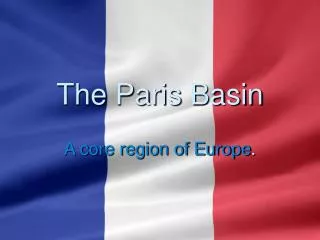
The Paris Basin. A core region of Europe. Why is the Paris basin a core region?. A Core Economic Region of Europe. A distinct economic core region because of its geology, soils, agricultural productivity, thriving economy and city of Paris.

E N D
The Paris Basin A core region of Europe.
Why is the Paris basin a core region?
A Core Economic Region of Europe • A distinct economic core region because of its geology, soils, agricultural productivity, thriving economy and city of Paris. • Many natural and human advantages for settlement and industrial location. (Relief, climate, soils, accessibility, population). • Over 20 million people live in the region. • A centre of in-migration. • Culturally mixed. • Largest manufacturing centre in France. • Well developed transport network. • Centre of government and decision making in France.
Sketch Map Question • Draw an outline map of a European region – not Ireland – or a continental / subcontinental region. • Show and name the following on it: • 1 – any two physical features in the region. • 2 – any two urban centres in the region. • (20 marks)
Physical Characteristics • Relief and soils • Drainage • Climate Land rivers weather soils
Relief and Soils • Occupies nearly 25% of France. • 480km from west to east. 320km from north to south. • A huge down-fold (syncline) in sedimentary rocks created over 400 million years ago. The biggest scarp is called the Falaise de France. • Each rock type (clay, chalk, limestone, sand and gravel) has produced different soils which have influenced the type of farming across the basin. • The different farming areas are known as pays in French.
In the centre of the basin, very fertile limon soil lies on the sands and gravels (North European Plain). • Limon soil – a fertile stoneless soil easily worked by machinery; ideal for the growth of cereals. • Alluvium – deposited by rivers on their flood plains. • Clay soils – ‘heavier’ soils and suitable for dairy farming. • This central region is extremely productive and is known as the Ile De France. • Most of the area is under 200m in height and is very suitable to agriculture. • Well known for its cereal production and is often nicknamed the Granary of France. • Varied, fertile soils allow a wide range of farming activities.
Drainage • 3 rivers flow across the region. • The Seine and its tributaries (Yonne, Oise and Marne) flow north-west through Paris and enters the sea at Le Havre. • The River Somme flows across the north of the Paris Basin. • The River Loire flows west across the southern edge of the region.
Climate • Changes as you travel from west to east across the region. • West – maritime climate (sea influence) keeps summers cool (16 deg) and winters mild (5 deg), average rainfall of 800mm. • East of region – continental climate (no sea influence) with hot summers (19 deg) and cold winters (2 deg), less than 700mm of rainfall. • Between the two extremes of maritime and continental climatic regions, there is a transitional type climate. • The even distribution of rainfall and the long growing season are great advantages for agriculture.
Towns of the Paris Basin: • Paris • Beauvais • Epernay • Reims • Rouen
Primary Economic Activities. • Agriculture is influenced by factors such as: • Fertile soils • Mild climate • Low lying relief • 2 main topics are: • Agriculture • Energy Production
Agriculture • Fertile limon soil and climate have allowed the production of wheat, barley and maize cereal crops throughout the region. • Spring and early summer rainfall help crop growth and the long hours of sunshine are ideal for ripening crops. • Close to the River Seine, alluvial soils also favour intensive farming. • Farms are big (over 400 hectares), mechanised and highly productive. • Large consumer market – over 21 million people.
Farm production in different farming areas (pays) of the Paris Basin • Different farming regions have developed based mainly on the soil types of the region. • The Ile de France. • Low lying, flat region covered with fertile limon soil. • Large farms (over 400 hectares) that produce wheat. • Yields are the highest in France. • Beauce • Limestone upland covered in limon soil. Large and mechanised farms. • Main wheat producing region. • Sugar beet also grown.
Brie and Valois • In these 2 pays, clay soils occur. • This soil produces good pasture land. • Farmers here are dairy farmers, famous for cheese (Brie cheese) and butter. • Being so close to the urban area of Paris, they also supply fresh milk to the city. • The Champagne Region. • The chalk ridges are infertile, well drained soils. They have a southerly aspect and are suitable for vines. • It is here around the town of Reims that the famous champagne wine is produced. • The production of wine is a specialist type of farming called viticulture.
Conditions: Fertile Limon Soil Sedimentary rocks Hours of sunshine Summer rainfall = crops grow and ripen Types of farm: Intensive farming Large farms (400Ha +) Mechanised High yields Brie and Valois: Clay soils Pasture land Dairying Brie cheese Milk/cream to city Champagne Region: (Wet area) Dairying Cattle breeding Low lying valleys Picardy & Artois: Low lying flat areas Limon soils Barley Wheat Sugar beet Dairying in coastal areas Agriculture Champagne Region: (Dry area) Clay valleys between chalk ridges Well-drained Southerly aspect Viticulture = wine Ile de France: ‘Granary of France’ Low lying centre region Limon soils Wheat Supply of bread
Energy Production • High energy consumption. • Oil and gas are imported through the port of Le Havre where oil refining and petrochemical production form the basis of the economy.
Oil and Natural Gas • France has small oil reserves at about 150 to 160 million barrels. • They are located in the Paris Basin and in the Aquitaine region. • France is the 3rd greatest oil-consuming country in Europe after Germany and Russia and 10th greatest in the world. • It has to import 95% of its oil needs. • The Paris Basin does not contain any gas reserves. • Gas is brought by pipeline from gas wells in the Aquitaine Basin to the south and from the Netherlands.
Coal Coal • Small reserves existed in the south of the region, but in 2004 coal production was phased out completely. • France now imports its coal needs.
Nuclear Energy • France depends heavily on its nuclear generating infrastructure for its electricity supply. • 75% of French electricity is generated by nuclear power and its nuclear generating capacity has increased by about 10% over the past decade. • 10 of its 37 power stations are located in and around the Paris Basin.
Secondary Economic Activities SRP’s (Why the Paris Basin is suitable for industry): Transport: Two international airports River Seine runs for 13km through the city from Paris port to Le Havre port Channel tunnel to London, UK. Metro train system SNCF rail lines (Société Nationale des Chemins de fer français) TGV Population: 12 million in Paris City 21 million total in region Agri raw materials: Variety of crops grown in region Cereal crops, dairy, meat, wine etc Food processing and bottling
SRP’s (Why the Paris Basin is suitable for industry): Industry: 20% of workforce employed in industry Jewellery (Cartier) Perfume (Yves St. Laurent) Clothing (Chanel) Car manufacturing (in Canal St. Denis: Citroen) Academic printing and publishing (near Sorbonne university) Oil/Steel/iron refining (Canal St. Denis)
Tertiary Economic Activities: Tourism Tourists to the Paris Basin are attracted due to a number of reasons ranging from sport to culture, history, art, architecture and a well known theme park. Tourists interested in art are provided for with the world famous Louvre museum. This old building with the modern glass pyramid is home to the ‘Mona Lisa’ by Da Vinci. Four miles north the artists’ quarter is the location for the former studio of Salvidor Dali. Architecture also draws many visitors to the area. The Sacre Coeur Cathedral on Montmarte provides a view of the capital city. The Eiffel tower contains a restaurant and visitor viewing area. The Notre Dame Cathedral has an interactive tour for the 800,000 visitors who come each year. Out of the city the old walled town of Caen displays reminders of the medieval era. Sport is another attraction. The city of Paris and France itself was home to the 1998 World Cup (which France won) and the region includes the world famous Stade des France and Parc des Princes stadia. The Tour de France always finished under the Arc de Triomphe at the end of the Champs Elysees. The Seine river is home to the daily open-top boat trips and night time diner cruises. This allows tourists to see the length of Paris with areas like the Military museum, La Gare station/Museum and the palaces en route. Finally, the rich agricultural practices of the region draw thousands of visitors to the world famous towns of Reims and Epernay for the annual wine tasting festivals.
Students should note that other tourist attractions not mentioned include: • Paris Fashion week • Shopping the famous Boulevard Hausmann area • Disneyland Paris in Marne la Vallee • The ‘inside out’ museum of modern art the George Pompideau centre • The Normady landing sites in memorial to WW2
Tourism Transport in the Paris Basin is a key tertiary activity due to a number of reasons. The region has two international airports linking Paris to many countries around the world. Charles de Gaulle airport north of Paris and Orly airport which lies south of the capital. Combining with the airports is the Metro system which enables tourists to freely access all areas of Paris city and it directly links to the SNCF rail system in France. This allows over 20 million visitors to visit sites of interest in Paris city each year and attend festivals held in the region. The river Seine travels for 13km through the city. This river is used for open top cruises and night time diner cruises each day.