Download
1 / 10
100 likes | 243 Views
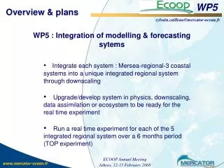
WP5. Data integration and tool development. Objective of WP 5. To manage data in a standardised manner and make data suitable for post processing.

E N D
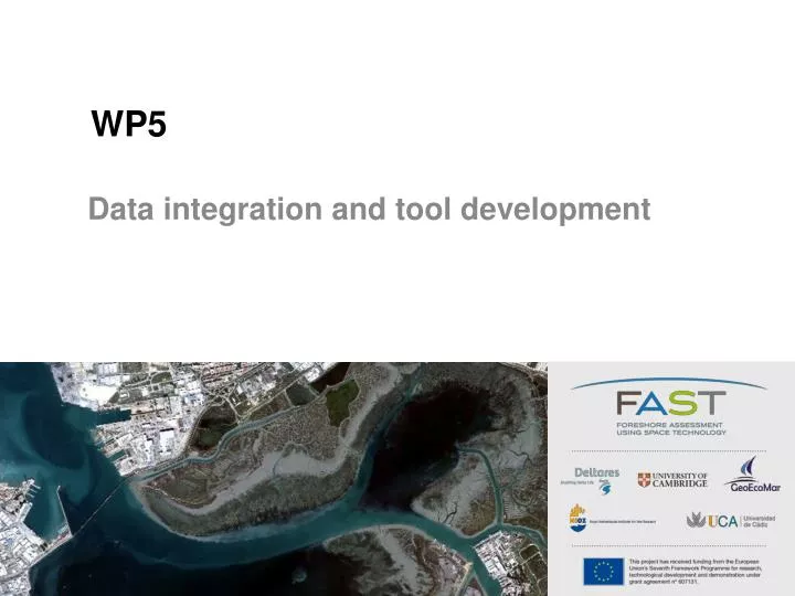
WP5 Data integration and tool development
Objective of WP 5 • To manage data in a standardised manner and make data suitable for post processing. • To derive general rules for relationships between foreshore and flood plain characteristics and wave attenuation, bed stability and levee design. • To design, develop and validate a software prototype in close collaboration with end-users. • To ensure end-user commitment and involvement in tool design and testing.
The Tasks • Task 5.1. Data standardisation and data management MI-SAFE Processed data Geodatabase All other data Raw data
The Tasks • Task 5.1. Data standardisation and data management
The Tasks • Task 5.1. Data standardisation and data management • Task 5.2. Link physical data with field derived vegetation data and scale-up using satellite images Algorithms Measurement data General rules Vegetation/soil data Foreshore
The Tasks • Task 5.1. Data standardisation and data management • Task 5.2. Link physical data with field derived vegetation data and scale-up using satellite images • Task 5.3 Translation of generalised rules to design of flood defences Water level General rules Output parameters Water height … Area/Euro’s/Design Foreshore Boundary conditions
The Tool -Vulnerability maps -Hazard maps -Damage costs -… -Elevation transect -Biomass distribution -… -Show wave spectra -Indicate breaking -… Output System -Water level -Wave height -biomass -wave attenuation -height/length -return period -wave height -wave period -water level -bathymetry -tides Input Parameters Processed information Hydraulic boundary conditions End-user output
The Tasks • Task 5.1. Data standardisation and data management • Task 5.2. Link physical data with field derived vegetation data and scale-up using satellite images • Task 5.3 Translation of generalised rules to design of flood defences • Task 5.4 Agile end-user consultation process (UCA) • Task 5.5 End-user driven software design and development
The Tasks • Task 5.1. Data standardisation and data management • Task 5.2. Link physical data with field derived vegetation data and scale-up using satellite images • Task 5.3 Translation of generalised rules to design of flood defences • Task 5.4 Agile end-user consultation process (UCA) • Task 5.5 End-user driven software design and development • Task 5.6 End-user driven business plan development (UCA)
The Deliverables (in the first year) • D5.1 Description of data standardisation & management protocols (month 5) • D5.9 Description of end-user tool software development process (month 6) • D5.6 First end-user-partner consultation report (month 8) • D5.10 Description of system requirements and design (month 10) • D5.13 Business plan template (month 11)