Download
1 / 54
560 likes | 786 Views
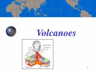
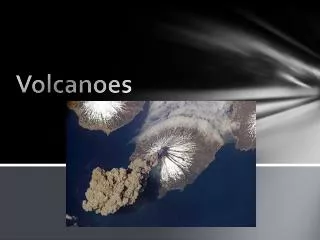
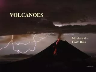
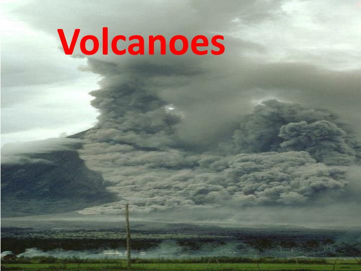
Volcanoes. The Volcanic Setting. Subduction zones Rift valleys Hot spots. VOLCANIC LANDFORMS. Landforms. Type of Eruption. Effusive gentle flows lots of lava Explosive viscous lava trapped gases. shield volcanoes cinder cones plateau basalts. composite volcanoes calderas.

E N D
The Volcanic Setting Subduction zones Rift valleys Hot spots
VOLCANIC LANDFORMS Landforms Type of Eruption Effusive • gentle flows • lots of lava Explosive • viscous lava • trapped gases shield volcanoes cinder cones plateau basalts composite volcanoes calderas
Cinder coneBig Cinder Butte, Craters of the Moon, Idaho • forms small hills, less than 450 m high • black scoria rock with air bubbles
Shield volcanoMauna Loa, Hawaii Low viscosity magma Gases readily escape from this magma Effusive eruptions
Seamounts Hot spot
Photo of Rift Valley In East Africa
Mount Pinatubo June, 1991
Four years later Live Photo of Mt. St. Helens http://www.fs.fed.us/gpnf/volcanocams/msh/
Carbon dioxide (CO2 : 250,000 ppm !) Hydrogen sulphide (H2S) Sulphur dioxide (SO2) Hydrofluoric acid (HF) Chlorine (Cl) compounds
CalderaCrater Lake, Oregon 6600 years ago windblown ash landed in Calgary
Volcanic hazards and effects • hot ash (pyroclastics) • steam and gas explosions • lava flows • poisonous gases (sulfuric acid; even CO2 if at extreme concentrations) • landslides • tree blowdowns • lahars (steam-melted ice and snow cause flooding and large mudflows) • increase in atmospheric dust (decreased global temperatures in short term – increase in long term?)
Volcanic Benefits New fertile soils - Hawaii, Philippines Geothermal energy - Iceland, Italy, New Zealand New real estate - Iceland, Japan, Hawaii
A terrane is a region where a craton is exposed at the surface. migrating crustal piece that becomes attached to plates. nucleus or heartland region of continental crust. chain of islands formed from hotspot volcanism. downward-faulted block of crust.
A terrane is a region where a craton is exposed at the surface. migrating crustal piece that becomes attached to plates. nucleus or heartland region of continental crust. chain of islands formed from hotspot volcanism. downward-faulted block of crust.
The deformation of rocks by compression, such as that occurring at convergent plate boundaries, is called _____. thrusting faulting lithification shearing folding
The deformation of rocks by compression, such as that occurring at convergent plate boundaries, is called _____. thrusting faulting lithification shearing folding
An anticline is the result of which type of crustal stress? isostasy tension shear subduction compression
An anticline is the result of which type of crustal stress? isostasy tension shear subduction compression
The Basin and Range Province of the United States consists of alternating horsts and grabens due to the presence of numerous _____ faults. right-lateral left-lateral reverse thrust normal
The Basin and Range Province of the United States consists of alternating horsts and grabens due to the presence of numerous _____ faults. right-lateral left-lateral reverse thrust normal
A non-volcanic mountain range is likely an expression of a(an) oceanic plate-oceanic plate collision. oceanic plate-continental plate collision. oceanic plate-oceanic plate divergence. continental plate-continental plate divergence. continental plate-continental plate collision.
A non-volcanic mountain range is likely an expression of a(an) oceanic plate-oceanic plate collision. oceanic plate-continental plate collision. oceanic plate-oceanic plate divergence. continental plate-continental plate divergence. continental plate-continentalplate collision.
The logarithmic scale of earthquake amplitude-magnitude measurement is called the _____ scale. Mercalli tectonic activity Richter Beaufort Fujita
The logarithmic scale of earthquake amplitude-magnitude measurement is called the _____ scale. Mercalli tectonic activity Richter Beaufort Fujita
The epicenter of an earthquake is defined as the area at the surface that is directly above the focus. the subsurface area where the motion of the seismic wave was initiated. the sticking point along a fault that prevents movement. an area that is tectonically quiet and overdue for an earthquake. the area of greatest structural damage and loss of life.
The epicenter of an earthquake is defined as the area at the surface that is directly above the focus. the subsurface area where the motion of the seismic wave was initiated. the sticking point along a fault that prevents movement. an area that is tectonically quiet and overdue for an earthquake. the area of greatest structural damage and loss of life.