Download
1 / 30
300 likes | 404 Views
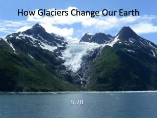
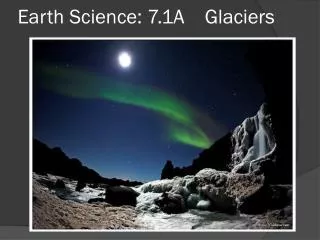
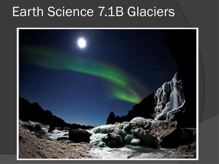
Earth Science 7.1B Glaciers. Glacial Erosion. Glaciers are natures bulldozers. Their massive force tears rock from valley floors and walls carrying the rock fragments down the valleys as they travel.

E N D
Glacial Erosion • Glaciers are natures bulldozers. Their massive force tears rock from valley floors and walls carrying the rock fragments down the valleys as they travel. • Unlike streams that drop sediments when they slow; glaciers carry their sediments until they eventually melt. Because of this, many landscapes were changed by glaciers in the last ice age.
How Glaciers Erode • Glaciers erode the land in two ways: • Plucking • Abrasion • Plucking occurs when rock surfaces beneath glaciers break up as melted water from the glacier penetrates the cracks. When the water refreezes, it expands and pries rocks loose. As the glacier flows over these fractured rocks, it loosens and lifts the rocks and carries them with the ice flow, plucking them from the Earth.
How Glaciers Erode • In abrasion, the load of rock and ice combined acts like sandpaper as it slides over the surface.The rock fragments act to smooth and polish the rock beneath, scraping away the surface. This leaves telltale lines going in one direction showing the direction of ice flow. • This pulverized rock produced by this scraping is called rock flour.
How Glaciers Erode These marks are called glacial striations. They are the long scratch marks left by the dragging of stones and boulders by the glaciers as they moved, abrading the surface.
How Glaciers Erode: rate of erosion As with all agents of erosion; the rate of erosion is controlled by several factors. 1: rate of glacier’s movement 2: thickness of the ice 3: shape, hardness, and amount of rock fragments in the ice at the glacier’s front edge 4: the type of surface and hardness of the rock beneath the glacier Grooves in the rock cut by glacial abrasion
Landforms created by Glacial Erosion • Glaciers are responsible for a variety of erosional landscape features. Among these are • Glacial troughs • Hanging valleys • Cirques • Aretes • Horns
Glacial Troughs Before a glacier moves through a mountain valley, the valley is usually a deep V shaped trough from the downcutting of streams. When a glacier moves through a mountain valley, it widens, deepens, and straightens this valley. The once V shaped valley becomes a U shaped glacial trough.
Hanging Valleys The amount of glacial erosion depends on the thickness of the ice. Main glaciers cut deep U shaped valleys that are deeper than the those carved by smaller side glaciers that feed into the main glacier. When all the ice recedes, the valleys from these smaller side glaciers is left higher up than the floor of the main glacier. These side valleys are called hanging valleys.
Cirques A cirque is a bowl shaped depression at the head of a glacial valley that is surrounded on three sides by steep rock walls. Cirques form at the head of a glacier, in the zone of accumulation. Glaciers carve cirques by plucking rock from the side walls and bottom. The glacier acts as a means to move this plucked debris down the mountain as the glacial ice moves from top to bottom.
Aretes and Horns Other mountain landscape features result from these glaciers, side glaciers, and cirques. Aretes are snaking, sharp-edged ridges produced when cirques form on either side of a divide. As the cirques grow, the divide separating them is ground down, reduced to a sharp edge narrow divide. Horns are pyramid shaped peaks produced when several cirques surround a mountain. Swiss Matterhorn
Glacial Deposits • Glaciers transport huge loads of debris as they slowly advance across the land. • When glaciers begin to melt, they deposit these large amounts of materials they carry. • These deposited sediments give us features ranging from the rocky fields of New England to the formation of Cape Cod.
Glacial Drift • The term glacial drift is used to include all sediments of glacial origin; no matter where, how, or what form they were deposited in. • There are two types of glacial drift: • Till • Stratafied drift
Till • Till is material deposited directly by the glacier, deposited as the glacier melts and drops it’s load of rock debris. • Because everything is dropped at once, till is usually an unsorted mixture of rocks made up of all sizes. Course glacial till
Stratified Drift • Stratified drift is sediment laid down by glacial meltwater. • Stratified drift contains particles that are sorted by size and weight of the debris. • Some deposits of debris come from streams coming directly from the glacier. • Stratified drift often consists of sand and gravel because meltwater cannot carry large boulders and the finer sediments remain suspended and are carried farther away by the waters flow.
Depositional features • Glaciers are responsible for a variety of depositional features including: • Moraines • Outwash plains • Kettles • Drumlins • Eskers
Depositional features: Lateral Moraines • Lateral Moraines: The sides of a glacial valley gather large amounts of debris from the inside walls. • Lateral moraines are ridges that form along the sides of glacial valleys when the glaciers melt and leave the material it has gathered.
Depositional features: End Moraines • When the snow and ice accumulate at the head of the glacier at the same rate the glacier melts, the glacier stays stationary, balanced in it’s glacial budget. • End Moraines form when glaciers stay stationary for long periods of time. • Within the glacier, the ice still flows. This flow still carries rock debris to the foot of the glacier like a conveyer belt. Here the debris builds up and produces End Moraines.
Depositional Features: Ground Moraines • Ground moraines form when glaciers begin to recede. • The glacier front continues to deliver debris with the ice movement but instead of creating a ridge (as in the end moraine) the retreating foot of the glacier deposits the debris as a rock strewn plain. • This rock strewn plain is a ground moraine.
Depositional features: Terminal Moraines • Glaciers can periodically retreat and than find balance again and remain stationary for a long time period. • A glacier will form an end moraine when stationary than create ground moraines in it’s periods of retreat. • This pattern can repeat many times before the glacier completely melts.
Depositional features: Terminal Moraines • The farthest end moraine created in this pattern of stopping and retreating is called the terminal moraine. • End moraines that form when the ice front occasionally becomes stationary during it’s retreat are recessional end moraines.
Depositional features: Outwash Plains • At the same time that end moraines are forming, streams of fast moving meltwater emerge from the bases of glaciers. • This water is so full of fine sediment it almost looks like milk. • Once it leaves the glacier, the water slows and drops it’s sediment in a broad ramp-like accumulation downstream from the end moraine. This sediment ramp resulting from the retreating ice sheet is called an outwash plain.
Depositional features: Kettle ponds and lakes • You can often find depressions; ponds and small lakes called kettles. • Kettlesform when blocks of stagnant ice become buried in drift and eventually melt. This melting leaves pits in the glacial sediment resulting in small ponds and lakes. Kettle ponds
Depositional features: Drumlins and Eskers • Moraines are not the only landscape features formed by glacial deposits. • Drumlins are long elongated hills composed of glacial till. Drumlins are taller and steeper on one end; ranging in height from 15 to 60 meters and .4 to .8 kilometers long. • The steep side of the hill faces the direction the glacier came from and the gentle slope side the direction the ice moved toward.
Depositional features: Drumlins and Eskers • Eskers are snakelike ridges composed of sand and gravel that were deposited by streams once flowing in tunnels beneath glaciers. • They can be several meters high and many kilometers long. • Many eskers are mined for the sand and gravel they contain.
Glaciers of the Ice Age • Many of the deposits and landscape features that define North America today are the product of the glaciers that covered this continent during the last ice age. • During the last ice age, glaciers covered almost 30% of the earth’s land. North America, Siberia, and Europe were extensively covered.
Glaciers of the Ice Age • The ice sheets greatly affected the drainage patterns of major rivers in North America. • Before the glaciers: • The Missouri River flowed north toward Hudson Bay • The Mississippi flowed through central Illinois • The Great lakes did not exist
Glaciers of the Ice Age • The sheets of glacial ice also triggered changes in the climates of North America beyond their edges. • Regions that are arid today became cooler and wetter. This change in climate at the time resulted in the formation of large lakes in regions of Nevada and Utah.
Key Concepts : • Many landscapes were changed by the widespread glaciers of the last ice age. • Glaciers are responsible for a variety of erosional landscape features; such as hanging valleys, cirques, aretes, and horns. • Glacial drift applies to all sediments of glacial origin; no matter how, where, or what form they are deposited. There are two types; till and stratified drift. • Glaciers are responsible for a variety of depositional features, including moraines, outwash plains, kettles, drumlins, and eskers.