Download
1 / 23
240 likes | 422 Views
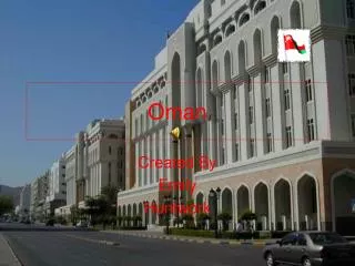
OMAN TOURIST ATLAS PRODUCTION USING GEOGRAPHIC INFORMATION SYSTEMS (GIS) AND GLOBAL POSINTING SYSTEM (GPS). Dr Lotfy Azaz Dr Talal Al-Awadhi GIS and Urban Planning Sections, Geography Department College of Arts and Social Sciences Sultan Qaboos University Lotfy_azaz@yahoo.co.uk.

E N D
OMAN TOURIST ATLAS PRODUCTION USING GEOGRAPHIC INFORMATION SYSTEMS (GIS) AND GLOBAL POSINTING SYSTEM (GPS) Dr Lotfy Azaz Dr Talal Al-Awadhi GIS and Urban Planning Sections, Geography Department College of Arts and Social Sciences Sultan Qaboos University Lotfy_azaz@yahoo.co.uk
Contents • Introduction • The Project • Project Phases • Phase 1 • Phase 2 • Phase 3 • Phase 4 • Future Phase (s) • Value
Introduction • His Majesty Sultan Qaboos bin Said emphasizes the importance of diversification of Omani national income. • Oman is gifted with plenty of unique archeological, cultural, tourist resources.
Introduction • These resources – if invested well - can put Oman in the position where the tourism can represent a big share of the national income compared with current situation. • Therefore, there is a growing official interest to give more attention to tourism sector.
The Project • Part of this interest was characterized by the cooperation between Ministry of Tourism and Geography department of Sultan Qaboos University to quantify all available archeological, cultural, and tourist resources in Oman.
SPATIAL DATABASE AND WEB PORTAL FOR TOURIST RESOURCES OF OMAN USING REMOTE SENSING, GEOGRAPHIC INFORMATION SYSTEMS (GIS), AND WEBGISFOR THE MINISTRY OF TOURISM DRLOTFY KAMAL ABDOU AZAZ DR TALAL AL-AWADHI NASEER AL-NAMANI MOHD AL-BARAWANI AMINA AL-BALUSHI HAITHAM AL-GHASANI ISAMAIL AL-RAWAHI Sultan Qaboos University and Ministry of Tourism
The Project • Spatial database using Geographic Information Systems (GIS) and Global Positioning Systems (GPS) can be used for that purpose.
Project Phases • Phase 1 • In the middle of 2007, the project started with Data Collection phase through filed Surveys all over the Sultanate of Oman. • Members from our integrated team collected coordinates data using GPS devices and ancillary data as well (digital photos, descriptive data…etc).
Project Phases • Phase 2 • The second phase started late 2007, where, all spatial data were transferred to our customized spatial database using ArcGIS for processing. • Ancillary data were linked to the spatial data as attributes.
Project Phases • Phase 3 • The third phase, Data Delivery, where GIS data were delivered to Ministry of Tourism to be used as a base for the GIS unit and to be used for WebGIS portal of Ministry of Tourism.
Project Phases • Phase 4 • The fourth phase was maps production for English version of OMAN TOURIST ATLAS (Get Going).
Get GoingOfficial guide and atlas to Oman • First edition was published in 2010 • 308 pages • 12 Chapters • 101 maps with different scales • Plenty of photographs • descriptive information about tourist places in Oman.
OMAN TOURIST ATLAS • In 2013, the Arabic version of OMAN TOURIST ATLAS was published.
Project Phases • Future Phase (s) • Building Web Portal containing all necessary tourist information about Oman (tourist attractions, hotels, ..etc) linked with its locations and publish it on the Ministry of Tourism web site using the integration between Geographic Information Systems (GIS) and Web publishing (WebGIS). • We hope that Ministry of Tourism support this final Phase.
End Products • Spatial Database • Oman Tourist Atlas (Arabic and English versions) • Web GIS Portal
Project benefits • These outcomes will enable tourists and holiday makers to plan their tours to Oman in advance and book it as well. • To help and encourage tourists and residents of Oman to visit such sites. • Moreover, the final results of this project may have a significant scientific feedback in the fields of Archeology, Culture, and tourism.
Project benefits • These outcomes may help to achieve short and long term goals of the Ministry of Tourism in developing tourism sector for the benefit of Omani Economy.
Thank You For Your Attention OMAN TOURIST ATLAS PRODUCTION USING GEOGRAPHIC INFORMATION SYSTEMS (GIS) AND GLOBAL POSINTING SYSTEM (GPS) Dr Lotfy Azaz and Dr Talal Al-Awadhi GIS and Urban Planning Sections, Geography Department College of Arts and Social Sciences Sultan Qaboos University Lotfy_azaz@yahoo.co.uk