Download
1 / 30
340 likes | 558 Views
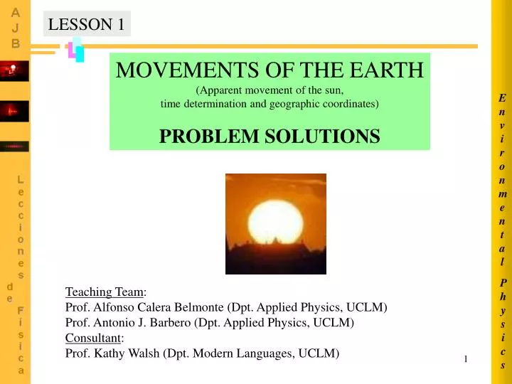
Environmental. Physics. LESSON 1. MOVEMENTS OF THE EARTH (Apparent movement of the sun, time determination and geographic coordinates) PROBLEM SOLUTIONS. Teaching Team : Prof. Alfonso Calera Belmonte (Dpt. Applied Physics, UCLM) Prof. Antonio J. Barbero (Dpt. Applied Physics, UCLM)

E N D
Environmental Physics LESSON 1 MOVEMENTS OF THE EARTH (Apparent movement of the sun, time determination and geographic coordinates) PROBLEM SOLUTIONS Teaching Team: Prof. Alfonso Calera Belmonte (Dpt. Applied Physics, UCLM) Prof. Antonio J. Barbero (Dpt. Applied Physics, UCLM) Consultant: Prof. Kathy Walsh (Dpt. Modern Languages, UCLM)
Environmental Physics * Gnomon: a vertical stick over a flat platform, by measuring the length of the shadow it is possible calculating the incident angle of the rays of the sun. PROB. 0101 / MEASURING THE EARTH RADIUS Eratóstenes of Cirene (284-192 B.C), a greek astronomer, geographer, mathematician and philosopher, was the first wise man who got an accurate measure of the circumference of the Earth. His procedure to do that based on the following: he knew that at noon of the summer solstice day the rays of the sun dropped vertically on the bottom of a well in the ancient city of Siena (near the actual Assuan, Egipt), located almost exactly on the Cancer tropic. Using a gnomon* he could measure the inclination angle of the solar rays in the city of Alexandria, the same day at the same time. Alexandría was located about 800 km to the North from Siena (Eratostenes was director of the famous Library of Alexandría). The angle measured by Eratostenes was 7º14’. From those data, determine the Earth circumference (or its radious). (At the Eratostenes time, the most difficult data to obtain was an accurate value for the distance between the two cities). http://www.astromia.com/biografias/eratostenes.htm
32º 36º Alexandria Environmental 0 TROPIC OF CANCER 0 28º R Siena Physics 24º d R PROB. 0101 / MEASURING THE EARTH RADIUS (CONTINUED) d 800 km = 7º14’ = 7.23º d http://www.lib.utexas.edu/maps/africa/egypt_pol97.jpg
Environmental Physics PROB. 0102 / TIME AND DAY LENGTH The geographic coordinates of Palma de Mallorca are 39º34’ N, 2º39’ E and those of Edinburgh are 55º57’, N 3º10’ W Compare the following quantities for the days December 4th and June 4th in both cities: A. The official times of sunrise and sunset. B. The lenght of the day. C. Solar elevation and azimut at noon (official time). D. What time (official) is the sun crossing the local meridian? You have to have in mind the fact that in Spain the official winter time and the official summer time are forwarded respect GMT by 1 hour and 2 hours, respectively. In Britain, the official summer time is forwarded by 1 hour, but the official winter time has no forward respect GMT.
December 4th (J=338) Declinations: June 4th (J=155) Environmental Sunrise hour angle: Palma Mallorca (Jun 4th) Physics (Dec 4th) Edinburgh (Jun 4th) PROB. 0102 / TIME AND DAY LENGTH (CONTINUED) PART A) (Dec 4th)
Environmental w (º ) = - s Sunrise time (LAT) 12 : 00 : 00 15 º / hora Physics PROB. 0102 / TIME AND DAY LENGTH (CONTINUED) PART A) Local apparent time at sunrise:
LST = LAT - 4(Ls-Le) - Et Sunrise time (LST) Environmental 4-dic, Calculus. Exemple Palma M. Time equation of the day Converting longitude degrees to minutes = 6.973 h = 6:58:24 Local longitude (decimal fraction of a degree) Physics LAT in minutes Standard meridian longitude (in this case, Greenwich) PROB. 0102 / TIME AND DAY LENGTH (CONTINUED) PART A) = 438.56 min -10.60 min -9.59 min = 418.39 min LST = 7:18:35 - 4(0-(-2.65º)) - 9.59
Sunrise time (LST) LST = LAT - 4(Ls-Le) - Et Environmental Physics Winter (Dec 4th): Official time = LST + 1 = 7h 58m 23s Winter (Dec 4th): Official time = LST = 8h 31m 09s Summer (Jun 4th): Official time = LST + 2 = 6h 27m 53s Summer (Jun 4th): Official time = LST + 1 = 4h 40m 43s PROB. 0102 / TIME AND DAY LENGTH (CONTINUED) PART A) Official time: Edinburgh: Palma de Mallorca:
Palma M. Edinburgh Environmental 4-dic 4-dic 4-jun 4-jun Physics PROB. 0102 / TIME AND DAY LENGTH (CONTINUED) PART B) Length of the day.
Solar elevation Environmental Azimut LAT 12:00:00 12:00:00 Edimburgo, 4-dic LST Official time h m s Edimburgo, 4-jun 11:00:00 12:00:00 11:00:00 Palma M., 4-dic 12:00:00 10:00:00 12:00:00 Palma M., 4-jun Physics PROB. 0102 / TIME AND DAY LENGTH (CONTINUED) PART C) LAT = LST + 4·(Ls-Le) + Et
Solar elevation Environmental Azimut Edinburgh, Dec 4th Edinburgh, Jun 4th Palma M., Dec 4th Palma M., Jun 4th Physics PROB. 0102 / TIME AND DAY LENGTH (CONTINUED) PART C) Hour angle determination (degrees) from LAT
Environmental LST Official time 11:50:24 Edinburgh, Dec 4th Edinburgh, Jun 4th 12:57:54 Palma M., Dec 4th 12:50:24 Palma M., Dec 4th 13:57:54 Physics The sun is passing through the local meridian PROB. 0102 / TIME AND DAY LENGTH (CONTINUED) PART D) Determination of the official time when the sun passes across the local meridian. We add 1 or 2 hours to LST corresponding to LAT = 12:00 h m s
PROB. 0103 / DETERMINATION OF LATITUDE AND LONGITUDE Environmental 70º Physics On the evening of the 15th April Her Majesty’ agent 007, James Bond, is kidnapped in London by enemy agents from a secret organization attempting to swap him with one of their own main ringleaders, who is getting a holiday paid by the government as a convict in a britain prison. Bond is inmediately carried by plane out of the country and that night he is locked up in an secret hiding-place abroad. However before the sunrise, a few hours later, our clever agent 007 escapes and finds a safe refuge in the tower of a church from which he can watch over an extensive area around him. Once he’s convinced to have eluded his kidnappers, Bond waits for the sunrise and when the sun is just rising in the horizon he uses the Polar star as the north point reference and, using two straight sticks and his splendid analogical watch (the stupid kidnappers did not take it away, they didn’t notice that these watch was also a pocket computer), he gets a measure of the angle between the rising sun and the north direction. The result of that measure is 70º towards the East. After that, he catches a carrier pigeon from the pigeon loft of the tower, and uses some old wooden boards he finds there to built a cage to keeping the animal. Furthermore, he uses a flat board and another stick to build a simple ‘gnomon’ (see next page picture). Polar star
Environmental Physics PROB. 0103 / DETERMINATION OF LATITUDE AND LONGITUDE (CONTINUED) When the sun is about to reach its maximum elevation, Bond watches carefully the shadow of the stick and writes down the time of the tower clock at the moment when the shadow reaches its minimum length. This clock indicates 11:44 h, whereas on his own watch he can see 9:44 h. At this moment, the tower clock indicates 11:44 and Bond’s watch indicates 9:44 Gnomon Using these measurements along with a table he gets from the memory of his wonderful watch, and after using also the calculator that of course it has, Bond pulls out a sheet from his notebook, writes on it the geographical coordinates of the place where he actually stands and a brief note addressed to the local government of the country where he actually is, asking for a rescue helicopter. Straight away, he ropes the piece of paper to the leg of the carrier pigeon and releases it. Then, he sits calmly down and waits for the rescue. Minimum lenght Which are the geographic coordinates? The government of which country has he asked for rescue?
Environmental W N S 70º = 110º E Physics PROB. 0103 / DETERMINATION OF LATITUDE AND LONGITUDE (CONTINUED) Sun crossing over the local meridian at 11:44 LST If the angle to the north is 70º at sunrise, then the solar azimut is = 180º-70º = 110º Besides we know from the tower clock that when the sun reaches the meridian it is 11:44 (LST) and of course it is 12:00 (LAT) Moreover, from Bond’s watch we also know that in London it is 9:44
April 1st Environmental April 16th Latitude determination: Physics PROB. 0103 / DETERMINATION OF LATITUDE AND LONGITUDE (CONTINUED) Relationship between azimuth and latitude, declination and solar altitude angles: At sunrise = 0 The kidnapping occurred on April 15th, and Bond escapes the following day, which is the 106th day on the year (assuming no leap year). For day J = 106 we find = 9.84º, and Et = 0.02 min, so we’ll consider negligible the Et contribution. The latitude is obviously 60º N for the observer can see the Polar star.
Time equation Local standard time Environmental Local apparent time Longitude correction 0:00 12:00 = 11:44 + 4 (Ls-Le) + Et 4 (Ls-Le) = 12:00 - 11:44 = +0:16 +16 minutes towards E from standard meridian = +4º from standard meridian of this place Physics PROB. 0103 / DETERMINATION OF LATITUDE AND LONGITUDE (CONTINUED) Longitude determination LAT = LST + 4 (Ls-Le) + Et Longitude correction Because the sun takes 4 minutes to going over ONE grade Difference of longitude between the standard meridian Ls and the local meridian Le (Ls-Le) = 4º What is the standard meridian of this place?
Environmental Ls Standard meridian longitude Greenwich Ls Le -Le = 30º+4º=34º Physics -4º 0º -34º -30º E PROB. 0103 / DETERMINATION OF LATITUDE AND LONGITUDE (CONTINUED) Standard meridian of this place Bond’s watch indicates London time: there it is 09:44 LST (the same in Greenwich). The tower clock indicates local standard time: it is 11:44 LST. So, we conclude from these difference (2 hours) that the standard meridian lies 30º E from Greenwich: Ls = -30º. Le Local meridian longitude (Ls-Le) = 4º (towards W, longitude> 0; towards E, longitude< 0) (-30º-Le) = 4º Le = -34º (34º E)
Geographic coordinates: 60º N, 34º E Environmental 60º N 34º E Physics PROB. 0103 / DETERMINATION OF LATITUDE AND LONGITUDE (CONTINUED) Country: Rusia N
January Day Declination (º) Time Equation (min) PROB. 0104 / DETERMINATION OF LATITUDE AND LONGITUDE ON THE SEA On 31st January 2005 a loner navigator happens on some point of the North Atlantic ocean. He has a sextant aboard and also an accurate clock keeping GMT time. By using his sextant the navigator finds that when the sun is passing through the local meridian its altitude upon the horizon is 30º23’24’’, and at this moment the clock indicates that GMT is 14:00:00. • What is the geographic position of this navigator (latitude and longitude). • The navigator goes always to the bed at sunset. What time will he go to the bed this day? Give the result both in LAT and GMT. Use table of declination and time equation for January.
Maximum solar altitude Celestial equator W 30º23’24’’ N S E Daily solar path on 31st Jan PROB. 0104 / DETERMINATION OF LATITUDE AND LONGITUDE ON THE SEA (CONTINUED)
= -17.61º = -17º36’36’’ Et = -13.00 minutes Latitude: = 90º -(-) =90º - (30º23’24’’-(-17º36’36’’)) = = 90º - (30º23’24’’-(-17º36’36’’)) = 90º-48º = 42º N = 90º -(-) = -17º36’36’’ = 42º N Ecuador celeste W =30º23’24’’ N S E PROB. 0104 / DETERMINATION OF LATITUDE AND LONGITUDE ON THE SEA (CONTINUED) 31st January =30º23’24’’= 30.39º
Ls= standard meridian longitude Le= local meridian longitud This is LST in Geenwich LAT = 12:00 h (noon) GMT = 14:00 h Et = -13 min = 42º N Le = 26º45’ W >0 towards W Ls, Le <0 towards E Le = 26º45’ W PROB. 0104 / DETERMINATION OF LATITUDE AND LONGITUDE ON THE SEA (CONTINUED) Calculation of longitude LAT = GMT + 4(Ls-Le) + Et 4(Ls-Le) = 12:00 – 14:00 – (-0:13) 4(Ls-Le) = -120 min – (-13 min) = -107 min Ls= 0º (Greenwich) -Le = -107 min/4 (min/grado) = -26.75º Le = +26.75º = 26º45’ W
GMT = LAT - 4(Ls-Le) - Et PROB. 0104 / DETERMINATION OF LATITUDE AND LONGITUDE ON THE SEA (CONTINUED) Sunrise time on 31st January at 42º N Sunrise hour angle: At sunset the hour angle is the same than it was at sunrise, but towards the west. The number of hours passed from noon until sunset is: Sunset time (LAT): 12:00 + 4:53 = 16:53 hours Sunset time (GMT) LAT = GMT + 4(Ls-Le) + Et GMT = 16h 53 min - 4(0-26.75) – (-13) min = 16 h 53 min + 107 min + 13 min = 18 h 53 min
City Latitude Longitude Day September 21st October 22nd November 23rd December 24th January 25th February 26th March 27th April 28th May 29th June 30th PROB. 0105 / LOCAL APPARENT TIME Determine the local apparent time on each of the following cities for each of the below listed days when it is 12:00:00 UTC. Use the Spencer formula for the time equation. It is recomended to use an Excel sheet to perform all calculations.
PROB. 0105 / LOCAL APPARENT TIME (CONTINUED) Since we have to calculate LAT at 12:00:00 UTC, our reference meridian will be that of Greenwich. LAT = LST + 4 (Ls-Le) + Et So Ls = 0º0’0’’ and LST = UTC = 12:00:00. We have to calculate a the time equation for each day from Spencer formula. (J is the number of the day of the year) beeing the daily angle
2º 0º 40º 38º 36º PROB. 0106 / LOOKING FOR A WRECKAGE • An archeological team aboard an scientific ship looking for sunken vessels of historical interest finds on February 13th a wreckage in the Mediterranean sea, near of the Spanish coast. As the GPS aboard is out of order, the captain takes manually some measures to record the position of the shipwreck: • 1º) At the sunrise time, the solar azimut is 72.71º. • 2º) When the sun is crossing the local meridian, the spanish official time, indicated by the clock of the ship, is 13:17:23. • Determine the geographical position of the wreckage. Point out on the map these coordinates. • What is the official time for the sunrise this day on that point? What is the solar elevation upon the horizon at 12:00:00 LAT?
Official time when the sun crosses the local meridian: 13:17:23 Ecuador celeste W N S =72.71º (Sunrise) E PROB. 0106 / LOOKING FOR A WRECKAGE (CONTINUED) February 13th data from tables: = -13.63º; Et = -14.26 min Relationship between azimut, declination, latitude and solar elevation:
Longitude of the shipwreck Le = +0.779º = 0º 46’ 45’’ W PROB. 0106 / LOOKING FOR A WRECKAGE (CONTINUED) At the sunrise time the solar elevation is = 0 = cos-1(0.79288) = 37.54º = 37º 32’ 40’’ Latitude From this latitude we can obtain inmediately the solar altitude at noon (12:00:00 LAT): = 90º - + = 90º - 37.54 + (-13.63) = 38.83º = 38º 49’ 48’’ Longitude determination: LST = Official time –1 = 12:17:23 (winter schedule) 4 (Ls-Le) = LAT – LST – Et LAT = LST + 4 (Ls-Le) + Et 4 (Ls-Le) = 12:00:00 – 12:17:23 – (-00:14:16) = -00:17:23 + 00:14:16 = -00:03:07 Ls-Le = -0.779º 4 (Ls-Le) = -3.117 min Ls = 0º (Greenwich)
2º 0º 40º 38º 36º 37º 32’ 40’’ N 0º 46’ 45’’ W PROB. 0106 / LOOKING FOR A WRECKAGE (CONTINUED) Sunrise hour angle (February 13th): Coordinates of the wreckage: 37º 32’ 40’’ N, 0º 46’ 45’’ W s = 79.26º = 79.26/15 = 5.284 hours Sunrise LAT (February 13th): 12-5.284 = 06:42:58 Sunrise LST (February 13th): LST = LAT - 4 (Ls-Le) - Et = 07:00:21 Sunriseofficial time at the wreckage position 08:00:21