Download
1 / 39
390 likes | 541 Views
Aim: How can rock layers change over time?. Do Now: Let’s take a look at Mr. Rankin’s infamous plate tectonic video. Sit back and enjoy the feature!. Earth: Dynamic Crust (Active/Moving). Deformed Rock Structures:.

E N D
Aim: How can rock layers change over time? Do Now: Let’s take a look at Mr. Rankin’s infamous plate tectonic video. Sit back and enjoy the feature!
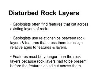
Earth: Dynamic Crust (Active/Moving) Deformed Rock Structures: Sedimentary strata normally form in a horizontal position. Any change from the horizontal position is evidence of minor crustal change.
Tilting Faulting
Fossil Evidence of Crustal Movement 1. Marine fossils found at high elevations suggest uplifting forces. 2. Shallow water marine fossils found at great ocean depths suggest subsidence (to move under something else).
Plate Tectonics: • Earth’s Structure: • Earth’s Interior ESRT: pg. 10
Crust Mantle Outer core Inner core
Earth’s Surface: 1. Ocean 2. Granitic Continental Crust 3. Basaltic Ocean Crust 6. Lithosphere (Crust and Upper Mantle 4. Rigid Upper Mantle 5. Asthenosphere
Thickness of: Continental Crust: 32 km average (100 km) Ocean Crust: 5-8 km Asthenosphere: the plastic like layer below the lithosphere in Earth’s mantle.
Summary Describe the few ways in with layers of strata can be altered (changed). What are two types of fossil evidence that can determine crustal movement? How many distinct layers make up Earth? Name them in increasing depth.
Aim: How can we obtain density, temperature, and pressure measurements within the four major layers of Earth? Do Now: Using pg. 10 of the ESRT, determine relationship between depth and temperature.
Using pg. 10 of the ESRT; answer the questions on the worksheet.
Aim: How did Alfred Wegener come up with his theory of continental drift? Do Now: What observable characteristic can you make about the east coast of South America and the west coast of Africa?
Theory of Continental Drift Alfred Wegener proposed the theory of Continental Drift in the early 1900’s
Evidence for Continental Drift: • 1. Coastline of the continents: for example, the east coast of South America fits well with the west coast of Africa like pieces of a giant puzzle. Pangea: Supercontinent that included all the landmasses of Earth.
2. Fossil Clues: certain fossils of ancient life forms are found on widely separated continents. Mesosaurus: It was a small freshwater reptile. It’s fossils are found in Africa and S. America.
3. Rock and Mineral Correlation: Coal (tropical conditions) are found in the extremely cold climates of Antarctica. • Rock layers of continents across the vast ocean match in age and type.
4. Glacial Movements: Evidence of glacial movements on different continents in the Southern Hemisphere matches if they were together.
Summary Describe some observations that can support the evidence of continental drift. As evidence accumulates, the support for the theory that the present continents were at one time a single large landmass: increases, decreases, or remains the same?
Aim: Why are North and South America very far from Europe and Africa? Do Now: Using pg. 5 of the ESRT, name the feature that separates U.S. from Europe
Theory of Sea Floor Spreading: Topography of the Ocean Floor:
Guyot Mid Ocean Ridge Rift Zone Continental Slope Oceanic Trench Continental Shelf
Rift Zone Abyssal Plain Seamount
Continental Shelf: Shallow marine; low gradient surface of the continent. Continental Slope: Connects continental crust to the oceanic crust. Seamount: Underwater mountain.
Guyot: Subsidence and wearing down of a seamount. Oceanic Trench: Deep sea depression from a collision between two plates.
Mid Ocean Ridge (MOR): Underwater mountain range that runs along a rift zone. Rift Zone: Fracture in rocks where plates are spreading and new crust is made. Abyssal Plain: Underwater plain extending from the ridge to the continental slope.
Evidence of Sea Floor Spreading • 1. Age Evidence: As the distance from the ocean ridge increases the age of the rock increases.
Increases Increases
2. Magnetic Evidence (Paleomagnetism): Magnetic clues from the iron-bearing basalt rock of the ocean floor supports the theory of seafloor spreading. Reverse Normal Normal Reverse