Download
1 / 18
180 likes | 356 Views
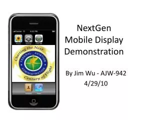
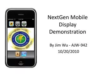
NextGen Mobile Display Demonstration. By Jim Wu - AJW-942 10/20/2010. Why Mobilization?. Service-Oriented Architecture (SOA) enables dissemination of weather information widely and instantly to new classes of clients within and beyond the FAA

E N D
NextGen Mobile Display Demonstration By Jim Wu - AJW-942 10/20/2010
Why Mobilization? • Service-Oriented Architecture (SOA) enables dissemination of weather information widely and instantly to new classes of clients within and beyond the FAA • NOAA has begun to provide weather alerts to the general public using modern dissemination mechanisms (i.e., tweets, blogs, mobile devices) • Mobilization of ITWS weather information is technically feasible • ITWS service expansion mission brings terminal weather information to new users in and around major metropolitan areas under OEP Terminal airspace • Mobilization enables the near term NextGen paradigm shift “dissemination” by providing a new and popular mechanism for receiving alerts and context sensitive information • Mobilization enables the mid-term NextGen paradigm shift “Translation” of Weather into Weather Constraints leading to benefits for Decision Support Tool (DST) developers who now have a new tool for demonstrations • ITWS functions may be subsumed by NextGen Weather Processor (NWP)
Service Gap • There are more than 10,000 airports in the US, yet less than 150 Air Traffic Control Towers have direct access to ITWS Situation Displays • ITWS primarily serves large volume Air Traffic Control Towers (ATCTs), most TRACONs and ARTCCS, and the ATCSCC. • ITWS also serves airline dispatchers at seven major air carriers via Internet • ITWS is unavailable in-flight • ITWS helps bring common situational awareness among NAS operators, controllers and airlines enabling efficient timing of operational changes when first constrained / unconstrained by weather • Some OEP Secondary / Reliever Airports (SRA) now tie-in to their OEP Primary Hub via ITWS expansion • PROBLEM – Many potential users within ITWS covered terminal airspace remain in the dark • Lack of measurable operational benefits that outweigh the cost of expensive desktop or flight-deck situation displays, dedicated high bandwidth telecommunications and lifecycle organic maintenance
Mobile Solution • POTENTIAL SOLUTION - Handheld devices which: • Are very inexpensive compared to Situation Displays (< 1/10 the cost) • Operate instantaneously at the surface “and aloft” throughout all the terminal airspace covered by ITWS sensors • Eliminate expensive point-to-point telecommunications • Enjoy commercial development, maintenance and wide availability • Leverage immense non-recurring design cost for human-machine interoperability and understanding • There are 45 millions smart phone users in the USA. • Potential benefits from SOA dissemination of ITWS products may be realized by Pilots (pre-flight and in-flight), Flight Planners, Service Stations, Airports including Commercial small hubs, Air Cargo, GA, military, small ATCTs and non-towered fields (Federal, commercial and private) in the vicinity of major metropolitan areas • All may gain access to the “best available” terminal weather of ANSP quality becoming welcomed to common situational awareness between FAA controllers and now able to anticipate the timing of operational change due to weather constraints • New services promote the President’s Management Agenda concerning e-Government, and e-Commerce.
Integrated Terminal Weather System (ITWS) – Mobile Edition (ME) • ITWS-ME is a client/server based software package that will run on any Smartphone device. • Smartphones that will run ITWS-ME include Blackberry, iPhone, gPhone, and more. • The ITWS Weather Team is working to develop wireless software that will provide current & forecast ITWS and CIWS (Corridor Integrated Weather System) weather products • Data formats will be those used by wireless devices. • ITWS and CIWS weather information will be available to users with a Smartphone or similar device. • To fully realize the NextGen “Dissemination” paradigm shift in accord with “To-Be” Service Views the ITWS Weather Team envisions all NextGen weather products ought to be available wirelessly and universally to users of mobile devices in the near future.
ITWS-ME Demo System Architecture Weather data flow under the ITWS-ME version 1.0 demo - Read-only weather data goes from the ITWS PG SWIM server at Volpe FAA PC in admin network via VPN located in DC Smartphone web service server Iphone or Blackberry or Gphone.
ITWS-ME for Blackberry Access - Security FTI • Security Features: • FAA-owned and configured Blackberry • AES-256 Encryption • ITWS Application Certification - Only allows users with the proper certificate to access the Application • One-time Passwords emailed to users • GPS Function can be used to logically block/allow access based on physical location of the device Lotus Notes Server AES 256 Encrypted • FAA-Owned Blackberry with: • Email • GPS Function AES 256 Encrypted Running: Blackberry Application SQL Server Blackberry Server
Screenshots for ITWS-ME v1.0 IPhone Icon IPhone ITWS Main IPhone ITWS Detail
ITWS Future Development Goals ITWS ME will integrate FAA weather information with Global Positioning System on a 2D global map with live compass to describe the relationship between position with weather. ITWS ME will generate notification and alert to the end user via graphic and voice. ITWS ME will utilize the bandwidth share technology to save the cost ($) RIM Blackberry Apple iPhone GoogleNexus One
CoSPA for BlackBerry & AndroidFrom MIT- LL • CoSPA Mobile for BlackBerry and Android platforms • Mobile platforms show full CONUS and most basic weather products of CIWS and CoSPA, such as: • Realtime and forecasts of: • Standard Precip • Winter Precip • Echo Tops • Satellite imagery • Lightning • Overlays such as states, ARTCCs, and roads • Touch screen/keyboard for panning and zooming • Full screen viewing
CoSPA Application for BlackBerryFrom MIT- LL • Mobile Application vs. Mobile Website • BlackBerry application has more interactivity with the user than a website • Trackball to move around the map • Hotkeys for zooming, selecting forecast frames • Menu options for layers, zooming, and forecast frames • Better GPS location support • Cleaner presentation than a web browser • Application can easily be downloaded and installed/updated
CoSPA Application for BlackBerryFrom MIT- LL Automatic five-minute forecast updates. Context menu for map options. Select base product and other layers. Jump to forecast frame.
CoSPA Application for BlackBerryFrom MIT- LL Pan Around the Map Forecast Frame Selection Zoom In Zoom Out Previous Forecast Frame Layer Selection Next Forecast Frame Zoom to CONUS