Download
1 / 36
490 likes | 763 Views
July 25, 2012. Introducing the Esri Geoportal Server. @martenhogeweg. The BIG Picture: Open Data. Location Integrates Functional Areas…. Science/Modeling. Natural Resources. Conservation. Land Management. Defense/Security. Crime. Congestion. Agriculture/Forestry. Water.

E N D
July 25, 2012 Introducing the Esri Geoportal Server @martenhogeweg
Location Integrates Functional Areas… Science/Modeling Natural Resources Conservation Land Management Defense/Security Crime Congestion Agriculture/Forestry Water Business Efficiency Pollution Global Warming Energy Economic Recovery Human Health Population Facility Management Land Use Education Biodiversity Logistics Public Safety Development Environmental Protection Humanitarian Relief Urbanization Law Enforcement National Security Energy Emergency Management Oceans …at All Levels of Government…
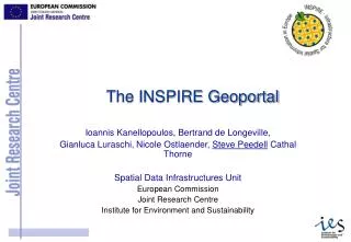
…and Forces Governments to Share Data Source: http://inspire.jrc.ec.europa.eu/reports/position_papers/inspire_ast_pp_v4_3_en.pdf
6/2003 Geodata.gov launched as e-Gov initiative. 3/2009 Data.gov – promotes transparent government. 6/2009 Data.gov connects to Geodata.gov web service and grows from 50 to 300,000 resources overnight. 10/2011 Geodata.gov becomes Geo.Data.gov. 7/2012 Geo.Data.gov includes 850,000+ resources. Geodata.gov > Data.gov > Geo.Data.gov
Open Government Made Useful Recovery.gov Expenditures vs. Need Haiti AID Funding World Bank Projects
HOWEVER: If You Can’t Find It, You Can’t Use It… • Data on Employee Desktops • Scanned Reports without Data Access • Sprouting API
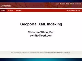
Search and view geospatial resources Manage, publish, and store metadata View live map services Download data Open Source Apache 2.0 23,000+ downloads 150 countries 74% outside US Esri Geoportal Server Enabling discovery and use of geospatial resources in heterogeneous environments
Geoportal Server is OPEN SOURCE Esri Community Esri Geoportal Server Forum Moderate Users Documentation Manage Contributors Source Code Develop Committers http://esriurl.com/geoportalserver
Use Case: “I want to find data …” Solution: • Simple keyword Search • Spatial search • Federated Search • Advanced options for experts • Smart matching and ranking • Thesaurus Service • Search results are simple to understand… yet contain detail for power users
Use Case: “I don’t want to search though…” Solution: • Analogous to Department Store • Implementer Organizes Hierarchy • Based on Metadata Content • Filter/Paginate Within Category • Classification and Relationships
Use Case: “I want to make a map …” Solution: • Preview services: • ArcGIS Server Map Services • ArcIMS Image Services • OGC WMS, SOS • GeoRSS • KML • Provide integration points for map viewer platforms • ArcGIS.com Viewer • JavaScript, Flex, Silverlight • ArcGIS Desktop ArcMap • ArcGIS Explorer
Use Case: “I want to download data …” Solution: • Select area • Select data • Set options • Deliver download link through email • Based on Clip-Zip-Ship Service • Extensible in Python
Use Case: “I want to share my resource…” Solution: • Register Servers or Services Directly • Create metadata online • Upload metadata • Register catalog service for harvesting • Support metadata standards: • INSPIRE • North American Profile • Dublin Core • Configurable
Use Case: “Is new data is available…?” Solution: • User specifies search criteria • Give user link to a GeoRSS feed • User subscribes to GeoRSS feed • Bookmark searches in the browser
Solution: Monitor Services Verify Implementation Performance and Scalability: FGDC Service Status Checker: Use Case: “Is my resource is available…?” http://resources.esri.com/enterprisegis/index.cfm?fa=performance.main http://registry.fgdc.gov/statuschecker/
DEMO Discover Access Use Discover Revisited
Geoportal Server Roadmap • Next • ArcGIS Metadata integration • ebRIM, Feature Data Dictionary, Feature Catalog support • Enhanced OGC support (WMTS, SOS, WPS…) • Faceted search • Version 1.2.2 – UC 2012 • Portal for ArcGIS integration • Include Flex Viewer 2.5 (Apache 2.0) • ISO 19115-2 Support (instrumentation) • Managing User Roles • FGDC Service Checker integration • Shopping Cart Framework • Version 1.2 – December 2011 • WMS and OpenStreetMap search map • Collections • MySQL support • Schematron metadata validation • THREDDS harvesting
Just When We Understood Systems of Systems… HydroPortal NCDDC OER NOAA Geoplatform NOAAYouTube OERYouTube ArcGISOnline NOS Data.gov CMGDS USGS.gov NGDC IOCM NCDC CSC SECART NODC A B = A searches B
Web Services We Need to Move to Platforms…? Web Client • RESTful Services • Easily Discovered • Open Standards • Application Programming Interfaces DesktopClient Web Client Mobile Client HighestPointService Demographic Health Data Point-to-Point Services Loosely Coupled and Orchestrated Services
Yes… Because the World is Not Waiting for Us http://www.wordle.net/show/wrdl/5293619/Changes_affecting_SDI
What You Really Want is the Power of AND • Minimalistic user experienceAND rich functionality • Simple descriptionsAND complete metadata • Work with our contentAND everyone else’s • Great taste AND 0 calories • Outsource everythingAND do it myself • Publish onceAND share everywhere I WANT THIS AND I WANT THAT
Direction 1 – Data Discovery Swiss Army Knife ISO CGDI FGDC INSPIRE ANSI OGC NEN GEOSS GEMINI W3C ArcGIS Online ANZLIC SPARQL GeoCommons ATOM OpenSearch CS-W Geoplatform.gov Portal for ArcGIS WeoGeo
Direction 2 – Geoportal Server AND ArcGIS Portal • Search ArcGIS Portals from Geoportals • Synchronize between portals • OGC CS-W Interface to ArcGIS Portal • Standards-based Metadata Editor • ArcGIS Portal items • ArcGIS Server services
Direction 3 – Go Beyond Metadata Searching • Find Features in Feature Services • Find Articles in RSS/Atom Feeds • Find (Non-)Geospatial (Social) Media (Video, Photo, …) Feature Services Social Media Geonames.org Documents Geodatabase Services THREDDS
DEMO SPARQL Search ArcGIS Portal Integration Federated Search metaDATA Search
Steps to evaluate UC sessions • My UC Homepage > “Evaluate Sessions” • Choose session from planner OR • Search for session www.esri.com/ucsessionsurveys
Thank you for attending • Have fun at UC2012 • Attend the SDI SIG at 12:00PM in 24B • Please fill out the evaluation: • www.esri.com/ucsessionsurveys • Session ID: 767