Download
1 / 44
440 likes | 725 Views
DARPA Grand Challenge. “It shall be a goal of the Armed Forces… that by 2015, one-third of the operational ground combat vehicles of the Armed Forces are unmanned.” (S. 2549, Sec. 217). A 175 mile “race” through the desert. DARPA Grand Challenge 2005. Description of Challenge.

E N D
DARPA Grand Challenge “It shall be a goal of the Armed Forces… that by 2015, one-third of the operational ground combat vehicles of the Armed Forces are unmanned.” (S. 2549, Sec. 217) A 175 mile “race” through the desert
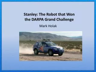
Description of Challenge • Up to 175 mile route through the desert • Mountainous terrain up / down 2000 ft • Completely autonomous vehicles • For March 2004, 106 teams entered, 25 qualified, 5 made it past the first 100 yds • Best showing: Carnegie Mellon @ 7.4 mi
Best Showings • "Vehicle 22 Red Team (Carnegie Mellon): At mile 7.4, on switchbacks in a mountainous section, vehicle went off course, got caught on a berm and rubber on the front wheels caught fire, which was quickly extinguished. Vehicle was command-disabled.“ • "Vehicle 21 SciAutonics II: At mile 6.7, two-thirds of the way up Daggett Ridge, vehicle went into an embankment and became stuck. Vehicle was command-disabled.“ • "Vehicle 9 The Golem Group: At mile 5.2, while going up a steep hill, vehicle stopped on the road, in gear and with engine running, but without enough throttle to climb the hill. After trying for 50 minutes, the vehicle was command-disabled."
Summary of the Rules • The vehicle must travel autonomously on the ground in under ten hours. • The vehicle must stay within the course boundaries as defined by a data file provided by DARPA. • The vehicle may use GPS and other public signals. • No control commands may be sent to the vehicle while en route. • The vehicle must not intentionally touch any other competing vehicle. Destructive “behavior” is prohibited. • Tethered subsystems cannot be propelled or maneuvered independently of the ground vehicle. • Vehicles must have minimal environmental impact.
Race Video Footage, 2004 • History Channel Special about the “Million Dollar Challenge”
What is our objective? • Develop technologies for general use • Invent valuable IP • Build a new high-value company • Promote Indiana technology • Win the $2M prize
Current and Future applications of Autonomous Vehicles • Delivery and disposal of hazardous materials • Military logistics -- transport of materials • Non-military logistics – hospitals, airports, warehouses, manufacturing plants • Airport baggage • Farming and agriculture • Advance ground warfare • People movers
Major Milestones • December 15 – Basic autonomous operation • March 11 – Application video and paper • May 2 – DARPA Site visit • September 28 – NQE (National Qualifying Event) • October 8 – 2005 DARPA Grand Challenge
Current Team Members • Currently 22 “All Indiana” team members • 6 entrepreneurial business owners, some with substantial robotics experience • 3 professors with control, robotics, vision experience • 4 students • 9 engineering/programming professionals • A combined 300+ Years of experience on the team.
Skills Needed • Vendor survey of available sensors and their capabilities • Evaluate trade offs for a "make / buy" decision and sensor sophistication level • Physical mounting, environmental protection and articulation of sensor (if required) • Software signal conditioning and compensation • Pattern recognition software for terrain, obstacles, landmarks and localization • Sensor integrity analysis software for confidence evaluation • Software interface to navigation controller
Sensor Technologies • DGPS - 3D absolute localization and time standard • LADAR - a "cloud of LASER points" with both distance and intensity components • Vision - Passive cameras: stereoscopic, wide angle, color • Odometry - encoders on passive wheels • Inertial - 6DOF motion sensors • Magnetic - 3D field orientation, compass functions and local fields (power lines) • RADAR - Background speed, vehicle following / passing, metal obstacles • Thermal - FLIR thermal imaging • Vibration / Shock - robot health and terrain analysis • Touch - whiskers for "last resort" obstacle detection • Ultrasonic - SONAR for detection of objects transparent to other technologies • Clinometers - gravity based orientation (not inertial) • Helioscope - sun tracking for robot pose and shadow identification • Altimeters - for topographic map rationalization
Software • Motion control software (steering, throttle, etc) • Real-time image analysis and feature extraction • Sensor array and fusion software • Navigation control software • Path planning • Obstacle avoidance software • General system architecture • Network communications • Operating system • Fault tolerance • Logical deployment of recovery systems • Mapping technology
Mechanical Technologies • Gyro-stabilized sensor platform • Electrical system, battery backup • Environment controls (A/C, humidity) • Ruggedization • Robot health • E-Stop interface • Vehicle dynamics • Vehicle protection • Recovery systems
Other Required Functions • Development tools • System integration • Testing • Project Management • Cost management • Marketing • Public relations • Web development • Sponsorship recruitment
Ways for Purdue to be Involved • Class project(s) • Extra-curricular activity • Faculty research • Other?
LADAR Arrays in Hi-res Dynamic Environment Analysis • Recognize roads, terrain contours, and identify obstacles from an unstable vehicle traveling at 100 kilometers per hour with resolution in the centimeter range
Multi-spectral RADAR for Terrain Profiling • Identify hard and soft terrain features using RADAR at different frequencies to identify hard packed road paths from surrounding ground and rocks from bushes.
SONAR arrays in a High Speed, Unstructured Environment • Wind and speed create difficulties in extracting data from ultrasonic reflections
Using Arrays of GPS Receivers to Circumvent Invalid Positioning • Differential GPS corrects for a subset of positioning errors. An array of GPS receivers may allow faulty data from other error sources to be identified and either ignored or corrected.
Map Matching from Terrain Contours • Fused sensor data of surrounding terrain is used to register against topological and aerial maps for road identification and localization without GPS.
Stabilizing Instrument Platforms on High Speed Land Vehicles • Sensor stabilization may be critical for making sense of sensor data in real-time.
Sensor Fusion for Separating Critical Obstacles from Benign Terrain Features • Develop methods for using inputs from multiple sensors to separate dangerous obstacles such as rocks from easily negotiated terrain features such as shadows or tumbleweeds.
Sensor Fusion for Identifying Roads in an Unstructured Environment • Making best determination of road location with oftentimes conflicting imaging and obstacle-avoidance sensor data.
Strategic Recovery of an Autonomous Vehicle from Indeterminate Situated State • If the vehicle is immobile and sensor data is contradictory, what steps can be taken to “free” the vehicle from its situation and restore sensor effectiveness.
Why Purdue Involvement? • Worthy challenge for top engineering school • Multi-disciplinary approach • University-to-university collaboration • University-to-industry collaboration • Creation of a high-tech start-up • Long-term, ground-breaking research opportunities
More Information • Our website is http://IndyRobotics.com • DARPA site is http://www.darpa.mil/grandchallenge
THANK YOU!! • If you have interest, please contact us!
Doug Traster • Mr. Traster is an electrical engineering graduate of the University of Texas at Austin with 30 years of experience in embedded controller design and development, the last ten of which were in robotic applications. He is the inventor of three patents in video display design two of which are licensed for all closed caption televisions. He is also knowledgeable in data communications technology with patents in HDLC channelized T1. • Mr. Traster formed his first company, Varix Corporation, in 1981. It was one of the first personal computer based test equipment companies in the world. Varix built a universal PROM and PLD programmer, the first of it's kind to contain device programming algorithms entirely in software. • Mr. Traster's current company, Volant Corporation, was formed in 1985. It operates as a turnkey contract developer for a wide range of projects including high speed data communication, automobile diagnostic equipment, channelized T1, database applications, document management, and other embedded controller applications. In the last 15 years, the company has focused primarily on software and electronics for controlling robotic equipment - storage / retrieval systems, semiconductor device handlers and mobile robots. • Mr. Traster volunteers his time for Middle School and High School robotics. For the last three years he has mentored LEGO Mindstorms for the Indianapolis Public Library, provided technical leadership for several FIRST LEGO League teams and provided engineering leadership on a FIRST Robotics team.
Scott Jones Scott Jones, inventor of several patents, including telephone-company “Voicemail” used by over 500 million people globally, continues to actively build businesses that capitalize on advanced technologies. Founder/Chairman of one of Indiana’s leading VC firms, Gazelle TechVentures, as well as Founder/Chairman of Gracenote (maker of the widely-used Internet music recognition service, CDDB) and Escient (maker of the first hard-disk based music systems for the home), he served as Chairman of the Indiana Technology Partnership, a statewide organization comprised of business, academic, and civic leaders. Graduating from IU in ‘84, he was a research scientist at MIT’s Artificial Intelligence Lab and then founded Boston Technology in ‘86.