Download
1 / 35
400 likes | 772 Views
The Advent of Satellite Communication. Satcom Vision and Development of Launch Technologies Oct. ‘45 - Arthur CLARKE: “Extraterrestrial relays”, Wireless World, p.305 Three manned GEO space station Oct. ‘54 - John PIERCE: “Telecommunications satellites”

E N D
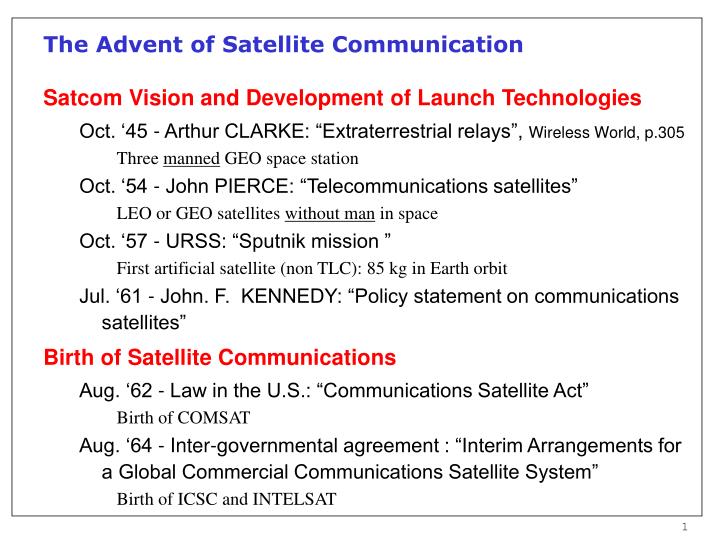
The Advent of Satellite Communication Satcom Vision and Development of Launch Technologies Oct. ‘45 - Arthur CLARKE: “Extraterrestrial relays”, Wireless World, p.305 • Three manned GEO space station Oct. ‘54 - John PIERCE: “Telecommunications satellites” • LEO or GEO satellites without man in space Oct. ‘57 - URSS: “Sputnik mission ” • First artificial satellite (non TLC): 85 kg in Earth orbit Jul. ‘61 - John. F. KENNEDY: “Policy statement on communications satellites” Birth of Satellite Communications Aug. ‘62 - Law in the U.S.: “Communications Satellite Act” • Birth of COMSAT Aug. ‘64 - Inter-governmental agreement : “Interim Arrangements for a Global Commercial Communications Satellite System” • Birth of ICSC and INTELSAT
Milestones of Satellite Communications (1) 1958-64: LEO and MEO experiments • Pre-recorded message transmission Dec. ‘58 - SCORE (60 kg of payload launched on ATLAS at 190 km perigee - 1500 km apogee) Oct. ‘60 - COURIER (227 kg, 970-1200 km) • Passive reflection Aug. ‘60 - ECHO I (76 kg, 1200-1480 km) Jan. ‘64 - ECHO II (248 kg, 980-1260 km) • Telephone and TV transmission Jul. ‘62 - TELSTAR I (77 kg, 940-5640 km) Dec. ‘62 - RELAY I (78 kg, 1320-7430 km) May ‘63 - TELSTAR II (79 kg, 970-10800 km) Jan. ‘64 - RELAY II (78 kg, 2080-7420 km)
Milestones of Satellite Communications (2) 1963-64: GEO experiments Jul. ‘63 - SYNCOM II (39 kg, almost GEO: i=33°) Aug. ‘64 - SYNCOM III (66 kg) 1965: The first HEO satellite (URSS) Apr. ‘65 - MOLNIYA I (1020-39450 km, 12 hours) Clarke’s conception of GEO
Milestones of Satellite Communications (3) 1965: GEO operational systems Apr. ‘65 - INTELSAT I (“Early Bird”) • Starts INTELSAT GEOs for intercontinental fixed services 1972 - FIXED CONTINENTAL SERVICES • In the U.S. regional systems start for fixed (continental) services 1982 - INMARSAT GLOBAL SYSTEMS • Fully operational GEO global systems, for mobile maritime service 1988 - FIRST LAND MOBILE SATELLITE SYSTEM • OMNITRACS starts to provide in North America land mobile satellite messaging and localization services 1991 - ITALSAT (ITALY) • The first satellite with on board processing and multibeam coverage
Service Evolution towardsMultimedia/Personal Communications P E R S O N A L ANYWHERE Converge at worldwide level ANYTIME ANYTYPE ANYVOLUME M U L T I M E D I A
16% 23% 7% 4% 2% 40% 12% 6% 2% 12% Mobile Subscribers Increments 4% 5% 6% 2% 13% 33% 3% 1% Fixed Subscribers Increments Market Distribution Forecast Years 2005-2010 Source: KPMG
BOEING ENTERS TELEDESIC (4/97) FIRST IRIDIUM SATELLITE LAUNCH (5/97) 1997 WRC-97 REVISES Ka-BAND (11/97) FIRST COMMERCIAL SATELLITE LAUNCH (?) 1998 WRC-95: Ka-FREQUENCIES TO LEOs (11/95) 2002 1996 ITALSAT LAUNCH (1/91) CELESTRI MERGES INTO TELEDESIC (5/98) FCC DEADLINE FOR KA BAND FILING (9/95) 1991 1995 1992 1999 1994 TELEDESIC FCC FILING (3/94) 2001 1993 SPACEWAY FCC FILING (12/93) ACTS LAUNCH (9/93) 2000 ASTROLINK FOUNDED(7/99) Multimedia Satellite Services: Perspective View
Multimedia/Personal Satellite Services Rationale • Global Information Infrastructure (GII) to every individual • Broadband services Services • Global Internet services • Interactive/multimedia video • Tele-medicine • Distance learning • Interactive home banking/shopping • Satellite news gathering • Disaster management • etc.
Main Technologies for Multimedia Satellite Services On board antennas Phased and multibeam antenna • to shape beams for specific footprint • to focus beams (“hot spots”) • to steer beams HPAs and beams forming networks Reconfigurable output power distribution • to add flexibility in traffic management • to improve satellite reliability Processing satellites On board processing and inter-satellite links • to allow single-user routing • to mix digital traffic typologies
Satellite Constellation Cost Drivers • Satellite • Antenna size • Number of beams • Power requirement • Stabilization • Lifetime • Number of satellites • Launch • Satellite size • Altitude • Orbits type • Terrestrial system • Number of gateways • Operation costs • PTSN and trunking • Network coordination and management • Network maintenance • Billing and customer services
Satellite Networks Basic Features • Favorable attributes of the satellite • Coverage potentially offered to large regions • Direct-to-user services • Promptness of service implementation • Service and traffic capacity reconfiguration • Classification of direct-to-user services • One-way services (i.e. broadcasting) • Two-way services (i.e. communication) One-way Two-way
One-way and Two-way Satellite Topologies:Transparent vs. Regenerative Repeaters a) Full coverage antenna and transparent transponder b) Multibeam: one receiver and one transmitter per beam, connected to a switching matrix
Orbits and Frequencies: the Capacity Issue Low Orbits • Geostationary-Earth-Orbit (GEO) • Low-Earth-Orbits: an alternative for high capacity global systems • Capacity grows with d-2 LEO/GEO capacity advantage is about 362 1300 High Frequencies • Traditional L band (frequency, f, about 1-2 GHz): low capacity • New Ka band and beyond (20-30 GHz and higher): high capacity • Capacity grows with f3 • Ka/L capacity advantage is about 203 8000 Low Orbits and High Frequencies • Combing low orbits and high frequencies potentially provides a huge advantage • L-band GEO / Ka-band LEO capacity advantage is 10 million times
Transmission capacity, C, can be expressed as: • where means “proportional” and • n is the number of “cells” • For a given antenna size: • A is the cell area • is the angular width of the antenna beams • d is the satellite altitude Capacity Advantage as a Function of Satellite Altitude
Orbit Altitude Trade-offs As H is reduced we have the following advantages: • The footprint of each on board antenna spot is reduced • Reducing the footprint (“cell”) brings a larger frequency reuse (with the inverse of the square of cell radius). • The free-space loss (FSL) is reduced • Reducing the FSL allows to set less stringent requirements both on board the satellite and to the user terminal. Reducing the power per channel on board is a basic factor towards the optimum use of the spectrum (this is analogous to cellular systems). • To the low power of the terminal the benefits of low consumption and less radiation hazard are associated. • The propagation delay is reduced • A short propagation delay allows more complex signal processing to contrast the channel impairments and/or allows the double-hop via satellite.
Capacity Advantage as a Function of Frequency Transmission capacity, C, can be expressed as: where • B is the available band • k is the number of times B is reused • For a given antenna size: • A is the cell area • is the angular width of the antenna beams
Spectral Allocations Spectrum for non-GEO systems was considered in three World Radio Conferences (WARC’92, WRC’95 and WRC’97) and by the FCC (1994 and 1997) • WARC’92: assigned the band 1610.0-1626.5 MHz (“L band”) and the band 2483.5-2500.0 MHz (“S band”) to LEO services on a primary use basis worldwide for up-link and down-link, respectively • FCC (1994): divided the two band (L and S) and assigned the lower 11.35 MHz part to CDMA systems (e.g. GLOBALSTAR) and the upper 5.15 MHz part to TDMA systems (IRIDIUM) • WRC’95: took the following main decision: • the band 1980-2200 MHz was made available for ICO since the year 2000 • bandwidth was allocated for the the non-GEO MSS service in several frequency bands (from 4 to 30 GHz) (TELEDESIC)
FCC L/S Band Spectral Allocations to LEOs • FCC allocated bandwidth to MSS LEO systems in 1994 • Bands were split in two and assigned to systems adopting TDMA (IRIDIUM) and CDMA (GLOBALSAR) separately.
Spectral Allocations at Ka Band WRC’97 and FCC-1997
Orbit Classifications: General • Based on the inclination, i, over the equatorial plane: • Equatorial (i=0°) • Polar (i=90°) • Inclined (0°<i<90°) • Based on eccentricity: • Elliptical • Circular
Orbit Classifications: Circular Orbits • Based on the circular orbit altitude, H, over the Earth surface: • Low-altitude Earth Orbit (LEO): 500 km < H < 1700 km • Medium-altitude Earth Orbit (MEO): 5000 km < H < 10500 km • Geostationary Earth Orbit (GEO): H = 38500 km • When locating a satellite • we wish to avoid: • Atmosphere which is still dense at H< 250 km • Van Allen Belts: • internal belt H1700-5000 km • external belt H10000-20000 km
DM am 2·bM H gM Satellite Link Geometry Main relationships: 1) 2) 3) where: • H is the satellite altitude • 2·M is the maximum nadir angle • m is the minimum elevation angle • 2 ·M is the maximum subtended angle • DM is the maximum satellite-to-terminal distance (edge of coverage) • RE = 6378 km is the average Earth radius
Subsatellite Tracks LEO GEO (perfectly stabilized) HEO Geosynchronus (imperfectly GEO)
Orbit Constellations Features • Coverage • Need to have a fully deployed constellation for real time services (e.g.: voice) with full Earth coverage • Sparse constellations suitable for non real time data services • To reduce the constellation size coverage of polar regions (lat. >70°) is generally avoided • Main parameters for communications services: H, am • Altitude, H • H takes into account the need to avoid Van Allen Belts and atmospheric drag • Elevation angle, am • Minimum elevation angle, am, under which the terminal “sees” the satellite at the coverage border influences constellation size • A small am, beneficial to reduce constellation size, is however in conflict with a low probability of obstruction (due to orography, etc.)
Circular Orbit Centrifugal Force = Gravitational Force m = satellite mass (don’t care!!) g0 = 9.81 m/s2 RE = 6378 km = Earth radius H = orbital height T = orbital period
am = 70° am = 40° S’ S0 Satellite am = 10° H ’ d RE M Lower Bound on the Number of Satellites Circular orbits Earth’s area Pole’s area Area to be covered (service area) Single satellite coverage area where d is earth's spherical segment deepness where M =f (am,H) and ’=20°
GEOs: Visibility from Earth Coverage provided by three INTELSAT satellites
Geometrical Characteristics for GEO Links (1) • Plot shows the maximum elevation angle under which a terminal “sees” the satellite as a function of terminal latitude • Plot shows the variation of range, R, from GEO satellite to Earth station with latitude and relative longitude L • The maximum value of (R/R0)2 is 1.356 which means a variation of 1.3 dB in Free Space Loss
Geometrical Characteristics for GEO Links (2) • Figure shows how to rotate the Earth station antenna around its boresight to achieve polarization match with a linearly polarized wave from satellite • Assumes polarization plane of transmitted wave perpendicular to orbital plane • Figure allows, for the angle determination of azimuth, A, and elevation angle, E, of an Earth station, to point a GEO satellite
Highly Elliptical Orbits (HEOs) • HEOs (i = 63.4°) are suitable to provide coverage at high latitudes (including North Pole in the northern hemisphere) • Due to very high apogee, the satellite is very slow along a large arc • Satellite handover: all traffic must be periodically transferred from the “setting” satellite to the “rising” satellite • Depending on selected orbit (e.g. Molniya, Tundra, etc.) two or three satellites are sufficient for continuous time coverage of the service area.
HEO Satellites Mechanics Accounting for the Earth rotation the tree satellites appear as if they were an a single track • Advantages vs. GEO: higher elevation angle, coverage of high latitude • Disadvantages vs. GEO: large delay, larger Free Space Loss, larger number of satellites Fixed observer Earth-fixed observer
Effects of the Propagation Delay • In a GEO link, one-way propagation delay is 240 < td < 275 milliseconds, depending on location of Earth stations. • Therefore, two-way (circuit) delay is about 500 ms • Direct effect (psychological) and indirect effect (echo) can impact on subjective service quality. • Direct effect pushes the unaware talker to repeat the voice message, so producing “garbling”. • Indirect effect is a consequence of the conversion between two-wire and four-wire connections in telecommunications networks.
A Delay-related Problem in GEO Links: Echo • To reduce echo disturbance, • UIT recommends a maximum • circuit delay of 400 ms. • This prevents usage of two-hop • GEO communications.
Echo Countermeasures • Echo Suppressor Based on the “imprecise” assumption that when “talker A” is talking, “talker B” is listening, and vice versa. Not suitable for data transmission (i.e. computers). • Echo Canceler Based on estimation of the echo and its cancellation with an out-of-phase replica. Suitable both for voice and for data.