Download
1 / 57
570 likes | 654 Views
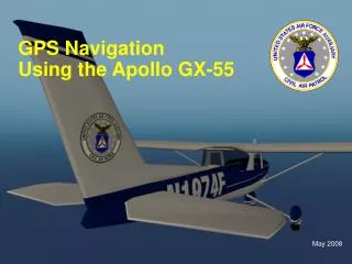
Special thanks to Keith Counsel for providing this presentation. Navigation Training Humminbird Field Test Program Date: December 4 th , 2008. GPS is an acronym for Global Positioning System.

E N D
Special thanks to Keith Counsel for providing this presentation. Navigation TrainingHumminbird Field Test ProgramDate: December 4th, 2008
GPS is an acronym for Global Positioning System. GPS provides accurate position (latitude, longitude, altitude) information virtually anywhere on the earth through satellite technology and personal receivers on the ground. A series of geosynchronous satellites broadcast a unique signal toward the earth once per second. A GPS receiver, receives the signals from these satellites and is able to determine position based on very slight differences in the time each signal is received and the receiver’s knowledge of the location of each of the satellites.
COG- Course Over Ground Course Over Ground is the current direction the boat is traveling measured in degrees from North (where 000° is North, 090° East, 180° is South, 270° is West). When the Course Over Ground is equal to Bearing, the boat is said to be “On Course” and will arrive at the destination in the most efficient manner. N 45deg 290deg
SOG- Speed Over Ground Speed Over Ground is the measurement of the boat’s progress across a given distance; the speed measurement provided by GPS; accurate destination times can be derived from this measurement. SPEED…………
Water Speed The current speed of the water as it flows past the boat. (Must have optional TSW or SW Speed Sensor installed)
Bearing Bearing is the direction to a destination waypoint measured in degrees from North (i.e. 321°, where 000° is North, 090° East, 180° is South, 270° is West). N 45deg 290deg
VMG- Velocity Made Good Velocity Made Good is the speed of travel relative to the next waypoint on the route. The goal is for VMG to equal Speed. Actual Course Next to each orange line is it useful speed 7 mph 10 mph 6 mph Waypoint Best Course 10mph Start Actual speed always 10mph
VMG- Velocity Made Good Commonly used in sailing… Wind Is it better to go slower into the wind or faster a little more off the wind? Say red and green arrive at the same time… because red was going at a fast speed its VMG was the same as the boat going on the more direct course at a slower speed.
XTE- Cross Track Error Cross Track Error is the straight-line distance of the boat from the intended Track. XTE measures how far the boat is off course, and also triggers the Off Course Alarm. Start Waypoint XTE XTE XTE Off Course alarm
Date, Time, speed, course, and Altitude are all calculated from the GPS signal we receive. It takes about 12-13 mins for a 100% signal to be accrued but we start to have acceptable signal from 30sec to 2mins. Internal GPS units do take longer to accrue signals.
Fix Type - (No Fix, 2D Fix, 3D Fix, Enhanced.) Enhanced fix means we have started to use info from WAAS. HDOP - Horizontal Dilution or Precision - This data comes from the current satellite configuration. We will run any were from 0.6 to 3 normal. Lower number means better. EPE - (Estimated Position Error) unit take a number of factors to calculate an ESTIMATED possible error. (2.5m is our call out)
What is WAAS?WAAS = Wide Area Augmentation System. WAAS is a complementary technology to GPS that provides enhanced accuracy through correction signals broadcast from Federal Aviation Administration WAAS satellites stationed over the USA. These secondary signals are automatically received by most GPS Receivers. With WAAS signal, GPS accuracy is improved to within 3 meters 95% of the time. Outside the United States, regional governmental coalitions have created similar systems such as EGNOS (Europe) and MSAS (Japan).
Main Menu- Nav TabSaved TrackSame options as Current Track but you must select the track you want to affect.Good thing to note- say you have a track that you do not want to get rid of but do not want to see. You can do this via this menu option (edit).
Main Menu- Nav TabRoutesRoutes are multiple destinations navigation that you want to get to… On water you can go as the “crow” flies often, but some times you need to go around a island, stump field, or some other no-entry area, that is where routes come in.
Main Menu- Nav TabChart Orientation NORTH-UP COURSE-UP
Main Menu- Nav TabTrolling Grid Rotation Why use this?- Girds are great way to ensure you do not go back over area already covered, by rotating it you get a reference. Why only 89deg?- 90deg is 0deg, it is a square.
Main Menu- Nav TabTrackpoint Interval and Track Min DistanceThese two actually work together.Let say you are moving at 60’ per min.Now you have your trackpoint interval at 1 second and Track Min Distance at 16’That means the trackpoint interval is saying put a trackpoint every 1sec but the min distance says no you must be at least 16’ away from the last.Let see if I can explain this better…
Main Menu- Nav TabTrackpoint Interval and Track Min Distance - Example - Speed 60’ per min (1’ per sec) Trackpoint Interval- 1 secTrack Min Distance- 5’ Trackpoint Interval- 5 secTrack Min Distance- 1’ Trackpoint Interval- 1 secTrack Min Distance- 10’ Trackpoint Interval- 20 secTrack Min Distance- 1’ Trackpoint Interval- 1 secTrack Min Distance- 50’ Why is this useful? - You are limited on the total number of trackpoints in the unit!
Main Menu- Nav TabCourse Projection Line HIDDEN VISIBLE
Main Menu- Nav TabExport and Delete all Nav DataExport and Delete only affect saved Tracks, not your current track!For export to work you must have an SD card in the unit.
Main Menu- Nav TabContinuous Navigation ModeWhat does it do? If you are navigating to a point, when you arrive, the unit does not stop navigating to that point unless you cancel.Why is this useful? No anchor zones or you want to not anchor and stay over the same point or near the same point.
Main Menu- Nav TabGPS Receiver OverrideThis lets you choose which GPS receiver to use…if they are connected.Order:AutoInterLink GPSExternal GPSInternal GPSRemote External GPSRemote Internal GPS
Navionics Icons Port Current Station Tide Station Snapshot of item/port Buoy Boat Ramp
Navionics Platinum & Platinum+ Options Features: New Menu Satellite overlays. Overlays only go so far away from shore, remember these are marine maps. Ability to adjust how transparent the overlay is.
Navionics Platinum & Platinum+ Options New Features: Pilot Book- contains detailed info on the port (depends heavy on what Navionics has) This is a new screen called “Chart plus pilot book view” Cursor thought by using the cursor button and “goto” button. If you press info and select port then you can get the traditional port info, the pilot book entry for that port or an aerial photo of the port.
Navionics Platinum & Platinum+ Options Platinum Platinum+
Navionics Platinum & Platinum+ Options Look at the dock Platinum Platinum+ Look at the dock
Navionics Platinum & Platinum+ Options Platinum+ Platinum
Navionics Platinum & Platinum+ Options Platinum Platinum+
Main Menu- Chart TabMap Borders Navionics data is made up of thousands of maps… Even Uni-map is made of multiple maps (Uni-map is a Navionics Product that we purchased.)
Main Menu- Chart TabShaded Depth Something interesting people are doing with shaded depth is if the water level is extremely low on their lake they are using the shaded depth to give them a new outline of the lake.
Main Menu- Chart TabChart SelectAllows someone override the unit chart selection…
Main Menu- Chart TabNVB Chart Preference (only in NVB units)Allows a user to choice which chart type to use.
Main Menu- Chart TabNVB Chart Preference(only in NVB units)Why would you want to be able to do this?Can occur is areas where Gold and Hotmaps meet.