Download
1 / 173
1.87k likes | 2.23k Views
Localization Technology. Outline. Defining location Methods for determining location Triangulation, trilateration, RSSI, etc. Location Systems. Introduction. We are here !. What is Localization. A mechanism for discovering spatial relationships between objects. Location Tracking.

E N D
Outline • Defining location • Methods for determining location • Triangulation, trilateration, RSSI, etc. • Location Systems
Introduction We are here !
What is Localization • A mechanism for discovering spatial relationships between objects
Applications • Wildlife Tracking • Weather Monitoring • Location-based Authentication • Routing in ad-hoc networks • Surveillances
Applications of Location Information • Location aware information services • e.g., E911, location-based search, target advertisement, tour guide, inventory management, traffic monitoring, disaster recovery, intrusion detection • Scientific applications • e.g., air/water quality monitoring, environmental studies, biodiversity • Military applications • Resource selection (server, printer, etc.) • Sensor networks • Geographic routing • “Sensing data without knowing the location is meaningless.” [IEEE Computer, Vol. 33, 2000] • New applications enabled by availability of locations
Localization • Well studied topic (3,000+ PhD theses??) • Application dependent • Research areas • Technology • Algorithms and data analysis • Visualization • Evaluation
Properties of Localization • Physical position versus symbolic location • Absolute versus relative coordinates • Localized versus centralized computation • Precision • Cost • Scale • Limitations
Representing Location Information • Absolute • Geographic coordinates (Lat: 33.98333, Long: -86.22444) • Relative • 1 block north of the main building • Symbolic • High-level description • Home, bedroom, work
No One Size Fits All! • Accurate • Low-cost • Easy-to-deploy • Ubiquitous • Application needs determine technology
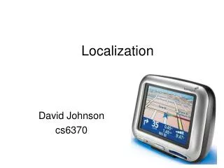
Consider for Example… • Motion capture • Car navigation system • Finding a lost object • Weather information • Printing a document
WiFi Beacons GPS Physical contact Ad hoc signal strength VHF Omni Ranging Ultrasonic time of flight Laser range-finding Array microphone Stereo camera Infrared proximity E-911 Lots of Technologies! Ultrasound Floor pressure
Some Outdoor Applications E-911 Bus view Child tracking Car Navigation
Some Indoor Applications Elder care
Outline • Defining location • Methods for determining location • Triangulation, trilateration, RSSI, etc. • Location Systems
Approaches for Determining Location • Localization algorithms • Proximity • Lateration • Angulation • RSSI • ToA, TDoA • Fingerprinting • Distance estimates • Time of Flight • Signal Strength Attenuation
Proximity • Simplest positioning technique • Closeness to a reference point • It can be used to decide whether a node is in the proximity of an anchor • Based on loudness, physical contact, etc. • Can be used for positioning when several overlapping anchors are available • Centronoid localization
Lateration • Measure distance between device and reference points • 3 reference points needed for 2D and 4 for 3D
Lateration vs. Angulation • When distances between entities are used, the approach is called lateration • when angles between nodes are used, one talks about angulation
Determining Angles • Directional antennas • On the node • Mechanically rotating or electrically “steerable” • On several access points • Rotating at different offsets • Time between beacons allows to compute angles
Triangulation, Trilateration • Anchors advertise their coordinates & transmit a reference signal • Other nodes use the reference signal to estimatedistances anchor nodes
Optimization Problem • Distance measurements are noisy! • Solve an optimization problem: minimize the mean square error
Estimating Distances – RSSI • Received Signal Strength Indicator • Send out signal of known strength, use received signal strength and path loss coefficient to estimate distance • Problem: Highly error-prone process (especially indoor) • Shown: PDF for a fixed RSSI PDF PDF Distance Signal strength Distance
Estimating Distances – Other Means • Time of arrival (ToA) • Use time of transmission, propagation speed, time of arrival to compute distance • Problem: Exact time synchronization • Time Difference of Arrival (TDoA) • Use two different signals with different propagation speeds • Example: ultrasound and radio signal • Propagation time of radio negligible compared to ultrasound • Compute difference between arrival times to compute distance • Problem: Calibration, expensive/energy-intensive hardware
Fingerprinting • Mapping solution • Address problems with multipath • Better than modeling complex RF propagation pattern
Fingerprinting • Easier than modeling • Requires a dense site survey • Usually better for symbolic localization • Spatial differentiability • Temporal stability
Received Signal Strength (RSS) Profiling Measurements • Construct a form of map of the signal strength behavior in the coverage area • The map is obtained: • Offline by a priori measurements • Online using sniffing devices deployed at known locations • They have been mainly used for location estimation in WLANs
Received Signal Strength (RSS) Profiling Measurements • Different nodes: • Anchor nodes • Non-anchor nodes, • A large number of sample points (e.g., sniffing devices) • At each sample point, a vector of signal strengths is obtained • jthentry corresponding to the jth anchor’s transmitted signal • The collection of all these vectors provides a map of the whole region • The collection constitutes the RSS model • It is unique with respect to the anchor locations and the environment • The model is stored in a central location • A non-anchor node can estimate its location using the RSS measurements from anchors
Outline • Defining location • Methods for determining location • Triangulation, trilateration, RSSI, etc. • Location Systems • GPS • Active Badge, MIL, Active Bat, Cricket • RSS-based indoor localization • RSS-based smartphone indoor localization • Power-line based localization • Passive location tracking
GPS (Global Position Systems) • Use 24 satellites • GPS satellites are essentially a set of wireless base stations in the sky • The satellites simultaneously broadcast beacon messages • A GPS receiver measures time of arrival to the satellites, and then uses “triangulation” to determine its position • Civilian GPS • L1 (1575 MHZ) • 10 meter acc.
Why We Need 4 Satellites? • Assume receiver clock is sync’d with satellites • In reality, receiver clock is not sync’d with satellites • Thus need one more satellite to have the right number of equations to estimate clock called pseudo range
Active Badge • IR-based: every badge periodically, sends unique identifier, via infrared, to the receivers • Receivers, receive this identifiers and store it on a central server • Proximity
MIL (Mobile Inequality Localization) Illustration for relative distance constraints Static Constraint Velocity Constraint “Weighted center” based position estimation
Active Bat • Ultrasonic • Time of flight of ultrasonic pings • 3cm resolution
Cricket • Similar to Active Bat • Decentralized compared to Active Bat
Cricket: Introduction • Location system • Project started in 2000 by the MIT • Other groups of researchers in private companies • Small, cheap, easy to use Cricket node v2.0
Cricket: 5 Specific Goals • User privacy • location-support system, not location-tracking system • position known only by the user • Decentralized administration • easier for a scalable system • each space (e.g. a room) owned by a beacon • Network heterogeneity • need to decouple the system from other data communication protocols (e.g. Ethernet, WLAN) • Cost • less than U.S. $10 per node • Room-sized granularity • regions determined within one or two square feet
Cricket: Determination of the Distance • First version • purely RF-based system • problems due to RF propagation within buildings • Second version • combination of RF and ultrasound hardware • measure of the one-way propagation time of the ultrasonic signals emitted by a node • main idea : information about the space periodically broadcasted concurrently over RF, together with an ultrasonic pulse • speed of sound in air : about 340 m/s • speed of light : about 300 000 000 m/s
Cricket: Determination of the Distance 1. The first node sends a RF message and an ultrasonic pulse at the same time. 2. The second node receives the RF message first, at tRF and activates its ultrasound receiver. RF message (speed of light) Node 2 Node 1 ultrasonic pulse (speed of sound) 3. A short instant later, called tultrasonic, it receives the ultrasonic pulse. 4. Finally, the distance can be obtained using tRF, tultrasonic, and the speed of sound in air.
Cricket: Difficulties • Collisions • no implementation of a full-edged carrier-sense-style channel-access protocol to maintain simplicity and reduce overall energy consumption • use of a decentralized randomized transmission algorithm to minimize collisions • Physical layer • decoding algorithm to overcome the effects of ultrasound multipath and RF interferences • Tracking to improve accuracy • a least-squares minimization (LSQ) • an extended Kalman filter (EKF) • outlier rejection
Cricket: Deployment • Common way to use it : nodes spread through the building (e.g. on walls or ceiling) • 3D position known by each node • Node identification • unique MAC address • space identifier • Boundaries • real (e.g. wall separating 2 rooms) • virtual, non-physical (e.g. to separate portions of a room) • Performance of the system • precision • granularity • accuracy
Cricket: Deployment At the MIT lab : on the ceiling
Cricket: Different Roles A Cricket device can have one of these roles • Beacon • small device attached to a geographic space • space identifier and position • periodically broadcast its position • Listener • attached to a portable device (e.g. laptop, PDA) • receives messages from the beacons and computes its position • Beacon and listener (symmetric Cricket-based system)
Cricket: Passive Mobile Architecture In a passive mobile architecture, fixed nodes at known positions periodically transmit their location (or identity) on a wireless channel, and passive receivers on mobile devices listen to each beacon.
Cricket: Active Mobile Architecture In an active mobile architecture, an active transmitter on each mobile device periodically broadcasts a message on a wireless channel.
Cricket: Hybrid Mobile Architecture Passive mobile system: used in normal operation Active mobile system: at start-up or when bad Kalman filter state is detected
Cricket: Architecture Cricket hardware unit – beacon or listener
Microcontroller the Atmega 128L operating at 7.3728 Mhz in active and 32.768 kHz in sleep mode operates at 3V and draws about 8mA(active mode) or 8μA(sleep mode) RF transceiver the CC1000 RF configured to operate at 433 Mhz bandwidth bounded to 19.2 kilobits/s Cricket: Architecture