Download
1 / 28
280 likes | 351 Views
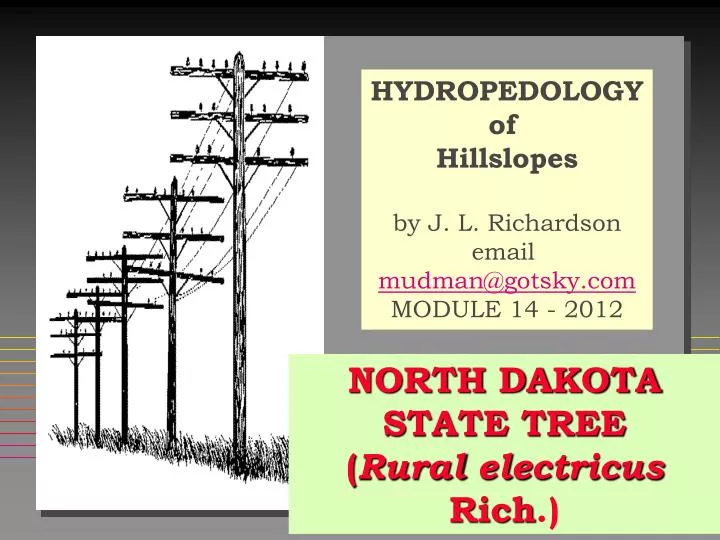
HYDROPEDOLOGY of Hillslopes by J. L. Richardson email mudman@gotsky.com MODULE 14 - 2012. NORTH DAKOTA STATE TREE ( Rural electricus Rich .). 1. Objectives. The student will be able to:

E N D
HYDROPEDOLOGY of Hillslopes by J. L. Richardson email mudman@gotsky.com MODULE 14 - 2012 NORTH DAKOTA STATE TREE (Rural electricusRich.) 1
Objectives • The student will be able to: • construct simple hydrologic landscape cross-sectional models using geomorphic and stratigraphic concepts based on aquifers and aquitard conditions in the landscape. • recognize and analyze differences between open and restricted flow landscapes. • Recognize, analyze and explain flow differences between hummocky and smooth surface storage on landscapes. 2
UNIFYING PRINCIPLE • WATER FLOW CREATES SOIL CHANGE (SOIL GENESIS). • THEREFORE, SOIL MORPHOLOGY REFLECTS HYDROLOGY by integrating soil development over time. • Soil Morphology of soils on the landscape are waiting for us to interpret the hydrology, which yields a soil-water survey. 3
4 STEPS • We create a slope profile. • We place the soils on the slope. • We figure out how the water created those soils. • We create a cross-section of the landscape with the soils, parent material and water flow in the soils on that landscape. 4
d2 h d2 h d2 h dH Q = + + Q=K dx2 dy2 dz2 dL FLOWNETS LaPlace’s Equation Darcy’s Law Recharge Zone Discharge Zone water table elevation Flow is lateral Flow is down Flow is up equipotential lines flow lines 5
Effects of Coarse-textured Lenses. • Homogeneous textures produce regular flownet. • Coarse textured lens “focuses” discharge above lens • Almost all flow is within lens water table elevation Discharge 6
Effects of Fine-textured Lenses Discharge • Homogeneous textures produce regular flownet. • Fine textured lens “focuses” discharge below lens • Very little flow in lens 7
Effects of Layering (Anisotropy) Layering favors lateral flow K’s Equal K’s Unequal Flow Cross-sections K K 1 1 1 10 1 0.1 Downward movement is governed by the slowest layer and lateral flow is governed by the fastest layer. 8
Hummocky topography results in many local groundwater-flow systems. • Long, even slopes produce simple flow-systems • Choppy slopes of high relief produce complex flow-systems 9 After Toth, 1963
RECHARGE & DISCHARGE • RECHARGE removes material from a horizon (or soil or landform). • DISCHARGE adds material to a horizon (or soil or landform). • RECHARGE water moves toward the ground water. • DISCHARGE water moves from the ground water. 10
SOIL HORIZONSArgillic Horizon & Anisotropy RECHARGE RECHARGE P I A E Bt C Clay translocated Calcium leached ANISOTROPHY E = aquifer; Bt = aquitard HYDROLOGY STEPS FOR FORMING A Bt. 11
FRAGIPAN AQUITARD Precipitation Inputs RECHARGE FLOWTHROUGH 332 325 318 Bx aquitard Gamble. E. E. 1993. 12
Type 1: Geologic Outcrop Seep part 1 Recharge loam Seep Aquifer-sandstone Aquitard-shale WHY DOES THE SEEP DISAPPEAR IN DRY YEARS? 13 Brown, 1964; Halvorson and Richardson 2011
Seep Type 1; part 2 Recharge Seep Aquifer-sandstone Aquitard-shale Recharge water is moving through a finer-textured material than the aquifer. The water must fill all the poresin the recharge material before it can flow to the coarse materialin the aquifer (saturation). Matric flow cannot move easily from finer material to coarse material. Once water enters the aquifer, it moves faster than it did in the recharge loam. 14
Type 2: Coal Seam Seep Recharge Seep Aquifer-coal seam Aquitard- Underclay 15
Type 5:Slope change Seep Soil Aquifer Slope Break Aquitard Seep 16
Type 6:Hydrostatic Pressure Seep Recharge Aquifer ARTESIAN DISCHARGE Often Quick Sand Sand Lens Seep Pinch Out Aquitard – Shale 3 refs Brown., Winter, Richardson 17
Type 4 Seep – Texture Change or Structure ChangeSOIL AS A SURFICIAL AQUIFER Silt Loam Aquitard – Shale or Clay Loam Seep Loam 18
INPUTS = OUTPUTS +/- STORAGEP+Ho+GWd = GW r + So +ET+ Storage Precipitation (P) Evapotranspiration (ET) Runoff (Ho) Infiltration Recharge Surface Outflow (So) DSW Storage Groundwater Discharge (GWd) Groundwater Recharge (GW r) 20
HORTON’S MODEL Ei P = Ei + Ho + I +/- ∆Ss Zone of Erosion I Divides water 3-ways No Sheet Erosion Ho Often Deposition 21
MAP UNITS BASED ON THIS MODEL BACKWEARING MODEL Most Important lines 9 NOTE ALSO THAT THE UNITS ARE MEANINGFUL IN TERMS OF RELATIVE ARE OF THE SURFACES. 22
“Throughflow” On vegetated soils FOR MOST RAIN EVENTS P = I + Ei DSw ET Dp Tf 23 After Chorley & Kirkby 1967
LANDSCAPE WATER FLOW I =infiltration P= precipitation Ho=Runoff Ro=reflow Tf=throughflow (Tu & Ts) Dp=deep water flow P I Ho I Tf Ro Ro=Return Flow Dp GOVEN RANCH IN JULY 1990 Tf can be saturated (Tu) or unsaturated (Tu). 24
PARTIAL AREAof Saturation ONLY PART OF WATER- SHED THAT CONTRIBUTES WATER TO THE STREAM. Ro Dunn and Black 1970 27
Overland and Throughflow:Convergent Landscapes Potential hydric soil zone Runoff Infiltration Percolation Throughflow 25 Pennock et al. 1987 Richardson et al. 2001
CROSS-SECTION CONTRASTS OF CLOSED AND OPEN FLOW SYSTEMS CLOSED with loss on caps and gains in lows Loss Gain OPEN with Backslope retreat (Backwearing) 26
Open SystemCross-section Wymore Otoe(WyC2) Pawnee Nodaway III = WATER TABLE BASED ON MORPHOLOGY 2 II I EASY TO DRAW 3 1 Seasonal high water table based on soil morphology and field observations. Can you explain? 1, 2, & 3 are differing strata. 27
LANDSCAPE WATER FLOW • P = Ei + Ho +I +/- ∆Ss Surface • I = Dp + Tf + ET +/- ∆SwInfiltrated Water • Tf can saturate a soil (transient or longer times). If the transient water reaches the surface it “returns” to the surface and flows on it (Ro). • Lateral water flow occurs because of roots, desiccation cracks, freeze and thaw fractures, anisotropy, geologic stratigraphy, soil stratigraphy (e.g. Bt-horizons), and geostatic pressures. 28