Download
1 / 27
280 likes | 416 Views
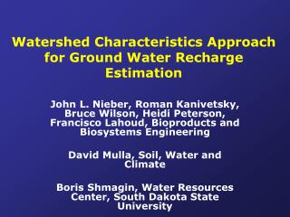
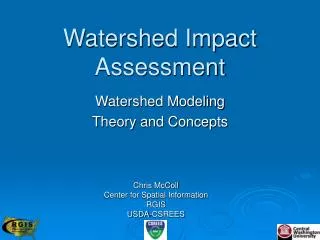
Water quality assessment based on watershed characteristics : Somesul Mic watershed. Radu Mihaiescu Faculty of Environmental Sciences, University « Babes-Bolyiay », Cluj-Mapoca, Romania. curriculum in natural environmental science, 2005. Map of Romania.

E N D
Water quality assessment based on watershed characteristics : Somesul Mic watershed Radu Mihaiescu Faculty of Environmental Sciences, University « Babes-Bolyiay », Cluj-Mapoca, Romania curriculumin natural environmental science, 2005
Map of Romania curriculumin natural environmental science, 2005
Relief map of Somes Mic watershed curriculumin natural environmental science, 2005
Table 1. Average of multi annual monthly temperatures (1991–2000) Table 2. Average of multi annual monthly precipitation (1991–2000) curriculumin natural environmental science, 2005
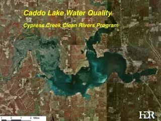
Somesul Mic hydrographic network and water quality curriculumin natural environmental science, 2005
Somesul Mic geological map curriculumin natural environmental science, 2005
Soil map of Somesul Mic watershed curriculumin natural environmental science, 2005
Population density by administrative districts in the Somesul Mic watershed curriculumin natural environmental science, 2005
Land use changes between 1967 and 1992 according to the CORINE database curriculumin natural environmental science, 2005
Somesul Mic valley – downstream Cluj-Napoca curriculumin natural environmental science, 2005
Tarnita reservoir upstream Cluj-Napoca curriculumin natural environmental science, 2005
Reservoirs cascade upstream Cluj-Napoca curriculumin natural environmental science, 2005
Diffuse nutrient sources in the watershed Chemical fertilizers Septic systems Plants wastes Manure Sediments curriculumin natural environmental science, 2005
Pollution sources Point sources Diffuse (non-point) sources curriculumin natural environmental science, 2005
Diffuse pollution sources curriculumin natural environmental science, 2005
Modelled soil erosion risk for the Somesul Mic watershed curriculumin natural environmental science, 2005
Major modelling sub-basins of the Somesul Mic watershed curriculumin natural environmental science, 2005
Land use in individual sub watersheds curriculumin natural environmental science, 2005
Total hydrological balance in Somesul Mic watershed modelled for the year 2001 curriculumin natural environmental science, 2005
Specific erosion in Somesul Mic watershed modelled for the year 2001 curriculumin natural environmental science, 2005
Total P loadings in the sub-watershed in the Somesul Mic watershed modelled for the year 2001 curriculumin natural environmental science, 2005
Total N loadings in the sub-watersheds in the Somesul Mic watershed modelled for the year 2001 curriculumin natural environmental science, 2005
Monthly average nutrient loadings in the Somesul Mic watershed modelled for the year 2001 curriculumin natural environmental science, 2005
Comparison between modeling results and “Apele Romane” National Company balance calculation curriculumin natural environmental science, 2005
CONCLUSIONS The integrated watershed assessment highlighted the interaction of the anthropic and natural factors in the defining of the water resources state and quality. The analysis revealed the water quality problems generated by the cumulative impact of the anthropic activities. The capacity of supportability of the Somesul Mic hydro ecosystem was exceeded in the reach down stream Cluj–Napoca. The diffuse pollution sources account for appreciatively 50% of the total nutrient loads of the surface waters, also atmospheric contribution should be considered. curriculumin natural environmental science, 2005
CONCLUSIONS Mathematical modeling proved to be a useful tool in: - the support of watershed assessment providing supplementary data and facilitating the analysis of various development scenarios in the frame of a well fundamental integrated watershed management plan. - assessment of water quality, providing a valuable decision support in designing strategies of water management, to cope with the problems of achieving sustainable development in the conditions global change. Designing and implementation of measures to reduce the water diffuse pollution sources has become a major part of watershed plans. curriculumin natural environmental science, 2005
CONCLUSIONS The preliminary study showed the good correspondence between the measured and modeled data but these results still need to be refined before substantial policy decisions can be based on this model. There are required further measurements of nutrient loads into the watershed to verify concentration and loading assumptions. Also are required pilot studies on small sub watersheds for a better calibration of the model. The study area can be extended easily for watersheds with similar characteristics. curriculumin natural environmental science, 2005