Download

1 / 20
200 likes | 346 Views
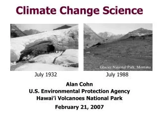
Remarks on Cyberinfrastructure and Climate Change from a Polar Science Point of View. Geoffrey Fox gcf@indiana.edu http://www.infomall.org http://www.futuregrid.org School of Informatics and Computing Digital Science Center Indiana University Bloomington.

E N D
Remarks on Cyberinfrastructure and Climate Changefrom a Polar Science Point of View Geoffrey Fox gcf@indiana.edu http://www.infomall.orghttp://www.futuregrid.org School of Informatics and Computing Digital Science Center Indiana University Bloomington April 27 2013Earlham College Hackathon
Big Data Ecosystem in One Sentence Use Clouds running Data Analytics processing Big Data to solve problems in X-Informatics ( or e-X) X = Astronomy, Biology, Biomedicine, Business, Chemistry, Crisis, Earth Science, Energy, Environment, Finance, Health, Intelligence, Lifestyle, Marketing, Medicine, Pathology, Policy, Radar, Security, Sensor, Social, Sustainability, Wealth and Wellness with more fields (physics) defined implicitly Spans Industry and Science (research) X = Climate, Polar Science, Radar Education: Data Science see recent New York Times articles http://datascience101.wordpress.com/2013/04/13/new-york-times-data-science-articles/
Some Trends • The Data Delugeis clear trend from Commercial (Amazon, e-commerce) , Community (Facebook, Search) and Scientific applications • Light weight clients from smartphones, tablets to sensors • Multicore reawakening parallel computing • Exascale initiatives will continue drive to high end with a simulation orientation • Clouds with cheaper, greener, easier to use IT for (some) applications • New jobs associated with new curricula • Clouds as a distributed system (classic CS courses) • Data Analytics (Important theme in academia and industry) • Network/Web Science
Data Deluge is also Information/Knowledge/Wisdom/Decision Deluge? Data-1Source Layered GIS View ReadData-1 Prepare View FilterData FuseData ReadData-2 Data-2Source
Use Services + Mashup + GIS/Portal • All (coarse grain = big) Software written as a Service • Chunk of code that receives input as messages and gives results as a message sent to another service (or client) • Generalizes Web Server-client interaction • Important set of API’s (application program interfaces defining syntax of message) • See programmableweb.com • The linking of several services together is called a mashup or a workflow • The final step is a server (called a portal) that prepares data for transmission to client • For Earth/Polar science data use “Geographical Information System” (e.g. Google maps) as client model
Sea Level Rise CReSIS data says sea level rise likely to 30-50 cm not many meters. West Antarctica (Thwaites) worrisome
Ice sheet radar echograms Distance along flight line Air Depth resolution data CReSIS 1-5cm (snow) 50cm (bed) Distance below aircraft Ice First large scale high resolution data Previous 10km horizontalCReSIS 0.05 km Bedrock
Analyze Data with GIS Flight Paths Byrd Glacier Ice Depth (annual) Snow Layers
Geospatial Database and WMS Kyle Purdon, 2013 • Purpose: Access all radar datasets and campaigns simultaneously with powerful search and geographic browsing capability • Key Features: • Portable VM • Unlimited layers and layer relationships
Deployments & Installations • NASA Operation Ice Bridge • P-3B: MCoRDS, Accum, Ku-Band & Snow • DC-8: MCoRDS, Ku-Band & Snow • DC-8 operations could move to P-3 for fall deployments • CReSIS Field Work • Twin-Otter: MCoRDS, Accum, Ku-Band • Wings Expired: CReSIS operations are moving to the Basler (DC-3) • Basler: New UWB radar, Ku-Band & Snow, Google Camera • Meridian: UAV Radar (Single Channel MCoRDS) • Scale Model Yak: Compact HF Sounder. • In-Situ (Sleds) • Multi-Channel Accum, Ku-Band & Snow
Bellingshausen Sea (West Antarctica) Snow Radar Air Snow Ice
(Raw) Data Deluge Information Knowledge Wisdom Decision • The (airborne) radars take raw data and do substantial processing to convert toInformation • This information is analyzed to find the height/depth of layers (surface, bed, snow layers)Knowledge • This data is placed into models of individual ice-sheets or coupled ocean-atmosphere-environment-ice climate simulationsWisdom Sea level rise, climate change • Decisions: Steps to ameliorate causes and consequences of climate change
Uses of Data • Engineers in field taking data: quickly analyze data(information) in real time to detect and correct instrument errors • Polar Scientists using “Knowledge” planning expeditions (month long field trips) and corresponding flights • Trade off resolution versus coverage • Data scientists using “Knowledge analysis” to find layers – possibly combining data from overlapping flights • Polar modelers combining datasets to get region wide “knowledge” used to build ice flow models • IPCC (Intergovernmental Panel on Climate Change) preparing next report • “Virtual Earth Scientist” integrating different data modalities (ice sheet, snow, atmosphere, environment, ocean, shipping …) • All exploit geo-encoded data
A few References • a) Cyberinfrastructure and Geographical Information Systemshttp://www.cigi.illinois.edu/dokuwiki/doku.php/homehttp://www.tandfonline.com/doi/full/10.1080/13658816.2013.776049 (and http://josis.org/index.php/josis/article/viewFile/83/67) http://csiss.gmu.edu/http://www.geosquare.org/ (big project from LIESMARS Wuhan China) • b) GIS in general http://en.wikipedia.org/wiki/Geographic_information_system • c) Climate Change in generalhttp://en.wikipedia.org/wiki/IPCC_Fourth_Assessment_Report • d) Work on Polar Ice Sheetshttps://www.cresis.ku.edu/http://www.infomall.org/X-InformaticsSpring2013/slides/mitchell-radarinformatics-0415.pptx • e) Lots of Data e.g.http://geobrain.laits.gmu.edu/GeoDataDownload/https://data.cresis.ku.edu/e.g. ftp://data.cresis.ku.edu/data/rds/2012_Greenland_P3/kml_good/