Download
1 / 11
120 likes | 196 Views
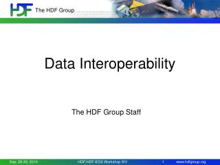
Data Interoperability and Access Activities Prepared for the Data Archiving and Access Requirements Working Group (DAARWG) Ken McDonald, TPIO/GEO-IDE Jeff de La Beaujardiere , IOOS Project Steve Hankin , PMEL/UAF Lead December 9, 2010. Session Agenda.

E N D
Data Interoperability and Access Activities Prepared for the Data Archiving and Access Requirements Working Group (DAARWG) Ken McDonald, TPIO/GEO-IDE Jeff de La Beaujardiere, IOOS Project Steve Hankin, PMEL/UAF Lead December 9, 2010
Session Agenda • GEO-IDE Introduction and Overview – Ken McDonald • IOOS Data Interoperability and Access – Jeff deLaBeaujardiere • GEO-IDE Unified Access Framework (UAF) – Steve Hankin • Discussion on Future Direction
Addressing NOAA’s Need for Enterprise Environmental Observation and Data Management • Individual programs and projects have specific requirements for environmental data • Historically they have individually addressed those needs • Significant efficiencies to be gained by an enterprise approach to environmental observation and data management • Even greater benefit by looking outward as well as inward
GEO-IDE Overview • Purpose – Maximize use and utility of NOAA environmental data and information • Concept developed by the NOAA Data Management Integration Team (DMIT) • Vision – A “system of systems” • Framework that provides effective and efficient integration of many quasi-independent systems • Concept – Services-oriented architecture • Provides common services and leveraging the benefits of existing data management systems • Implementation – A set of processes, guidelines and supporting activities • Work with and through programs and projects, NOAA-wide • Not intended to be a major development effort • Includes development of selected infrastructure elements and demonstration projects
GEO-IDE Activities • Standards Subtask • Adopting, documenting and promoting data and information system standards within NOAA • Engaging with NOAA programs and initiatives • Active member in OGC , ISO-TC 211 • Pilot Project • Unified Access Framework • Demonstration of NOAA-wide data integration • Outreach and Engagement • GEO Architecture and Data Committee (ADC) • USGEO Architecture and Data Management (ADM) • CEOS Working Group on Information Systems and Services (WGISS) • Federation of Earth Science Information Partners (ESIP) • IOOS Integrated Product Teams • Global Interoperability Program (GIP) • Coastal and Marine Spatial Planning (CMSP)
DMIT/GEO-IDE Impact • Recognized for its expertise in environmental data management • Frequently called upon as a resource for NOAA’s environmental data management enterprise
GEO-IDE approach Represents all of NOAA’s environmental data
GEO-IDE approach Efforts to integrate within different domain areas Atmosphere Climate Ecosystems Ocean
GEO-IDE approach Need integration across different functional areas Discovery Access Atmosphere Climate Ecosystems Interoperability Ocean Preservation
GEO-IDE approach Opportunities to integrate different structural data types Grids Profiles Ship tracks Aircraft flights Trajectories Points Discovery Satellite products Model outputs HF Radar Access Atmosphere Climate Ecosystems Interoperability Moored buoys Weather stations Ocean Preservation Argo floats Radiosondes * Additional dimensions (e.g. “user type”) not shown
GEO-IDE approach…Encourage Convergence UAF Project (data type based) Grids Profiles Trajectories Points Discovery Access Atmosphere Climate Ecosystems Interoperability Ocean Preservation IOOS Project (domain based)