Download
1 / 43
430 likes | 525 Views
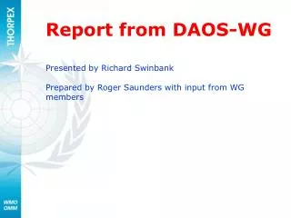
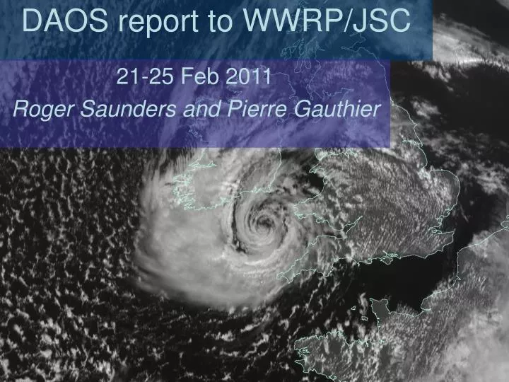
DAOS report to WWRP/JSC. 21-25 Feb 2011 Roger Saunders and Pierre Gauthier. Overview of DAOS report to JSC Roger Saunders and Pierre Gauthier. WG Activities Update on observations for global NWP Update on developments in DA Results from THORPEX campaigns Paper on targeted observations.

E N D
DAOS report to WWRP/JSC 21-25 Feb 2011 Roger Saunders and Pierre Gauthier
Overview of DAOS report to JSCRoger Saunders and Pierre Gauthier • WG Activities • Update on observations for global NWP • Update on developments in DA • Results from THORPEX campaigns • Paper on targeted observations
Mission statement The DAOS-WG was established to ensure that THORPEX contributes to the international efforts to optimise the use of the current Global Observing System and to the development of well-founded strategies for the evolution of the GOS to support NWP primarily for 1 to 14 day weather forecasting. To achieve its mission the DAOS WG, in collaboration with the CBS OPAG-IOS: • Addresses Data Assimilation issues including the development of improved understanding of the sources and growth of errors in analyses and forecasts • Promotes research activities that lead to a better use of observations and the understanding of their value • Provides input and guidance for THORPEX regional campaigns for the deployment of observations to achieve scientific objectives.
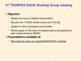
3rd THORPEX DAOS Working Group meeting Université du Québec à Montréal8-9 July 2010Montréal (Québec) CANADA • http://web.sca.uqam.ca/~wgne/DAOS/DAOS3_meeting/
Update on Observations • E-AMDAR coverage expanding and now water vapour • Use of IASI radiances over cloud shown to be beneficial • Chinese FY-3A MW sounder radiances proven for NWP • Reduced thinning of AMSU-A radiances at ECMWF • Use of Hi-RES AMVs for improved TC forecasts • Continuity of scatterometer (Oceansat-2?) and GPS-RO data (COSMIC-2) looks hopeful • Polar Communications and Weather Mission in a Molniya orbit for improved coverage of the northern polar latitudes. • Raman lidar shows vertical profiles of water vapour at very high time and vertical resolution and can be available 24 hrs a day for high resolution mesoscale models. • Common data format for radar backscatter measurements
E-AMDAR: Network Developments 1. 1st Nov 2010 - EZY fleets providing data over UK domain and selected European airports. Software installed on BAW A319 (LCY – SNN – JFK). 9
PCW 12
Enhanced AMVs from CIMSS CTL: NCEP cloud winds CIMSS-6h: CIMSS 6-hourly wind
Track and Intensity Analyses for Sinlaku (32 members) Enhanced AMVs: Significant improvement in analyzed position, track and intensity in first 3 days
This plot shows the density of AMSU-A channel 9 data for the case of 2008/12/14@00UTC for the different experiments: EXP-HI: global thinning to 0.625o EXP: global thinning to 1.25o (i.e. ope) EXP-SV: EXP but with SV thinning 0.625o EXP-CLI:EXP but with SVcli thinning 0.625o EXP-RND: EXP but with random thinning 0.625o Target areas occupy same fraction (15%) of the Southern hemisphere. The SV-based climatology was derived from the mean 2007 SV-areas Experiments have been run for JAS08 and D08JF09 Forecasts from these experiments have been verified against EXP-HI analyses (~83 cases per season AMSU-A thinning experiments EXP-HI EXP EXP-SV EXP-CLI EXP-RND
Update on Data Assimilation • Higher resolution reduced thinning • Observability of structure functions • Move to hybrid 4D-Var systems • EnKF systems also being trialled • Improved background error statistics are key to make better use of humidity observations • Adjoint sensitivity tools now implemented at most global NWP centres. What about regional/mesoscale?
Concordiasi: an international projectParticipating Institutes:CNES, CNRS/INSU (LMD, LGGE, LA), Météo-France, NSF, AlfredWegener Institute, Met Office, Purdue University, UCAR,University of Colorado, University of Wyoming, BSRNPolar institutes: IPEV, PNRA, USAP, BAS, ECMWFCollaborating institutes:NWP centres (Australia…), NASA/GMAO, UCLA, ….Part of the THORPEX-clusterOverview of Concordiasi: “The Concordiasi project in Antarctica”Rabier et al, Bulletin of the American Meteorological Society, January 2010.Website: www.cnrm.meteo.fr/concordiasi/
CONCORDIASI • In September and October 2010, 19 balloons were deployed from McMurdo, 6 with a scientific payload sounding the stratosphere, and 13 of the driftsonde type. From the 13 driftsondes, around 640 dropsondes were dropped over Antarctica and the surrounding seas. Most of these were transmitted in real-time on the Global Telecommunication System, for use by the Numerical Weather Prediction centres.
Concordiasi: Sep 2010 Dropsonde Data • 39 reports up to 21Z 30/9/2010 • 37 assimilated. • Wind:Similar bias/rms to Antarctic sondes. • Temp: ~+0.5 K bias above 600hPa. ~-1.0K bias near surface (few reports rejected). • Humidity: 11/37 reports rejected. Not RS92 so data <-40C not used.
Assimilation of surface sensitive observations from AMSU over land: Impact on humidity analyses Impact studies with 2 versions of ARPEGE: CY32 and CY33 during summer 2006. CY33 introduces important changes in the physics. Data assimilation is identical between the two versionsand takes advantage of better description of the land surface emissivity to assimilate the observations near the surface (Karbou et al. 2006-2010ab). TCWV (EXP-CTL), CY32, August 2006 TCWV (EXP-CTL), CY33, August 2006 Similar humidity bias features were noticed with the assimilation of MERIS observations over land (Bauer, 2009) and AMSU observations in IFS F. Karbou More moisture in EXP
HyMeX: 2 types of balloons will be used in 2012-2013BAMED project (CNES)Alex Doerenbecher, Clement Fesquet, Claude Basdevant
The intercomparison experiment on the impact of observations • A goal of THORPEX is to improve our understanding of the ‘value’ of observations provided by the current global network • optimize the use of current observations • inform the design/deployment of new obs systems • In 2007, DAOS-WG proposed a comparison of observation impacts in several forecast systems, facilitated by the emergence of new (adjoint-based) techniques • Experiments for a baseline observation set were designed by DAOS members from NRL, GMAO, EC, ECMWF, Météo-France • …so far, results obtained for 3 systems: NRL, EC, GMAO
Daily average observation impacts Global domain: 00+06 UTC assimilations Jan 2007 NRL NOGAPS GMAO GEOS-5 EC GDPS • AMSU-A, Raob, Satwind and Aircraft have largest impact in all systems 27
24h Observation Impacts in GEOS-5 Average values at 00z for the period 01 Sep – 31 Dec 2010 Global Northern Hemisphere Southern Hemisphere Tropics
JANUARY 2009 Petropavlosk Circled stations provided ten or more profiles 1x10⁻³ J kg-1 (Moist Total Energy Norm) Error Reduction Error Increase Total # of targeted radiosonde data = 27,508 (06UTC and 18UTC) Number of targeted radiosonde profiles = 247 (33 stations provided at least one profile) Total targeted radiosonde impact = -0.4322 J kg-1 For comparison: 00UTC and 12UTC observations from these same stations: -4.24 J kg-1 and 2,154 profiles during all of January 2009
FEBRUARY 2009 TARGETED DROPSONDE IMPACT ON 24H FORECAST ERROR IN NOGAPS/NAVDAS Impact summed in 2x2 lat/lon boxes 1x10⁻³ J kg-1 (Moist Total Energy Norm) Error Reduction Error Increase Total # of assimilated dropsonde data = 32,172 (T, q, u, v at all levels) Number of dropsonde profiles = 355 Total dropsonde impact = -0.7176 J kg-1 Average impact per dropsonde observation = -2.23x10⁻⁵ J kg-1
ALL Lufthansa AMDAR January 2009 – all analysis times Impact summed in 2x2 lat/lon boxes 1x10⁻³ J kg-1 (Moist Total Energy Norm) Error Reduction Error Increase EAMDAR Summary Impact #of observations Level Flight - 3.618 J kg-1 337,506 + 3% from Dec 2008 Ascent Profiles - 1.891 J kg-1 79,850 + 19% from Dec 2008 Descent Profiles -1.003 J kg-1 33,301 + 64% from Dec 2008
Summary of intercomparison • Comparison experiments for GMAO, NRL and EC systems completed for baseline set of observations and now UKMO added • Despite differences in assimilation methodologies, overall quantitative results similar for all systems; but details of impact differ (e.g., impact-per-ob, channels) • Largest impacts provided by AMSU-A and raobs (GMAO, UKMO), AMSU-A and satwinds (NRL, EC); aircraft also has large impact in all systems • Common problem areas with AMSU-A noted; handling of surface properties a likely cause • First paper of adjoint impact intercomparison facilitated by DAOS WG has been published (Gelaro et al. 2010)
DAOS-WG draft statement on need for additional in-situ observations There is increasing evidence based upon results from A-TREC, TPARC, AMMA (in the form of OSEs, adjoint-based observation impact studies, and analysis uncertainty estimates) to recommend, if feasible, increases in observations from: • Commercial aircraft over the N. Pacific, N. Atlantic, and the S. Hemisphere in general. • Additional soundings from certain coastal radiosondes, including those in eastern Siberia, and perhaps selected stations in polar regions, Africa, and South America. to improve NWP forecasts in the 2-5 day timeframe.
Review of the impact of targeted data • Community paper being written • Lead author is Sharan Majumdar with contributions from the DAOS-WG and scientists involved in targeting campaigns (including Y. Song and Z. Toth) • Reconcile seemingly opposing views on the impact of targeted data • Summary of results obtained so far • Identify issues that need to be addressed to improve the use of observations that impact weather forecasts (e.g., metrics, assimilation methods, sampling of precursors to dynamic instability)
The targeting procedure A. Doerenbecher, Météo France
Field Campaigns: pre-THORPEX / independent campaigns • 1982-96: NOAA Hurricane Synoptic Flow • 1997-present: NOAA Hurricane Synoptic Surveillance • 2003-present: DOTSTAR Typhoon Surveillance 1997: FASTEX 1998: NORPEX 1999-present: NOAA Winter Storm Reconnaissance (WSR)
Field Campaigns: THORPEX era • 2003: A-TReC. Atlantic, minimal impact. (Forecasts very good without targeted obs) • 2006-9: European Experiments with a small targeting component: AMMA-THORPEX, COPS/E-TReC, GFDex, DTS-MEDEX, THORPEX-IPY • 2008: Summer T-PARC • 2009: Winter T-PARC • 2010 and future: Concordiasi, HYMEX, T-NAWDEX (THORPEX PDP) EURORISK PREVIEW helped facilitate coordination
Winter T-PARC case Y. Song, NOAA/NCEP
Summer T-PARC: effectiveness of targeted obs depends on model/DA NCEP GFS JMA GSM no mean improvement? track error reduced by up to 200km! ECMWF KMA WRF improvement after 72 h Period: 2008090900-2008091812 and 2008092412-2008092900 M. Weissmann, DLR
Conclusions 1 • Extratropical: average value of targeted data (mostly from aircraft) is positive but small. • Still a lack of strong consensus, limited evaluations • Results may depend on choice of verification metric • Tropical cyclones: significant benefits sampling around the storm; results depend on model. • Most evaluations for short-range (1-3 day) forecasts. Smaller sample for medium-range; results promising in some cases, neutral in others.
Conclusions 2 • Targeting techniques that identify ‘sensitive’ areas sometimes agree, sometimes disagree, but are not thought to be the first-order problem. • Targeting in sensitive areas is better than at random • Target areas are often in cloudy areas and/or baroclinic zones • Results from the adjoint-based observation impact calculations can be used to explain why we cannot consistently get large impacts from a few targeted observations. • Benefit of aircraft data per observation is large, but cumulative benefit is small.
Recommendations Seek to further optimize existing resources: commercial aircraft, rawinsonde network, satellite radiances, atmospheric motion vectors Account for data assimilation scheme in targeting strategy; quantitatively predict effects of obs Further evaluations with common cases and multiple models/DA would strengthen conclusions Targeting for longer-range f/casts is interesting topic, but results are not mature enough to make an authoritative statement. Broader-scale regime-based targeting seems the most promising approach.
Targeted Observations for Improving Numerical Weather Prediction: An Overview S. J. Majumdar (RSMAS/U. Miami) R. Saunders, P. Gauthier (DAOS WG Co-Chairs) S. Aberson, C. Bishop, C. Cardinali, J. Caughey, A. Doerenbecher, R. Gelaro, T. Hamill, R. Langland, A. Lorenc, T. Nakazawa, F. Rabier, C. Reynolds, Y. Song, Z. Toth, C. Velden, M. Weissmann, C.-C. Wu plus contributions from past and present DAOS WG members Manuscript in preparation for WMO Report and BAMS