Download
1 / 29
290 likes | 422 Views
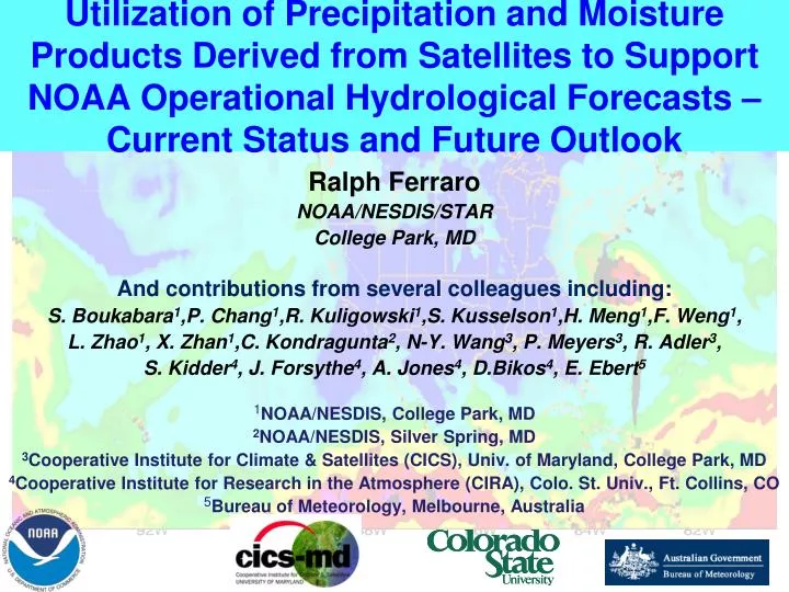
Utilization of Precipitation and Moisture Products Derived from Satellites to Support NOAA Operational Hydrological Forecasts – Current Status and Future Outlook. Ralph Ferraro NOAA/NESDIS/STAR College Park, MD And contributions from several colleagues including:

E N D
Utilization of Precipitation and Moisture Products Derived from Satellites to Support NOAA Operational Hydrological Forecasts – Current Status and Future Outlook Ralph Ferraro NOAA/NESDIS/STAR College Park, MD And contributions from several colleagues including: S. Boukabara1,P. Chang1,R. Kuligowski1,S. Kusselson1,H. Meng1,F. Weng1, L. Zhao1, X. Zhan1,C. Kondragunta2, N-Y. Wang3, P. Meyers3, R. Adler3, S. Kidder4, J. Forsythe4, A. Jones4, D.Bikos4, E. Ebert5 1NOAA/NESDIS, College Park, MD 2NOAA/NESDIS, Silver Spring, MD 3Cooperative Institute for Climate & Satellites (CICS), Univ. of Maryland, College Park, MD 4Cooperative Institute for Research in the Atmosphere (CIRA), Colo. St. Univ., Ft. Collins, CO 5Bureau of Meteorology, Melbourne, Australia
Outline • Review of NOAA Operational Satellites and their importance for Hydrological Applications • Individual sensors/products • Emerging blended products • Future vision • Potential new products/enhancements • GPM era/NOAA Precipitation Enterprise 2013 NOAA Satellite Conference – College Park, MD
Satellites for Hydrological Applications • Satellites are particularly useful where ground measurements are: • Not taken or missing • Examples – Sparse rain gauges and data delivery failure (maybe caused by an extreme rainfall event) • Of questionable quality • Examples – radar missing offshore rain; radar beam blockage in mountains • Not possible • Example – Open ocean • NESDIS provides operational satellite products of hydrological parameters for each individual satellite it operates. • GOES – visible and IR based, rapid update • POES – passive MW, 3 satellite, 4 hour global coverage • NOAA also utilizes satellite assets from other agencies like NASA, DoD, EUMETSAT and JAXA 2013 NOAA Satellite Conference – College Park, MD
NOAA Hydrological Satellite ProductsNot necessarily 100% all inclusive… 2013 NOAA Satellite Conference – College Park, MD
Super Storm Sandy (Oct. 22-31) • A historic storm for many reasons: • “Perfect storm” - Hurricane + Nor’easter • Record low pressure at landfall for MD/DE/NJ (~945 mb) • Record tidal flooding in NY&NJ • Record rain, wind, snow • Loss of life • 250+ in seven countries • Loss of property • $100 Billion? • Permanent changes to coastal regions 2013 NOAA Satellite Conference – College Park, MD
GOES Example - Hydroestimator Provided by R. Kuligowski, NESDIS/STAR Stage IV 24-hr Rainfall GOES HE 24-hr Rainfall 2013 NOAA Satellite Conference – College Park, MD
POES – MiRS TPW from ATMS Provided by S. Boukabara, NESDIS/STAR 2013 NOAA Satellite Conference – College Park, MD
Ensemble Tropical Rainfall Potential (eTRaP)http://www.ssd.noaa.gov/PS/TROP/etrap.html • eTRaP algorithm – E. Ebert (BOM/Australia) • Based on TRaP from Kusselson, Kidder, et al. • Forecast of 24-hour rainfall potential for tropical systems about to make landfall. • Based on extrapolation of microwave-derived rainfall rates along predicted storm track. • Ensembles improve deterministic forecasts and provide uncertainty information • Produced worldwide and used by operational agencies • Additional ensemble members (GOES, LEO) plus orographic, shear, storm rotation adjustments planned 18 UTC / 23 - 00 UTC / 24 00 – 06 UTC / 24 06 – 12 UTC / 24 12 – 18 UTC / 24 QPFEM QPFPM P≥50 mm P≥100 mm P≥150 mm P≥200 mm 2013 NOAA Satellite Conference – College Park, MD
eTRaP – Sandy – US Landfall • 24-hr estimates ending 06 UTC 30 October 2011 • Multiple satellite estimates used for this ensemble prediction • POES NOAA-18 and NOAA-19 (AMSU) • MetOp-A (AMSU) • TRMM (TMI) • DMSP-17 and DMSP-18 (SSMIS) • Maximum 24-hr rainfall predicted approximately 8 inches in MD/DE • Probability of 4 inch rain exceeds 50% over large region 2012 NOAA Satellite Conference – College Park, MD
Blended TPW (bTPW) Producthttp://www.osdpd.noaa.gov/bTPW/index.html • bTPW algorithm – Kidder and Jones, 2007 • Histogram matching to common reference • The bTPW product combines all available data sources into a “seamless” product for use by the NWS forecaster • Ocean – Satellite MW • Land – Satellite MW and GOES Sounder; GPS Met • Most flooding events can be linked to “atmospheric rivers” – high TPW that focus on a given location for extended period • Connection from (sub)tropics to mid and high latitudes • Product is useful to weather forecasters • Timing & magnitude of moisture “surges” (NWP models might miss) • Companion TPW Anomaly (from climatology) Product Blended TPW 21 UTC 1 May 2010 Provided by S. Kussleson, NESDIS/SAB 2013 NOAA Satellite Conference – College Park, MD
Future Products – GOES-R • GOES-R baseline –SCaMPR – Kuligowski (STAR) • 15 min Full Disk • Orographic Index – Bikos et al. (CIRA) • Use of GLM to improve ABI rainrates – Adler et al. (CICS) • Cloud Properties – Rabin et al. (NSSL) 2013 NOAA Satellite Conference – College Park, MD
Future Products – JPSS • Suomi NPP – MiRS is baseline ATMS product system – Zhan (STAR)/Zhao (OSPO) • GCOM – AMSR-2 – Chang et al. (STAR) • ATMS Snowfall Rates – Meng et al. (STAR) • Pole to Pole CMORPH – Xie et al. (NWS) 2013 NOAA Satellite Conference – College Park, MD
In the FUTURE, how do we consolidate into an even better product suite? Utilize the latest scientific concepts… Think out of the box…. Take concepts and turn into reality… And be prepared to defend yourself!
The Global Precipitation Measurement (GPM) Mission • GPM is “ripe” for R2O; why? • Precipitation Processing System (PPS) • NASA- Precip. Research Focus • NOAA – 24 x 7 Operations Focus • NOAA Unique products – TPW, OWS, AWIPS, … • Prototype system to • Reduce “stove pipes “ and system maintenance cost • Anchor for multi-satellite precipitation products • GOES and LEO • Anchor for multi-sensor precipitation products • Satellite, radar, gauges • L1C (Inter-calibrated radiances) • Ideal for climate related activities • May benefit NWP data assimilation GPM Core Satellite Launch Feb 2014 2013 NOAA Satellite Conference – College Park, MD
Current – Satellite Precipitation at NOAA Provided by C. Kondragunta, NESDIS/OSD 2013 NOAA Satellite Conference – College Park, MD
Future – Precipitation Enterprise Concept Provided by C. Kondragunta, NESDIS/OSD 2013 NOAA Satellite Conference – College Park, MD
One Example - Multi-sensor Data Fusion Provided by J.J. Gourley, NOAA/NSSL • NMQ is a prototype system for consideration. • Develop merged 3-D mosaics of reflectivity, hydrometeor type, and PSD retrievals over the CONUS by fusing dual-pol radar data from ground and dual-frequency data from space. • Will yield level-II precipitation rate and type products (1km/5min) using the merged mosaics and further enhanced with passive microwave satellite products 8-12 April 2013 2013 NOAA Satellite Conference – College Park, MD
Next Steps • Obtain final approval on GPM PPS L1RD and CONOPS; initiate execution of path forward (funding dependent) • Continue execution of NOAA funded projects on NASA PMM Science team (see backup slides) • NOAA risk reduction • NOAA collaborations on algorithms, data fusion and validation • Move forward with GPM Proving Ground and other recommendations from recently completed 3rd NOAA User Workshop on GPM (April 2-4) • Enhance synergies with GOES-R, JPSS and other broad-based NOAA programs 2013 NOAA Satellite Conference – College Park, MD
Backup Slides 2012 NOAA Satellite Conference – College Park, MD
Participation on PMM Science Team • Nine NOAA PI’s contributed to successful “Omnibus” no-cost to NASA proposal to ROSES2012 • NESDIS, NWS, OAR • NOAA secured 60% funds in FY13 • Some projects will be extended into 4th year • Shows continued interest in GPM at NOAA • Four funders within NESDIS • Two funders within OAR • JCSDA funding • Future funders identified • Please see our posters!
NASA-NOAA Algorithm Synergy & NWP Impact Assessment In support of GPM S. Boukabara (PI), K. Garrett, V. Tallapragada (co-PI), In-Hyuk Kwon Contributes to ROSES Focus Area of Algorithm/Product Validation and Enhancement Implementation of official CRTM 2.1 Sensitivity to Graupel PSD • Explore synergy between MiRS and GPROF • Utilize GPROF hydrometeor profiles in MiRS • Utilize MiRS surface emissivity in GPROF • Ensemble MiRS/GPROF: providing RR and Uncertainty • Validation of MiRS rainfall rate over snow and ice-covered surfaces • Extension of MiRS to snowfall rate • Optimization of MiRS rainfall rate with CRTM 2.1 implementation (impact of particle size) • “Wet Surface Emissivity” dynamic handling in active regions • Improved Data Assimilation Applications • Focus GSI 3DVAR/EnKF for HWRF/GFS extreme events • Direct assimilation of rainfall rates and heating rate • Improved vortex initialization for tropical cyclones • Advanced quality control of GPM data MiRS TMI Rainfall Rate assuming true graupel effective radius (re) (left) and 100% increase (error) in graupel re (right). Values of RR highly depend on the assumptions made about Dme. Understand errors due to error in surface emissivity Continued rainfall rate evaluation & Synergy MiRS 2A12 MiRS TMI Rainfall Rate (left) and TRMM-2A12 Rainfall Rate (right) over Hurricane Sandy MiRS Rainfall Rate with emissivity retrieval on (left), off (right) over Hurricane Sandy. False alarms a problem when emissivity not varied.
NOAA GPM Proving Ground and Utilization for HMT-SEPSR. Cifelli, S. Rudlosky, R. Ferraro, P. Xie Contributes to ROSES Focus Areas of Methodology Development for Improved Applications of Satellite Products • Extreme precipitation research: event climatology, QPE improvement, forecast challenges, high-impact event case studies • Research-to-operations transitions focus • Develop NOAA GPM “Proving Ground” – generate and serve GPM-era products to NWSFO’s and NOAA Testbeds for use and evaluation
Contributions to the MW-RE Precipitation over Land AlgorithmR. Ferraro, N-Y. Wang, H. Meng Contributes to ROSES Focus Area of Algorithm/Product Validation and Enhancement • Three primary objectives: • Provide operational NOAA snowfall rates to PMM team • Benchmark for GPM Day 1 snowfall rate retrievals? • Determine optimal information for GPROF data bases • MW HF & sounder emphasis • Determine optimal channel weights • MW HF & sounder emphasis
WiMerge: Research and Development of Unified CONUS 3-D Mosaics and QPE products J. Gourley, Y. Zhang, P. Xie, D. Kitzmiller, B. Kuligowski Contributes to ROSES Focus Areas of Methodology Development for Improved Applications of Satellite Products • The principal objective of the proposed study is to develop merged 3-D mosaics of reflectivity, hydrometeor type, and PSD retrievals over the CONUS by fusing dual-pol radar data from ground and dual-frequency data from space • Will yield level-II precipitation rate and type products (1km/5min) using the merged mosaics and further enhanced with passive microwave precipitation estimates Merging of space and ground radar data relies on the physical consistency through the particle size distribution (PSD) of hydrometeors
Characterization of Precipitation Field in High Latitudes of the Northern Hemisphere for the Future Use with the GPM Mission Products for Hydrological & Climate Change AssessmentsP. Groisman, D. Easterling, B. Nelson, D. Yang, V. Alexeev, et al. Contributes to ROSES Focus Areas of Algorithm/Product Validation, Enhancement & Utilization of Satellite/GV Products for Process Studies In the United States, we will secure the time series homogeneity of most national in situ networks used for the national climate change assessments; For the high latitudes of the Northern Hemisphere, we will update and maintain the science-quality archive of homogeneous daily precipitation time series; To facilitate the future fusion of GPM products with other hydrometeorological information in the high latitudes, we will generate the ‘ground truth’ regional (grid cell) precipitation and estimate the accuracy of this ‘truth’ values; Left. Mean intense (i.e., >12.7 mm d-1) precipitation, mm×(event)-1 that comes with 1-day- and 2-day-long events over the contiguous United States. Right. Nationwide annual precipitation intensity, I, changes over Russia. • We will estimate light precipitation in high latitudes using gauges in combination • with synoptic and surface data. Because the perspectives to secure measurements • of light precipitation from space are elusive, these in situ data will complement future • GPM products in high latitudes and jointly serve for hydrological applications and • climate and environmental change analyses. 25
Calibration of GMI Sounding Channels and Global Detectionof Radio Frequency Interference Fuzhong Weng (NESDIS/STAR), Xiaolei Zou (FSU) and Tiger Yang (ESSIC/UMD) Contributes to ROSES Focus Areas of Algorithm/Product Validation and Enhancement and Utilization of Satellite/GV Products for Process Studies and Model Development • Assessment of GMI non-linearity parameter through the WMO Global Space-Based Inter-calibration System (GSICS) algorithm • Calibration of GMI high-frequency sounding channels using ATMS • Global Detection of GMI Radio Frequency Interference (RFI) through a Double Principle Component Analysis 6.8 GHz 10.65 GHz RFI distributions of WindSat 6.8 and 10.65 GHz at horizontal polarization using double PCA technique over Antarctic during Feb 1-10, 2011. Indicated by circles are Antarctic research stations where RFI signals were transmitted.
Contributes to ROSES Focus Area of Algorithm/Product Validation and Enhancement Pole-to-Pole CMORPH and Integrated Regional Precipitation Analyses P.Xie and R.Joyce Pole-to-pole CMORPH 0.05olat/lon over the globe in 30-min interval Integration of PMW, GEO/LEO IR, and model info through Kalman filter Framework designed, prototype under development Regional CMORPH With R. Kuligowski 2km grid 15-min analysis over North America and nearby ocean Including GOES-R hi-res IR Products comprised of different latencies (15-min to 18 hours) Gauge-Radar-Satellite-Model merged analyses With Y.Zhang and OHD Hourly analysis over CONUS OI technique Prototype being tested
Analysis and Validation of GPM in LAPS Data Assimilation SystemY. F. Xie, S. Albers, S. Gutman, D. Birkenheuer, H. L. Jiang, and Z. TothGlobal Systems Division, Earth System Research Lab, NOAA/OAR Contributes to ROSES Focus Areas of Methodology Development for Improved Applications of Satellite Products Variational LAPS is a hotstart and multiscale data assimilation system used by 150+ users worldwide; With new or modified forward operators, GPM data will be tested in V-LAPS analysis and evaluated for its impact; For data validation, assimilated GPM data or products will be compared with Doppler radar reflectivity over selected domains and the differences will be described; After validation, GPM forward operators and assimilation methodologies can be used in parallel runs of global forecast systems (e.g. the Finite-volume Icosahedral Model-FIM) to evaluate the impact of GPM data in these models, particularly over the ocean. GPM data could potentially improve LAPS cloud, rain, snow, and graupel analysis over areas without radar coverage 28
Contributions to GPM at NOAA NWS/OHD & NESDIS/STAR – Data Fusion and ApplicationsY. Zhang, J. Gourley, R. Kuligowski, D. Kitzmiller, P. Xie Contributes to ROSES Focus Areas of Methodology Development for Improved Applications of Satellite Products • Retro-generation of SCaMPR (GOES-R version - Kuligowski) • Experimental blending of radar,satellite and gauge data • Bias correction via RLSF vs. Prob. matching (in conjunction with Xie at CPC) • Error characterization of R/S vs. gauge wrt distance • 2-step Co-kriging estimation/CBPK (w/ DJ, Pingping, Rob C) • Evaluation and cross validation • Russian river/NC • Hydro-model calibration and validation (in conjunction with AOR) • Data assimilation 29