Download
1 / 19
190 likes | 422 Views
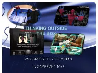
Augmented Reality. Kelompok 2 : Christian Tamin Edward Ivan Fadli Samuel Bethelius Claudio Bertho Belgio Arditya Tripakarsa Kevin Pratama Jason Pa s calasa . Apa itu Augmented Reality?.

E N D
Augmented Reality Kelompok 2 : • Christian Tamin • Edward Ivan Fadli • Samuel Bethelius • Claudio Bertho Belgio • Arditya Tripakarsa • Kevin Pratama • Jason Pascalasa
Apa itu Augmented Reality? • Teknologi yang menggabungkan benda maya dua dimensi dan ataupun tiga dimensi ke dalam sebuah lingkungan nyata tiga dimensi lalu memproyeksikan benda-benda maya tersebut dalam waktu nyata. • Tidak seperti realitas maya yang sepenuhnya menggantikan kenyataan, realitas tertambah sekedar menambahkan atau melengkapi kenyataan.
Hardware untuk Augmented Reality Smartphone Contact Lens Glasses
Handheld Game Devices (PSP, Nintendo DS) Produk Apple Android
Google Earth merupakan program yang berfungsimenampilkanbumidengancaramenampilkannyasepertifoto-foto yang diambillangsungdariSatelitataudaripesawatkhusus yang memangdisengajadibuatuntukmemantaubumi.
Spesifikasi Google Earth • Resolusi Baseline - U.S. : 15 m - Global : secaraumum 15 m (beberapa area sepertiAmerika Selatan, beradapadaresolusi yang sangatrendah). • Tipikalresolusitinggi - U.S. : 1m, 0.6m, 0.3m, 0.15m • Sistemkoordinatdanproyeksi - Sistemkoordinat internal dari Google Earth merupakankoordinatgeografispada World Geodetic System 1984 (WGS84). - Google Earth menampilkanbumiseakan-akanterlihatdarisatelit yang sedangmengorbit. Proyeksi yang digunakanuntukefekinidisebut General Perspective. Efekinimiripdenganproyeksiorthografis.
Ketidakuratan Google Earth IniadalahFaktor-faktorketidakuratan Google Earth : • Adanyadaerah yang tertutupawandanbayangan yang mempersulitpenglihatansecara detail termasukbayangandarisisigunung-gunung. • Gambar-gambarpadagoogle earth tidaksemuanyadiambilpadasaat yang sama. • Kesalahanjugaterjadikarenateknologi yang digunakanuntukmengukurtinggidaripermukaan
Film iron man merupakansalahsatucontohpenggunaan Augmented Reality , Tony Stark seringdiperlihatkanberinteraksidenganobyeknyata yang disimulasikandenganvirtualisasi 3D.
BeberapaContoh-ContohPenggunaan Augmented Reality di Iron Man
Software Augmented Reality Basic Principles ARToolKit ARToolKit applications allow virtual imagery to be superimposed over live video of the real world. Although this appears magical it is not. The secret is in the black squares used as tracking markers. The ARToolKit tracking works as follows:
Tutorial : Tracking Stability Figure 1: The simpleTest2 Program Figure 2: A closer view reveals jittering when the history function is not used.
Prinsip kerja sistem Augmented Reality Start Pembuatan Objek Pembuatan Marker Menggunakan Adobe Flex SDK untuk membangkitkan objek dari marker yang dibuat Process Webcam Image Get Webcam Image menghadapkan marker ke depan webcam Match up the patterns image dirender dan ditampilkan ke dalam dunia maya. Labeling Finish
5. Jika marker telah sesuai dengan yang ada didalam database, baru image dirender dan ditampilkan ke dalam dunia maya.