Download
1 / 39
420 likes | 662 Views
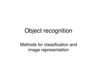
Experience to date with L8 Curtis Woodcock, Zhe Zhu, Pontus Olofsson , Shixiong Wang, Chris Holden, Boston University. Cloud/Cloud Shadow/Snow Detection Image Classification Data quality ( variograms ). Band 3 – Red. Image: Google Earth.

E N D
Experience to date with L8Curtis Woodcock, Zhe Zhu, Pontus Olofsson, Shixiong Wang, Chris Holden, Boston University Cloud/Cloud Shadow/Snow Detection Image Classification Data quality (variograms)
Band 3 – Red Image: Google Earth
Plot of virtually all available Landsat observations for a single pixel of a stable coniferous forest – the noisy values are observations influenced by undetected clouds and cloud shadows
Band 3 – Red Image: Google Earth
New Cloud/Cloud Shadow/Snow algorithm for Landsat 8 (Fmask) • The cirrus band is used to compute a cirrus cloud probability thatis combined withthe previous Fmask probability mask. • The only differences are in the potential cloud mask. • (We can make a beta version available online if people are interested)
Cirrus Cloud Probability Calculation The numbers in the parenthesis are MODIS test thresholds for land pixels. The number in red are new Fmask test threshold for all pixels. The MODIS high thresholds are mainly due to the cross-talking issues in the narrow bands. From Ackerman et al., ATBD, 2010
Thresholds for Cirrus clouds Cirrus band TOA reflectance: 0-0.01, 0.01-0.03, 0.03-0.04, 0.04-1 Landsat 8 image at Path 33 Row 61 (Amazon) acquired in October 5th 2013
Potential Cloud Layer • Step 1: Retrieving Potential Cloud Pixels (PCP) • Inputs for PCP computing: • Basic tests (Temperature, Band 7 ref, NDVI, and NDSI) • Whiteness • 0.47 vs. 0.66 • Band 4/Band 5 • Water test • Cirrus cloud test
Potential Cloud Layer • Step 2: Build Cloud probability mask (land) • 1. Temperature probability: Using non-PCP to calculate land surface temperature range (TempLow,TempHigh) and calculate the normalized Temperature probability for cloud (Temperature_prob). • 2. Variation probability: Choosing the largest value among NDSI, NDVI, and whiteness to calculate the spectral variation probability for cloud (Variation_prob). • Cloud_prob=Temperature_prob*(1-variation_prob) + Cirrus_prob
Potential Cloud Layer • Step 2: Build Cloud probability mask (water) • 1. Temperature probability: Using non-PCP to calculate water surface temperature and calculate the normalized Temperature probability for cloud (Temperature_prob). • 2. Brightness probability: Using normalized Band 5 reflectance to compute cloud probability (Brightness_prob). • wCloud_prob=Temperature_prob*Brightness_prob+ Cirrus_prob
SWIR, NIR, and Red composite Old Fmask results Landsat 8 image forPath 45 Row 30 (Oregon) acquired onApril 23th 2013
SWIR, NIR, and Red composite The new Cirrus band Landsat 8 image at Path 45 Row 30 (Oregon) acquired in April 23th 2013
SWIR, NIR, and Red composite New Fmask results Landsat 8 image at Path 45 Row 30 (Oregon) acquired in April 23th 2013
NIR, Red, and Green composite Old Fmask results Landsat 8 image forPath 33 Row 61 (Amazon) acquired on October 5th 2013
NIR, Red, and Green composite The new Cirrus band Landsat 8 image at Path 33 Row 61 (Amazon) acquired in October 5th 2013
The new Fmask Cirrus and cloud mask from QA Yellow (cloud) Yellow (cloud) blue (cirrus)
NIR, Red, and Green composite New Fmask results Landsat 8 image at Path 33 Row 61 (Amazon) acquired in October 5th 2013
NIR, Red, and Green composite Old Fmask results Landsat 8 image at Path 33 Row 62 (Amazon) acquired in May 30th 2013
NIR, Red, and Green composite The new Cirrus band Landsat 8 image at Path 33 Row 62 (Amazon) acquired in May 30th 2013
NIR, Red, and Green composite New Fmask results Landsat 8 image at Path 33 Row 62 (Amazon) acquired in May 30th 2013
No saturation even for the blue Band! SWIR, NIR, and Red composite at Oregon from Landsat 7 in May 1st , 2013 SWIR, NIR, and Red composite at Oregon from Landsat 8 in April 23rd , 2013
“Synthetic” data, or “model-based composite”, or ????Path 35 Row 32 (Colorado) NIR, Red, and Green composite August 1st August 6th 2002 August 9th 2002 Landsat 7 Synthetic image Landsat 5
Synthetic dataPath 27 Row 27 (Maine) NIR, Red, and Green composite July 13th2001 August 6th 2001 August 6th 2001 Landsat 5 Synthetic image Landsat 7
Comparison of land cover classifications using Landsat 8 and Landsat 7 data (Underflight Data) • Data: p22 r39 • Date: 03/29/2013 • Location: Southern Louisiana • Size: 3000 X 3000 pixels • 0% cloud coverage • Bands used • Landsat 7: 1, 2, 3, 4, 5, and 7 • Landsat 8: 2, 3, 4, 5, 6, and 7 • Classification algorithm: Random Forest
Classification Comparison (L7 and L8) • At least 3 reasons to expect improvements • Improved radiometric resolution (improved signal to noise) • Better detection of thin clouds • New spectral band (and possibly the improvements in the heritage bands) • We’ve tested the first case – by only using the heritage bands from L8 in comparisons with L7 from coincident images without clouds
Results (Louisiana scene) • 86% of pixels classified the same -- and those pixels are correctly classified 88% of the time • Of the pixels classified differently, the L8 answer is correct 70% of the time and L7 answer only 17.2% of the time • There appears to be less of the “salt and pepper effect” (high frequency noise) in the classification results of L8 (not yet addressed quantitatively)
Landsat 7 Random forest classification results Landsat 7 band 5, 4, 3 composite (400 X 400 pixels) Landsat 8 Random forest classification results Landsat 8 underflyband 6, 5, 4 composite (400 X 400 pixels)
Landsat 7 Random forest classification results Landsat 7 band 5, 4, 3 composite (400 X 400 pixels) Landsat 8 Random forest classification results Landsat 8 underflyband 6, 5, 4 composite (400 X 400 pixels)
Landsat 7 Random forest classification results Landsat 7 band 5, 4, 3 composite (87 X 87 pixels) Landsat 8 Random forest classification results Landsat 8 underflyband 6, 5, 4 composite (87 X 87 pixels)
Landsat 7 Random forest classification results Landsat 7 band 5, 4, 3 composite (400 X 400 pixels) Landsat 8 Random forest classification results Landsat 8 underflyband 6, 5, 4 composite (400 X 400 pixels)
2 Land Cover Mapping Accuracy Assessment • Classification results from L7 and L8 agree (86%)
Classification results in areas that disagree between L7 and L8 (14%) Landsat 8 underfly Landsat 7
Variograms of Landsat 7 vs Landsat 8 underfly (NIR band in radiance) Water Wetland High density built Forest
The NIR bands of Landsat 7 and Landsat 8 underfly 1. Water 2. Forest 3. Wetland
Comparison analysis of land cover classifications using Landsat 8 OLI/TIRS Pre-WRS-2 and Landsat 7 ETM+ data under the influence of cirrus clouds • Data: p134 r42 • Date: 03/30/2013 • Location: Northern Burma • Fmask • Bands used • Landsat 8: 2, 3, 4, 5, 6, and 7 • Landsat 7: 1, 2, 3, 4, 5, and 7 • Classification algorithm: Random Forest
Landsat 8 underfly classification map Band 6, 5, 4 composite Band 9 Landsat 7 classification map Band 5, 4, 3 composite
Conclusions • Potential for dramatic improvement in detection of clouds and cloud shadows – in particular thin clouds that have previously gone undetected and undermine many uses – particularly time series analysis for monitoring land cover change or trends in condition. • Image classification accuracies are improved using L8 vs L7 due to improved radiometric resolution/SNR • (need to work more on the question of the effect of previously undetectable clouds on classification) • Time series approaches open new opportunities for producing “composited” images (or whatever you want to call them) • Variograms show L8 data have reduced noise (expected) and increased variance (not sure why – maybe finer spatial resolution)
My “two-cents” worth • There is no going backward on radiometry – “everything is going to improve with improved radiometry” • The cirrus band (and cloud and shadow detection, in general) is critical to the next generation of applications and products • Increased frequency of observations remains the next “big step forward” in moderate resolution land imaging • Use of L8 in time series analysis dependent on ability to atmospherically correct L8 data to surface reflectance