Download
1 / 18
180 likes | 187 Views
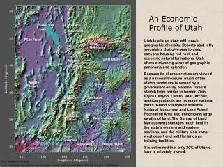
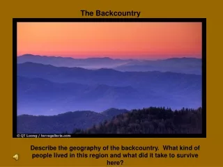
High Uinta Backcountry Guide. Paul Craig John Newton. Objective. Create a GIS system of user friendly maps of the High Uinta Wilderness area. These maps give hikers, fishermen, and the like a guide to streams, lakes, and other features of the High Uinta Mountains. Overview. Data Collection

E N D
High Uinta Backcountry Guide Paul Craig John Newton
Objective • Create a GIS system of user friendly maps of the High Uinta Wilderness area. These maps give hikers, fishermen, and the like a guide to streams, lakes, and other features of the High Uinta Mountains.
Overview • Data Collection • Data Manipulation • Creating New Features
Data Collection • DRG • DLG • NED • Land Cover
Data Manipulation Quadrangles • Clipping
Data Manipulation Quadrangles • Clipping
Data Manipulation Quadrangles • Clipping • Redefine coordinates
Data Manipulation Organizing Data • Geodatabases and feature data sets • Grouping layers • Activating layers at defined extent
Creating New Features • Trailhead point features
Creating New Features • Utah State Boundary polygon feature
Creating New Features • Weather and Sunset Information point features