Download
1 / 41
420 likes | 436 Views
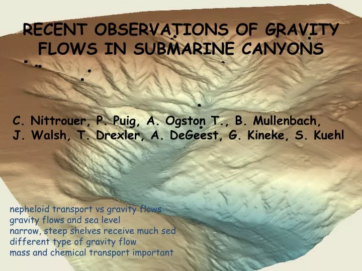
RECENT OBSERVATIONS OF GRAVITY FLOWS IN SUBMARINE CANYONS. C. Nittrouer, P. Puig, A. Ogston T., B. Mullenbach, J. Walsh, T. Drexler, A. DeGeest, G. Kineke, S. Kuehl.

E N D
RECENT OBSERVATIONS OF GRAVITY FLOWS IN SUBMARINE CANYONS C. Nittrouer, P. Puig, A. Ogston T., B. Mullenbach, J. Walsh, T. Drexler, A. DeGeest, G. Kineke, S. Kuehl nepheloid transport vs gravity flows gravity flows and sea level narrow, steep shelves receive much sed different type of gravity flow mass and chemical transport important
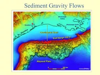
IMPORTANCE OF MODERN CANYONS To document modern sediment fluxes to the deep ocean To understand mechanisms of lowstand sedimentation SOME RECENT STUDY AREAS Narrow shelf: Eel canyon (northern California) No shelf: Sepik canyon (northern Papua New Guinea) Cold water: Cap Creus canyon (northeastern Spain)
0 0 0 0 0 3 4 0 0 0 0 2 0 8 0 0 0 1 0 0 0 0 0 7 4 0 6 2 5 0 0 6 5 0 5 5 2 0 1 9 3 0 0 7 0 5 3 1 Eel margin California Elevation 0 m 350 1400 Eel River Drainage Basin 41o00’ 40o50’ 40o40’ 124o40’ 124o30’ Study Area Eel River Drainage Basin ~9000 km2
mid-shelf gravity-flow processes from Traykovski et al., 2000
Signals of Episodic Sedimentation on the Eel Shelf
Larry entrance Normalized 210Pb 7Be Clay content dpm/(g clay) dpm/g % 10 20 30 2 6 10 25 35 45 0 4 depth (cm) 8 ND 12 ND Moe entrance Normalized 210Pb 7Be Clay content dpm/(g clay) dpm/g % 35 45 55 10 20 30 2 6 10 0 4 depth (cm) 8 ND 12 ND 16 Eel River sediment is quickly deposited in the Canyon
Larry thalweg 90m A 40o39.5’ 110 130 B A 90 39.33’ B 124o27.83’ 27.50’ 100 tripod Core 1 Water depth (m) 110 Core 3 120 Core 2 A 0 50 100 150 200 250 300 Distance along transect (m) Channelized sediment transport and deposition Formed by gravity-driven sediment flows Core 1 Core 2 Core 3 0 cm 10 20 30
sand silt clay Non-steady-state profiles in thalwegs Sand, silt and clay content (%) Total Pb-210 activity (dpm/g) 60cm Multiple seasonal deposits are preserved C 90 120 D 150 150 Cs-137 E B A 180
120 Evidence of sediment removal over decadal time scales Total Pb-210 activity (dpm/g) Total Pb-210 activity (dpm/g) 10 1 10 1 Moe 160 m MT160B Jul 98 Moe 450 m 0 0 MT450 Jul 98 180cm 90cm 50 50 100 100 Depth (cm) Depth (cm) 150 150 210 200 200 250 250
SEPIK CANYON narrow shelf (<5 km) and…
April 1999 Courtesy of Gail Kineke
Plume bifurcates ~15% sed mass as surface plume ~85% sed mass as bottom plume Courtesy of Gail Kineke
Accumulation Rate (cm/yr) 144o 30’ E Wei Island 4.0 - 5.0 3.0 - 4.0 2.0 - 3.0 1.0 - 2.0 0.3 - 1.0 1000 m 1000 m • 0.5 Blupblup Island 0.2 4o 30’ S • 0.2 500 m • 0.3 .94 • Kadovar Island 1.5 • • 0.7 0.6 0.8 • 0.8 • Bam Island • 1.3 • • 1.8 100 m 5.1 • • 3.5 • 3.9 1.0 • 0.6 • • 1.0 • 10 km Sepik River Kuehl et al. 2000
Some sediment reaches submarine canyons on the continental slope
Cap Creus Canyon (courtesy of Orange et al.)
Sediment accumulation rates ~mm/y Courtesy of Amy DeGeest
EuroSTRATAFORM Monitoring Winter 2003-04 Winter 2004-05 • Along-margin • Shelf-to-canyon Courtesy of Pere Puig
Long-term Monitoring Lacaze-Duthiers Canyon 10 February 1995 Durrieu de Madron et al., Prog. Oceanogr. (2005) & Heussner et al., Mar. Geol. (2006) Courtesy of Pere Puig
0.4 2.9 7.1 7.3 2.7 Courtesy of Pere Puig
Coarse sediment also observed to be transported Time series recorded at 500 m water depth (5 - 30 mab) Courtesy of Pere Puig
Heat flux Mixing INLs Neutral density level Dense shelf water cascades down continental slope Courtesy of Pere Puig Adapted from Fohrmann et al., J. Phys. Oceanogr. (1998)
Cap Creus Canyon (courtesy of Orange et al.)
Deep-towed side-scan sonar survey 750 m Courtesy of Pere Puig
Furrow orientation controlled by bottom currents Courtesy of Pere Puig
Sedimentary Furrow Formation Deposition during weak flows Erosion during strong flows Maximum width = 50 m Wavelength = 100 m Maximum height = 10 m Type 1C Erosive Cap de Creus Canyon sedimentary furrows Flood, Geological Society of America Bulletin(1983) Courtesy of Pere Puig
CONCLUSIONS Much sediment can enter submarine canyons today especially on collision margins Canyon heads commonly are located in shallow depths fluvial/estuarine processes (turbidity max) surface gravity waves (liquefaction, resuspension) shelf water masses intercepted Turbid water transported into canyon head regularly sed gravity flows (fluid mud, hyperpycnal flows) cold-water gravity flows also observed Autosuspending gravity flows occur less frequently turbidity currents flush canyon heads?