Download
1 / 6
70 likes | 202 Views
GeoWEPP ArcGIS 10.1 for soil erosion project. Development Team Haoyi Xiong – Application leading developer Jonathan Goergen - Application co-lead developer Misa Yasumiishi - Webpage developer Martin Minkowski - GeoWEPP ArcGIS 9.x developer (ESRI Project Engineer now)

E N D
GeoWEPP ArcGIS 10.1 for soil erosion project Development Team HaoyiXiong– Application leading developer Jonathan Goergen - Application co-lead developer MisaYasumiishi - Webpage developer Martin Minkowski - GeoWEPP ArcGIS 9.x developer (ESRI Project Engineer now) Chris Renschler - Project Leader LESAM Lab Team
Software Development • Water Fall Model as developing scenario GeoWEPPArcGIS 10.1 Software design
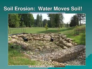
Study Area 1. simulate the red part stream Goal: 2. reduce runoff for the farmland area East of Gowanda, NY Data source: USDA
Environmental modeling with GeoWEPP(GeoWEPP extension - stream customization) ArcMap Hydrology Tools GeoWEPP without customization Stream Delineation GeoWEPP with Customization Subcatchments Delineation Erosion Prediction Generate climate data
Onsite assessment for best landuse management practice Soil Loss (Tons/year): 20.2 → 9.8 Runoff Volume( 5316.2 → 4891.1 Target high erosion place Plant trees as buffer on these place Generate new erosion pattern
References GeoWEPP: Renschler, C.S. (2003) Designing geo-spatial interfaces to scale process models: The GeoWEPP approach. Hydrological Processes 17, p.1005-1017. WEPP: Laflen, J.M., L.J. Lane, and G.R. Foster. 1991. WEPP—a next generation of erosion prediction technology. Journal of Soil Water Conservation 46(1): 34–38. Flanagan, D.C., and M.A. Nearing (eds.). 1995. USDA-Water Erosion Prediction Project (WEPP) Hillslope Profile and Watershed Model Documentation. NSERL Report No. 10, National Soil Erosion Research Laboratory, USDA-Agricultural Research Service, West Lafayette, Indiana. GeoWEPP Applications: Flanagan, D.C., J.R. Frankenberger, T.A. Cochrane, C.S., Renschler, and W.J. Elliot (2013) Geospatial Application of the Water Erosion Prediction Project (WEPP) Model. Transactions of the ASABE (in press) Renschler, C.S., and D.C. Flanagan (2008) Site-Specific Decision-Making Based on GPS RTK Survey and Six Alternative Elevation Data Sources: Soil Erosion Prediction. Transactions of the ASABE 51(2):413-424.[2009 ASABE Superior Paper Award] Renschler, C.S., and Lee, T. (2005) Spatially distributed Assessment of Short- and Long-term Impacts of Multiple Best Management Practices in Agricultural Watersheds. Journal of Soil and Water Conservation 60(6):446-456. Renschler, C.S., Flanagan, D.C., Engel, B.A., Kramer, L.A., and Sudduth, K.A. (2002) Site-Specific Decision-Making Based on GPS RTK Survey and Six Alternative Elevation Data Sources: Watershed Topography and Delineation. Transactions of the ASAE 45(6):1883-1895. Renschler, C.S., and J. Harbor (2002) Soil erosion assessment tools from point to regional scales – The role of geomorphologists in land management research and implementation. Geomorphology 47, p.189-209.