Download
1 / 44
440 likes | 444 Views
Communications Systems Used in the USA TARNS. Chris Hill, Meteorologist in Charge (ret) National Weather Service Seattle, Washington, USA. Washington Faces Many Non-Weather Hazards. Tsunamis. Earthquakes. Major Chemical Spills. Terrorism. Subduction Zone Comparison.

E N D
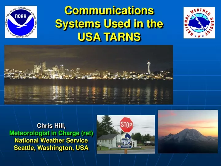
Communications Systems Used in the USA TARNS Chris Hill, Meteorologist in Charge (ret) National Weather Service Seattle, Washington, USA
Washington Faces Many Non-Weather Hazards Tsunamis Earthquakes Major Chemical Spills Terrorism
National Weather Service MissionServing America Since 1870 Provide Weather, Hydrologic, and Climate Forecasts and Warnings for the United States, its Territories, Adjacent Waters and Ocean Areas, for the Protection of Life and Property and Enhancement of the National Economy.
Warning System Goal: To maximize the number of people who take appropriate and timely action to minimize injury, death, and property damage due to hazardous weather and flooding.
The Warning System - Detection / Warning - Dissemination - Response
Government Agencies NWS Warning Product NOAA Port NOAA Weather Wire EMWIN Internet Private Vendors Associated Press ACCESS NWR / EAS Media Multiple Paths General Public Emergency Mgmt
The Tsunami Warning System NOAA Tsunami “DART” Buoy Tsunami Warning Center – Palmer, Alaska Weather Radio Receiver
Dissemination Methods • NOAA Weather Radio – radio broadcast • EMWIN – satellite/radio • NOAA Weather Wire – satellite/land lines • RANET – radio internet
NOAA Weather RadioA Life Saver for the Cost of a Pair of Shoes Direct from the NWS 24 hours a day Latest Area Forecasts and Conditions
NOAA Weather RadioA Life Saver for the Cost of a Pair of Shoes Over 900 Stations Across the U.S. 21 Stations Serve Washington
NOAA Weather RadioA Life Saver for the Cost of a Pair of Shoes Has a Warning Alarm Feature
NOAA Weather RadioA Life Saver for the Cost of a Pair of Shoes Key Element in Emergency Alert System (EAS) “All-Hazards”Warning System
NOAA Weather RadioA Life Saver for the Cost of a Pair of Shoes Receivers Available at Most Radio Electronic Retailers and via the Internet
Not All Weather Radios Receivers Are Alike • Key Features To Have • Warning Alarm • SAME (Specific Area Message Encoding) • Event Selection • External Antenna Jack • Others • Best Reception • Programming Capabilities and Ease • Terrain Challenges
NWS Messages to EAS * Tornado Watch or Warning * Severe Thunderstorm Watch or Warning * Flash Flood Watch or Warning * Flood Warning * High Wind Warning * Winter Storm / Heavy Snow / Blizzard Warning * Tsunami Watch or Warning * Civil Emergency Message
Non -NWS Messages on NOAA Weather Radio Examples include: * Civil Emergency Warning * Evacuation Immediate * Shelter in Place Warning * Volcano Warning * Child Abduction Emergency (AMBER)
NOAA Weather Radio is Washington’s “All-Hazards” Warning System Ocean Shores “AHAB”
Who Receives EAS Messages via NOAA Weather Radio • All Broadcasters • TV • Radio • Cable TV • Weather Radio Receivers • Homes • Businesses • Schools • Health Care Facilities • All-Hazards Alert Broadcast (AHAB) Units • Any With Receivers Ocean Shores “AHAB”
Satellite Delivery - EMWIN • Emergency Manager’s Weather Information Network • GOES East, at 75 degrees West • GOES West, at 135 degrees West. • Telstar 5 Satellite, at 97 degrees West. • The GOES downlink frequency used for the 9600 baud EMWIN datastream is 1690.725 MHz
Satellite Delivery - EMWIN • EMWIN is a nonproprietary operational dissemination system, primarily for the emergency management community. It provides a continuous, dedicated low speed data broadcast of up to 5,000 pages per day using an audio signal from the GOES satellite or terrestrial retransmitter. • The EMWIN datastream consists of: • real-time weather warnings, watches, advisories, forecasts, • a subset of alphanumeric products for each state, • a limited suite of non-value added graphical products, and some satellite imagery
Satellite Delivery - EMWIN • The EMWIN datastream was designed to run at minimal cost to the NWS and at no recurring costs to users in range of the signal. Basic software developed, but unsupported, by the NWS to meet minimum needs of users is available for free, and can be downloaded from the Internet. Low cost, supported commercial software with more features is available.
Radio Rebroadcast of EMWIN • To receive and make use of the EMWIN datastream, a user must be in acceptable signal range and have: • at a minimum, a 80386 or 80486 personal computer with DOS 5.0 or greater and Windows 3.1 or greater; • a relatively inexpensive portable receiver with antenna based on NOAA Weather Radio modified to receive the transmitted frequency; and • a custom built, but inexpensive demodulator that receives the signal from the receiver and feeds it to the serial port of the user's computer system.
Anywhere/Anytime Weather Forecasts You can now receive your weather forecast from the National Weather Service any where/anytime using your wireless device. All you need is a wireless device that can surf the Internet along with a wireless Internet service provider. WI FI
RANET – RAdio andinterNET • RANET is an international collaboration to make weather, climate, and related information more accessible to remote and resource poor populations. • RANET undertakes this mission in order to aid day-to-day resource decisions and prepare against natural hazards. • The program combines innovative technologies with appropriate applications and partnerships at the community level in order to ensure that the networks it creates serve the entirity of community information needs. • Community ownership and partnership is the core principle of RANET's sustainability strategy.
RANET – RAdio andinterNET • In co-operation with its partners, RANET is now able to make observations, forecasts, and bulletins more readily available to hydro-meteorological and extension services in Africa. • The satellite bandwith is made available by the WorldSpace Foundation. • With an appropriate receiver and adapter, a digital radio, this information can be easily accessed:
RANET – RAdio andinterNET • the radio picks-up information from the satellite using only a small antenna. • From the radio, the signal passes through a modem to a computer on which the information can be seen as text, illustrations and pictures. • In this way the limitations of internet connectivity or bandwidth and speed are no longer a barrier to critical information access. • The information broadcast by RANET can also be seen via the Internet, on a NOAA mirror site.
RANET – RAdio andinterNET • The networks RANET develops, however, are not limited solely to satellite systems. • The program works with a variety of partners to standardize appropriate FM community radio station equipment, HF systems, and even energy solutions such as solar and wind. • By bringing together various appropriate and sustainable technologies, RANET supports ‘human networks' of dialogue and partnership that serve as the basis for sharing knowledge to improve the lives of communities in remote areas.
StormReady /TsunamiReady Working Together to Save Lives Long Beach Ocean Shores
What is Storm/TsunamiReady? • A voluntary community preparedness program that promotes weather and tsunami hazard readiness. • Primary goal to improve public safety during emergencies. • A collaborative effort between federal, state, and local agencies, and the public.
Most important - • REDUNDANCY • REDUNDANCY!
TsunamiReady Community Components • StormReady Elements • Emergency Operations Center • Multiple Ways to Receive NWS Warnings • Multiple Ways to Disseminate Warnings • Multiple Ways to Monitor Conditions • Hazardous Weather Plan • Community Preparedness Education • TsunamiReady Elements • Identify Hazard Zones • Map Evacuation Routes and Assembly Areas • Install Evacuation and Assembly Signage • Educate Community on Tsunami Hazard and Safety Plans
StormReady / TsunamiReady • Who • Counties • Communities • Cities • Indian Nations • Supporters • Businesses • Schools