Download
1 / 23
230 likes | 426 Views
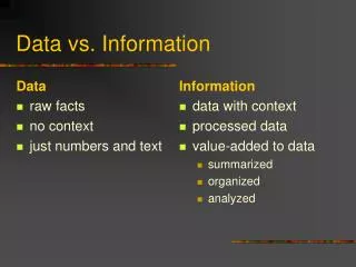
Data vs. Information. Data: raw facts or measurements Information: collection of facts organized/processed in such a way that they have value beyond the facts themselves. Adds meaning or context to achieve goal of user. What is Information?.

E N D
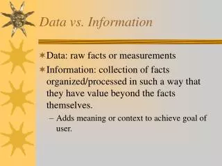
Data vs. Information • Data: raw facts or measurements • Information: collection of facts organized/processed in such a way that they have value beyond the facts themselves. • Adds meaning or context to achieve goal of user.
What is Information? • Information is the derivative of manipulating, organizing, summarizing, and presenting data in a form suitable for decision-making or further analysis.
Principle • MIS: The value of information is directly linked to how it helps decision makers achieve the organization’s goals
The “Information Spectrum” • . Omniscience • . Wisdom • . Knowledge • . Information • . Data
Info CharacteristicsANALYSIS TECHNIQUE • Affect value of information • Different attributes more important at different times or different applications • Trade-off between attributes
Accurate • Error free • measured correctly • Entered correctly • Interpreted correctly • GIGO • Program should verify data.
Complete • Has all important facts or data fields needed to achieve goals of IS. • Student records system: • Name, SSN, GPA, payments, course grades
Economical • Worthwhile to collect, buy or produce • “Value” of information vs. cost • What if “tip sheet” cost $1000 ? • Better be accurate and reliable!
Flexible • Can be used for a variety of purposes • supports different IS users goals • easily transformed to another use • Transferable to another application or use: Inventory levels used by: • Sales staff, purchasing, production
Reliable • Always accurate/available – not just sometimes • can be depended on • quality is consistent
Relevant • Important to decision maker • (not extraneous) • captures important aspects of model • can be used to problem at hand • Remove non-relevant items from screens
Simple • Easy to understand • Easy to manipulate
Timely • Delivered when it is needed • Maximizes value • Relevant in time: still contributes to goals of organization
Verifiable • Can check to see if correct • Has other sources or can be “proved”
Accessible • Can be retrieved in reasonable time in correct format
Secure • Only authorized users can access easily • Protected from damage (backed up)
What is GIS? • A Geographical Information System (GIS) is a compilation of computer hardware, software, data and personnel that • collects, analyzes and presents information that is tied to a geographic location.
What is GIS? • Converts data into visual form • Links geographical data with descriptive data and forms the information into layers • The layers create themes that represent particular features on a map and, when combined, form a complete picture.
Spatial Made up of points lines and areas: Points- locations: buildings, customers etc. Lines- streets, rivers. elevations Areas- polygons representing states, counties, market areas etc. Tabular Lists, spreadsheets and databases Can be linked to spatial data Sales to a region Image Satellite images, aerial photographs and scanned data One layer Cannot be broken down Three Types of Data
Vector x,y coordinates Interconnected coordinates represent the shape of a feature. Highways, rivers etc. Raster Matrix of cells with values Satellite imagery Color-coded to create a 3 dimensional image (elevations) Data Models
GIS Uses • Business Placement • Law enforcement • Emergency Response • Census/Demographics • Marketing • Pollution remediation • Medical (disease epidemiology) • Facility management (utilities) &Much More!
Links • www.gis.com • ESRI • MapInfo • NYS GIS Clearinghouse