Download
1 / 9
170 likes | 444 Views
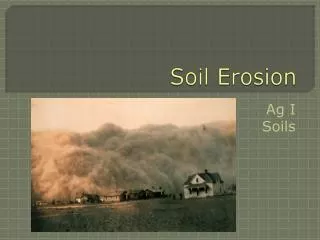
Estimating Soil Erosion From Water Using RUSLE. By: Andrea King USDA-Natural Resource Conservation Service. What is Soil Erosion?. Soil Erosion is the process of moving soil (by wind or water) from place of origin to another location. How do we estimate how much soil was eroded?.

E N D
Estimating Soil Erosion From Water Using RUSLE By: Andrea King USDA-Natural Resource Conservation Service
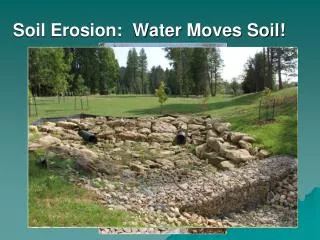
What is Soil Erosion? • Soil Erosion is the process of moving soil (by wind or water) from place of origin to another location.
How do we estimate how much soil was eroded? • Estimate Sheet and Rill Soil Erosion from Water with the Revised Universal Soil Loss Equation (RUSLE) • NRCS now uses RUSLE2 to estimate soil erosion. This is a computer generated estimator which is more specific in predicting soil loss.
RULSE • A = R x K x (LS) x C x P • A = Predicted Average Annual Soil Loss • (tons/ac/yr) • R = Rainfall Factor • K = Soil Erodibility Factor • LS = Slope Length and Steepness Factor • C = Cover and Management Factor • P = Support Practice Factor
Rainfall Factor (R) • Measure of rainfall energy and intensity rather than just rainfall amount. • R factors values in Missouri are specific by county. • Use RUSLE Rainfall-Factor Map to determine R Factor
Soil Erodibility Factor (K) • Measure of the relative resistance of a soil to detachment and transport by water. • Use Kf factor representing the fine-earth fraction of the soil. • The fine-earth fraction represents the soil subject to sheet and rill erosion. • Adjust the Kf factor using the Average Annual K Factor Table • K = RUSLE Adjusted K Value
Slope Length and Steepness Factor (LS) • Ratio of soil loss from a given field slope to that from a slope that has a length of 72.6 feet and a steepness of 9 percent. • Slope Length (L) is the point water starts to flow to the point where deposition occurs or runoff is concentrated. • Slope steepness (S) is the horizontal fall (ft) given in 100 feet. • Use Table 1: Values for LS for Rangeland, Pastureland, Long Term No-Till Cropland • Use Table 2: Values for LS for Row-Cropped Agricultural
Cover and Management Factor (C) • Ratio of soil loss from land cropped under specific conditions to corresponding loss from clean-tilled, continuous fallow. • One factor a landowner can impact the amount of soil loss. • Figure Climatic Zone for the specific county • Use corresponding C-Factor Table • Figure C factor based on rotation
Support Practice Factor (P) • Ratio of soil loss with a specific support practice to the corresponding soil loss with up and down the hill tillage. • Support practices include contouring, stripcropping, and terracing.