Download
1 / 20
200 likes | 316 Views
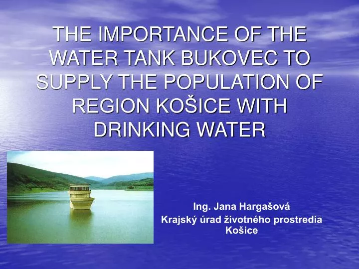
THE IMPORTANCE OF THE WATER TANK BUKOVEC TO SUPPLY THE POPULATION OF REGION KOŠICE WITH DRINKING WATER. Ing. Jana Hargašová Krajský úrad životného prostredia Košice. Characteristics of water tank (VN). district: Košice - okolie cadastral territory: Hýľov built in: 1968 - 1976

E N D
THE IMPORTANCE OF THE WATER TANK BUKOVEC TO SUPPLY THE POPULATION OF REGION KOŠICE WITH DRINKING WATER Ing. Jana Hargašová Krajský úrad životného prostredia Košice
Characteristics of water tank (VN) • district: Košice - okolie • cadastral territory: Hýľov • built in: 1968 - 1976 • location: in the watercourse Ida (tributary of Bodva), river kilometer (rkm) 37.60 • operator of the tank: Slovenský vodohospodársky podnik, š.p., OZ Košice
under § 11 of Law No. 364/2004 Coll Water Act as amended, VN Bukovec belongs to: international river basins: the Danube (redeem the Black Sea) river basin district: the Danube sub-basin: Bodva Catchment area
parameters of the dam: height: 56.00 m length: 333.00 m crown width: 6.00 m
Hydrological data • THE TANK: • max. operational level: 416.75 m a.s.l. • min. operational level: 380.00 m a.s.l. • total: 23.40 mil. m3 • flooded area: 105.00 ha • max. water depth: 48.2 m
b)CATCHMENT AREA: total distance of catchment area: 55.36 km2, of which: • distance of river-basin Ida: 47.20 km2 • distance of river-basin Myslavský potok: 8.16 km2
Aim of water work • to provide drinking water for the city Košice by compensating the varying yield of groundwater resources - karst springs - near the Turňa nad Bodvou and Drienovec • reduce the activity of flood
Composition of water work • water tank - which are in addition to its own drainage basin and transferred from the neighboring river basin Myslavský potok • stony gravel dam with associated functional objects, in which are platen taking for taking raw water to treatment plant under the dam
1 stony gravel dam 2 clay watertight core 3 two-ply filter 4 pit wasteway 5 associated functional object 6 sink 7 communication tunnel 8 grouting tunnel 9 subsoil - granite grey Dam – cross-section
Zone of sanitary protection VN Bukovec (PHO) Determination of buffer zones of water sources, which are also zones of sanitary protection results from the following legislation: § 32 of Low Nr. 364/2004 Coll Water Act as amended Decree of Slovak Ministry of environment No. 29/2005 Code, which provides details on determining the protective zones of water resources on measures to protect water and the technical adjustments in the protection zones of water resources
VN Bukovec has with this act defined I., II., and III. level of zone sanitary protection: • PHO I. level in river basin Ida • PHO II. level internal in river basin Ida • PHO II. level external in river basin Ida • PHO III. level in river basin Ida • PHO I. level of transfer water into the VN Bukovec • PHO II. level of internal transfer Myslavský potok • PHO II. level of external transfer Myslavský potok • PHO III. level of transfer Myslavský potok – doesn´t build up
There are 4 villages in the service area PHO: • Hýľov (PHO II. level internal) • Zlatá Idka (PHO III. level) • Rudník (PHO III. level) • Vyšný Klatov (PHO II. level internal)
The most important restrictions and prohibitions PHO I. level: • ban of entry without special authorization • prohibition of fertilizing with pesticides • mountain grass with manual mowing • prohibition of hunting and feeding animals • prohibition of recreation, water sports, swimming and sailing with motor vessels
The most important restrictions and prohibitions PHO II. level (internal, external): • prohibition fertilizing with pesticides • prohibition of the establishment of midden • prohibition of building parking ramps and car washing • prohibition of building landfill • prohibition of free passage through the waterways • prohibition of all recreational activities • prohibition of building fuel stations and oil storage
The most important restrictions and prohibitions PHO III. level: • prohibition of the use of chemical sanding • prohibition of building or expansion of ski slopes and terrains • prohibition of free passage through the waterways • exceptionally can be allowed storage of pesticides • prohibition of building fuel stations and oil storage
Current and prospective targets utilization water from water source • Catchment area VN Bukovec is characterized by a high degree of forest cover, which is very favourable factor on the creation, circulation and sustainment of water. • Water tank Bukovec is the most important water source from which is taking water for water supply Drienovec - Košice. This water supply is one of the largest water systems in the eastern Slovakia region. • With a capacity of VN Bukovec is also considered prospective for municipalities in the district of Košice-okolie and the city Košice.
Thank you for your attention. Ing. Jana Hargašová hargasova.jana@ke.kuzp.sk