Download
1 / 43
460 likes | 750 Views
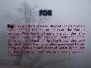
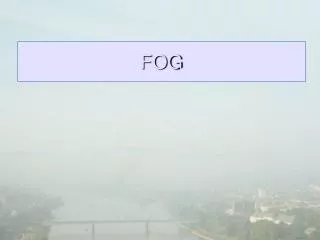
Fog Monitor User Training. http://www.nws.noaa.gov/mdl/fog_monitor/. Mike Churma Jason Taylor May 2008. Fog Monitor User Training Training Objectives. Introduction and Background Reviewing Station Observation Functionality Reviewing Fog Monitor’s presence in Guardian

E N D
Fog Monitor User Training http://www.nws.noaa.gov/mdl/fog_monitor/ Mike Churma Jason Taylor May 2008
Fog Monitor User TrainingTraining Objectives • Introduction and Background • Reviewing Station Observation Functionality • Reviewing Fog Monitor’s presence in Guardian • Explaining Satellite Algorithms • Describing Satellite Algorithm Limitations
Fog Monitor User Training Background The Fog Monitor is an AWIPS application that: • Monitors and displays station observation data, to alert forecasters of low visibility conditions. • Uses GOES satellite imagery to identify and highlight potential areas of fog. • Allows users to configure alert thresholds, algorithm settings, and the application’s monitoring area.
Fog Monitor User Training Fog Monitor Display Features in D-2D D-2D fog threat level image Interactive Table Station Plot Guardian Icon
Fog Monitor User TrainingThe Fog Monitor Zone/County Table • Displays worst-case scenarios for counties and marine zones. • Sorts data by column to reflect worst-case threat level. • Displays colors (green-yellow-red) based on user-selectable thresholds • Similar “buttonology” to SCAN and FFMP. • Clicking on a zone/county name will reveal station information for that area
Fog Monitor User Training Fog Monitor Display Features in D-2D “Configure Thresholds” button activates an interface with which to modify color threshold s in the table.
Fog Monitor User TrainingFog Monitor Station Table • Invoked by clicking on the county/zone ID in the zone table. D-2D map will zoom to the corresponding area. • Displays attributes for individual stations within the area. • Sorts data by column • Additional graphing and tabular features
Fog Monitor User Training Fog Monitor Display Features in D-2D • Visibility– in statute miles; rankable with an emphasis on lower values. • Ceiling – for METARS only – in hundreds of feet, ranked with emphasis on lower values; “CLR” and “SKC” will be presented as necessary. • Present Weather – not rankable; “NM” (not monitored) at the zone level, text info available at the station level. • Wind Direction – rankable according to user-specified azimuths (“NM” if no angle is specified.) • Wind Speed, Gust, Peak -- in knots; rankable with an emphasis on higher values. • Temperature, Dewpoint, Dewpoint Depression– in degrees Fahrenheit; rankable with an emphasis on higher values. • Relative Humidity – In percent; rankable with an emphasis on higher values. • Algorithm – Green/Yellow/Red worst-case thresholds in the zone; available at the zone level, but not at station level.
Fog Monitor User TrainingFog Monitor Display Features in D-2D 24-Hour trend graphs are available for most parameters. Color levels correspond to those in the table.
Fog Monitor User TrainingFog Monitor Display Features in D-2D Wind direction trend is represented by a hodograph
Fog Monitor User Training Fog Monitor Display Features in D-2D
Fog Monitor User Training Station Plots in Fog Monitor • METARS • Fixed Buoys • Ships and Moving Buoys • Mesonets • MAROBS Fog Monitor provides a conventional observation display, differentiated in color by station type.
Fog Monitor User Training Fog Monitor Display Features in D-2D Monitoring Area Configuration Tool (Zone Mode) • Found under the Fog Monitor selection in the Apps Launcher. • Add and remove counties/zones from the monitoring area. • Associate stations with zones/counties. • Set a time window to determine the duration of time to be monitored. • Set a distance from the nearest zone than a ship can be included. • Set the Fog Monitor algorithm status in Guardian.
Fog Monitor User Training Fog Monitor Display Features in D-2D Monitoring Area Configuration Tool (Station Mode) • Add and remove stations from the monitoring area. • Associate zones/counties to the stations. • Manually add a new station to the monitoring area
Fog Monitor User Training Fog Monitor Display Features in D-2D Monitoring Area Configuration tool -- Additional Features • Time Window • Ship Distance • Fog Monitor/Guardian toggle.
Fog Monitor User Training Fog Monitor contribution to Guardian • Fog Monitor’s fog icon in Guardian is colored according to worst-case threat level in the monitoring area. • Scrolling the cursor over the icon reveals worst case visibility conditions, present weather obscurations, and satellite algorithm worst-case conditions. • Users can control the visibility thresholds for this icon with a tool invoked from the Fog Monitor section of the Apps Launcher.
Fog Monitor User Training Fog Monitor Display Features in D-2D black= this location is not within the Monitored Area. gray= insufficient data available (usually due to clouds). green= there is probably no fog at this location. yellow= there may be fog at this location. red= there is probably fog at this location.
Fog Monitor User TrainingView Blocked by Opaque Higher Clouds Opaque high clouds can block the Fog Monitor’s view.
Nighttime Use 3.9 and 10.7 mm infra-red images to produce night time fog product. Fog areas based on night time fog product threshold Fog Monitor User TrainingAlgorithm Scenarios • Filter out high clouds using 10.7 mm IR data. • Apply a filter to eliminate small-sized areas as noise. (Optional) • Apply a filter to eliminate rough-edged detected area (Optional) Twilight No Detection • Daytime • Use the visible image to identify areas of brightness consistent with fog. • Apply smoothness filter to eliminate noise. (optional) • Apply a filter to eliminate snow/ice (optional)
Fog Monitor User Training Fog Monitor Image from Default Thresholds Settings
Fog Monitor User TrainingCustomizing Your Monitor Thresholds The Fog Monitor GUI enables offices to customize the range of: • IR brightness temperature differences - fog in fog product images. • Normalized visible brightness values - fog in visible images.
Fog Monitor User TrainingDecreasing Maximum Cloud Temperature Decreasing the Maximum Cloud Temperature Threshold will increase the potential areas considers as fog.
Fog Monitor ThresholdsIncreasing Maximum Cloud Temperature Increasing the Maximum Cloud Temperature Threshold will decrease the potential areas considered as fog.
Fog Monitor User Training Decreasing the Daytime Smoothness Threshold Decreasing the Daytime Smoothness threshold will increase the bright areas of depicted fog.
Fog Monitor User Training Increasing the Daytime Smoothness Threshold Increasing the Daytime Smoothness Threshold will help to filter out bright areas which may not be fog.
Fog Monitor User Training Adjacency Threshold The Adjacency Threshold determines a minimum pixel size for the potential fog areas.
Fog Monitor User Training Increasing Adjacency Threshold Increasing the Adjacency Threshold will increase the minimum size at which an area of fog will be flagged.
Fog Monitor User Training Increasing the Twilight Angle Threshold Increasing the Twilight Angle Threshold during twilight hours will allow Fog Monitor to apply an “unknown” determination to more areas illuminated by low angle sunlight.
Fog Monitor User Training Decreasing the Twilight Angle Threshold Decreasing the Twilight Angle Threshold during twilight hours will allow Fog Monitor to apply an “unknown” determination to less areas illuminated by low angle sunlight.
Fog Monitor User Training Default Twilight Angle Settings and Image
Fog Monitor User Training Increasing Fractional Dimension Threshold Increasing the Fractional Dimension Threshold will allow for shapes with more jagged edges.
Fog Monitor User TrainingDecreasing Fractional Dimension Threshold Decreasing the Fractional Dimension Threshold will allow Fog Monitor to consider brightness areas with relatively straight edges.
Fog Monitor User Training Algorithm & Display Limitations • Low sun conditions/Twilight • Brightness Averaging at Feature Boundaries • Brightness averaging between clouds and surface • Brightness averaging of cloud shadows • Sun Glint
Fog Monitor User Training Low Sun Conditions/Twilight Decreasing sunlight at lower angles affects Fog Monitor’s ability to properly normalize the visible satellite images.
Fog Monitor User Training Brightness Averaging at Feature Boundaries snow fog Actual Situation (with pixel boundaries superimposed) fog ground ground altostratus Satellite’s View (with pixel boundaries superimposed) Fog Threat Image (with pixel boundaries superimposed) (C) (A) (B) • Boundary between fog and dark ground. Top row of green pixels is too dark to recognize as fog. The fog area looks smaller. • Boundary between dark ground and snow. Column of red pixels is false fog. • Boundary between fog and bright higher cloud. Left column of green pixels is too bright to recognize as fog. The fog area looks smaller.
Fog Monitor User Training Brightness averaging between clouds and surface Small mid-level or translucent high-level clouds fog ground Actual Situation Satellite’s View Averaged brightness too high for fog. Averaged brightness matches fog. (A) (B) Small bright clouds or high translucent clouds makes the ground below look brighter to the satellite, causing the Fog Monitor to: (A) incorrectly identify the ground below the cloud deck as fog. (B) fail to recognize the fog below the cloud deck.
Fog Monitor User Training Brightness Averaging of Cloud Shadows lenticular fog cumulus ground snow-covered ground The red area is the ground directly under the cloud. The medium gray area is the ground obscured from the satellite’s view by the cloud. The blue area is the cloud’s shadow. Satellite’s View Satellite’s View The area outlined in red is the ground directly under the cloud. The medium gray area is the area that is obscured from the satellite’s view by cloud. The area outlined in blue is the cloud’s shadow. Fog Threat Image Fog Threat Image (A) (B)
Sun glint as it might be interpreted by the Fog Monitor Sun Glint Sun glint can cause the Fog Monitor to wrongly identify an area as having fog. Fog Monitor User TrainingLimitations-- Sun Glint
Fog Monitor User TrainingWeb Site http://www.nws.noaa.gov/mdl/fog_monitor/ • Users Guides • Technical Briefs • Troubleshooting Tips • SAFESEAS/Fog Monitor listserve information
Fog Monitor User Training Training Summary During this training the user has been: • Introduced to the Fog Monitor. • Informed about the Fog Monitor surface observation functionality. • Informed about the Fog Monitor information available in Guardian. • Informed about the Fog Monitor’s satellite algorithms. • Informed about the limitations of the Fog Monitor’s satellite algorithms.
Fog Monitor User Training http://www.nws.noaa.gov/mdl/fog_monitor/ Michael Churma Jason Taylor