Download
1 / 25
250 likes | 361 Views
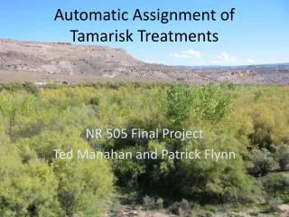
Automatic Assignment of Tamarisk Treatments. NR 505 Final Project Ted Manahan and Patrick Flynn. Tamarisk. Tamarisk or saltcedar is an invasive shrub or small tree Crowds out native willow and cottonwood Lowers water table. Image from http://www.oregonlive.com. Tamarisk Treatment Selection.

E N D
Automatic Assignment of Tamarisk Treatments NR 505 Final Project Ted Manahan and Patrick Flynn
Tamarisk • Tamarisk or saltcedar is an invasive shrub or small tree • Crowds out native willow and cottonwood • Lowers water table Image from http://www.oregonlive.com
Tamarisk Treatment Selection • We created a spacial model which assigns treatment types and generates a cost estimate for tamarisk control work for a specified geographic area. • The model selects appropriate tamarisk treatments based on accessibility, treatment type cost, and tamarisk infestation attributes such as density and size. • The estimate can inform the planning process, helping land managers understand the financial scope of a proposed tamarisk treatment project.
Base Map: Cost-Distance John Martin SWA • Cost to nearest town • Travel cost is inexpensive on roads • Travel cost is expensive off roads • Treatment area is outlined in green
GIS Analysis: Select Treatment Area • Define treatment area as a layer • Clip tamarisk data to area
GIS Analysis: Cost Layer • Off-road cost calculated using a model • Penalize cost over steep terrain
GIS Analysis: Cost Layer • Road cost layer: 66- speed limit • Convert to GRID • Merge road cost and off-road cost layers using CON statement • con(isNull([roadcost]), [slopeCost], [roadCost])
GIS Analysis: Tamarisk Attributes • Add slope and cost data to polygons • Create tables using Zonal Statistics as Table • Join tables to tamarisk polygons
GIS Analysis: Tamarisk Polygons • Export table to CSV file • Rename columns to standard values: VALUE, Pct_Cov, Area, SlopeMAX, CostMEAN
GIS Analysis: Centroid Matrix • Need to know adjacent polygons • Use Zonal Geometry as Table to get centroids • Use Hawth’s Tools, create NxN distance matrix
GIS Analysis: Treatment Costs • Previous work created two CSV files: • The file of tamarisk polygons, including slope and remoteness cost information • The file of distances between polygon centriods • Create treatment cost CSV file manually
function AssignTreatment($TamariskPolygons, $TreatmentGroups) { global $MinPctCovForAerial; global $MinAreaForAerial; global $MaxSlopeForMechanical; global $MinPctCovForMechanical; // The number of polygons and treatment groups $NumPolygons=count($TamariskPolygons); $TGCount=count($TreatmentGroups); echo "AssignTreatment: Assigning treatments for $NumPolygons polygons ". "in $TGCount groups.\n"; // Aggregate treatment groups //echo "AssignTreatment: Calling AggregateTGs from AssignTreatment\n"; $GroupAttrs=AggregateTGs ($TreatmentGroups, $TamariskPolygons); // Assign treatment to groups for ($GroupNo=0; $GroupNo<$TGCount; $GroupNo++) { //echo "\tAssigning values for treatment group $GroupNo\n"; if (($GroupAttrs[$GroupNo]["Area"]>$MinAreaForAerial) && ($GroupAttrs[$GroupNo]["Pct_Cov"]>$MinPctCovForAerial)) { $GroupAttrs[$GroupNo]["Treatment"]="Aerial"; } else { if (($GroupAttrs[$GroupNo]["SlopeMAX"]<=$MaxSlopeForMechanical) && ($GroupAttrs[$GroupNo]["Pct_Cov"]>=$MinPctCovForMechanical)) { $GroupAttrs[$GroupNo]["Treatment"]="Mechanical"; } else { $GroupAttrs[$GroupNo]["Treatment"]="Manual"; } } } // Dis-aggregate treatment groups for ($TG=0; $TG<$TGCount; $TG++) { $NumPolysInTG=count($TreatmentGroups[$TG]); for ($TGPoly=0;$TGPoly<$NumPolysInTG;$TGPoly++) { $Poly=$TreatmentGroups[$TG][$TGPoly]; $TamariskPolygons[$Poly]["Treatment"]=$GroupAttrs[$TG]["Treatment"]; } GIS Analysis: Assign Treatments • Use custom PHP program • Minimize total treatment cost scaled by accessibility • Treatment assignment uses three rules: • A polygon or group of polygons must have at least 75% cover and 250 acres to be eligible for aerial treatment • A polygon or group of polygons must have at least 50% cover an no more than 20% slope to be eligible for mechanical treatment • If neither aerial nor mechanical treatment can be used, manual treatment is prescribed
function AssignTreatment($TamariskPolygons, $TreatmentGroups) { global $MinPctCovForAerial; global $MinAreaForAerial; global $MaxSlopeForMechanical; global $MinPctCovForMechanical; // The number of polygons and treatment groups $NumPolygons=count($TamariskPolygons); $TGCount=count($TreatmentGroups); echo "AssignTreatment: Assigning treatments for $NumPolygons polygons ". "in $TGCount groups.\n"; // Aggregate treatment groups //echo "AssignTreatment: Calling AggregateTGs from AssignTreatment\n"; $GroupAttrs=AggregateTGs ($TreatmentGroups, $TamariskPolygons); // Assign treatment to groups for ($GroupNo=0; $GroupNo<$TGCount; $GroupNo++) { //echo "\tAssigning values for treatment group $GroupNo\n"; if (($GroupAttrs[$GroupNo]["Area"]>$MinAreaForAerial) && ($GroupAttrs[$GroupNo]["Pct_Cov"]>$MinPctCovForAerial)) { $GroupAttrs[$GroupNo]["Treatment"]="Aerial"; } else { if (($GroupAttrs[$GroupNo]["SlopeMAX"]<=$MaxSlopeForMechanical) && ($GroupAttrs[$GroupNo]["Pct_Cov"]>=$MinPctCovForMechanical)) { $GroupAttrs[$GroupNo]["Treatment"]="Mechanical"; } else { $GroupAttrs[$GroupNo]["Treatment"]="Manual"; } } } // Dis-aggregate treatment groups for ($TG=0; $TG<$TGCount; $TG++) { $NumPolysInTG=count($TreatmentGroups[$TG]); for ($TGPoly=0;$TGPoly<$NumPolysInTG;$TGPoly++) { $Poly=$TreatmentGroups[$TG][$TGPoly]; $TamariskPolygons[$Poly]["Treatment"]=$GroupAttrs[$TG]["Treatment"]; } GIS Analysis: Group Polygons • To meet minimum area requirement, polygons can be grouped • Group based on similar slope and coverage attributes • Groups of low-cost polygons can “steal” polygons from high-cost groups • Try multiple groupings, select lowest cost
Results: John Martin SWA • Unadjusted Treatment Cost: $11,676,764 • Adjusted Treatment Cost: $11,893,358 • Polygons have very similar accessibility • Group polygons to get enough area for aerial
Results: Lower Gunnison River Results: Lower Gunnison River
Results: Lower Gunnison River • Unadjusted Treatment Cost: $4,456,273 • Adjusted Treatment Cost: $64,002,145 • Polygons have different accessibility • Grouping does not affect treatment or cost
Conclusions • Preliminary treatment assignments are reasonable • Cost estimates may be too high; scaling by absolute accessibility may be better • Future improvements: • More treatment types: biological (bugs!), multiple mechanical treatments, goats… • Water as hard barrier