Download
1 / 19
190 likes | 330 Views
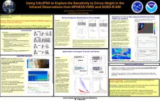
Michael Pavolonis*, Wayne Feltz*, Mike Richards*, Steve Ackerman*, and Andrew Heidinger# * CIMSS/UW-Madison # NOAA/NESDIS-Madison. Towards Operational Satellite-based Detection and Short Term Nowcasting of Volcanic Ash* *There are research applications as well. Volcanic Ash work at CIMSS.

E N D
Michael Pavolonis*, Wayne Feltz*, Mike Richards*, Steve Ackerman*, and Andrew Heidinger# * CIMSS/UW-Madison # NOAA/NESDIS-Madison Towards Operational Satellite-based Detection and Short Term Nowcasting of Volcanic Ash**There are research applications as well.
Volcanic Ash work at CIMSS • Key activities: • 1). Development of an automated ash detection algorithms that are applicable to a large variety of satellite imagers • 2). Pursuing methods to determine ash plume heights based on available spectral information • Thus far, this work has mainly utilized data from operational imagers, since they currently provide the greatest spatial and temporal resolution, which is most important for aviation applications.
Key Interactions with NOAA • The Extended Clouds from AVHRR (CLAVR-x) system offers one platform for operational implementation of the volcanic ash algorithms (A. Heidinger). • Gridded Solar Insolation Project-full disk (GSIP-fd) offers a similar potential operational platform for the GOES imagers (A. Heidinger). • CLAVR-x and GSIP-fd products include a cloud mask, cloud type, cloud top temperature, LWP, IWP, and much more. Ash products are currently being developed for the research versions of CLAVR-x and GSIP-fd. • We are currently collaborating with the Washington VAAC and Gary Ellrod on these potential options within NOAA.
Ash Detection Techniques • Several Techniques have been presented in the literature. For instance: • Reverse absorption (Prata et al., 1989; Yu and Rose, 2002) • SO2 detection using IR measurements in the 7 – 12 um range (Watson et al., 2004) • Image enhancement techniques (Ellrod et al., 2003)
Why Develop New Techniques? • Unfortunately, none of these techniques, alone, performs universally well (see Tupper et al., 2003). • Thus, there is a need to improve upon these tests and combine several techniques to produce an optimal, rigorously tested, automated ash mask for various sensors. • However, there will always be limitations (i.e. complete obstruction by meteorological cloud, very low ash content plumes, and very small-scale plumes relative to pixel size will still remain problematic).
Ash Cloud Properties 3.75/0.65 um reflectance ratio should be larger for ash than water or ice clouds. Split window “reverse absorption” feature
New Ash Detection Techniques Ash Dominated Ash that is covered by a layer of ice is uniquely detectable. Water or Ice Dominated Strength: Little water vapor dependence. Weakness: Will not work in sun glint. So far, only defined for water surfaces. Daytime only. Strength: Works well everywhere. Weakness: Only applicable to explosive eruptions. Daytime only.
Nighttime Ash Detection Techniques Atmospherically Corrected Reverse Absorption Technique Clear sky calculation Meteo. Clouds Linearly roll down from clear sky calculation to 0.0 at 270 K in tropics. Ash Clouds Meteorological and ash cloud simulations support this approach, which is similar to that shown in Yu and Rose (2002). ***Nighttime 3.75, 6.5, 11, and 12 um tests are also currently under development.
Plume Height Estimation Techniques • Shadow techniques (daytime only and under limited conditions) • Aircraft/ground observations (daytime/sparse) • 11 um brightness temperature lookup (thick plumes) • Wind correlation (gives a rough estimate) • CO2 slicing (Tony Schreiner/Mike Richards/Steve Ackerman, very promising – see next slide)
Sheveluch, Russia – August 28, 2000 – Terra/MODIS 2355Z • CO2-slicing yields heights at approximately 10-11 km, video estimate is 14 to 16 km, MODIS is 80 minutes after eruption. Credit: Mike Richards
Why Develop New Techniques? • CO2 slicing should provide the best plume height estimate but… • CO2 channels are not available on all current sensors (e.g. MTSAT, GOES-10 imager, AVHRR) and will NOT be available on the MODIS-like VIIRS on NPOESS (2008 and beyond). • There are also no CO2 channels on the AVHRR and the AVHRR will be around until at least 2014. • The VIIRS (0.75 km resolution) and the AVHRR (1-4 km resolution) provide detailed imagery that is useful for identifying volcanic plumes.
New Plume Height Retrieval(Heidinger and Pavolonis, in prep.) • Split window 1DVAR-optimal estimation technique • Cloud top temperature/emissivity are retrieved simultaneously. • Day/night independent. • Currently used in CLAVR-x and GSIP. MODIS AVHRR Results are being validated against MODIS. Goal is to achieve consistency with MODIS and VIIRS for thin cirrus – difficult from AVHRR.
Manam, PNG October 24, 2004 Black = BTD(11 um – 12 um) < 0.0 K
Manam, PNG October 24, 2004 *Image area and color scales are different. Darwin VAAC estimated lower plume to be at about 18,000 feet (~5000-6000 m).
Mount St. Helens AVHRR Example VAAC Height up to 11000 m VAAC Height up to 6000 m Retrieved heights agree well with VAAC analysis in the thickest regions of the plume.
Future Work • Continue algorithm refinement/characterization and “validation” while keeping in mind the global aspect of the problem. • Develop quality flags. • Utilize hyperspectral data to perform more detailed volcanic plume retrievals.