Download
1 / 13
130 likes | 293 Views
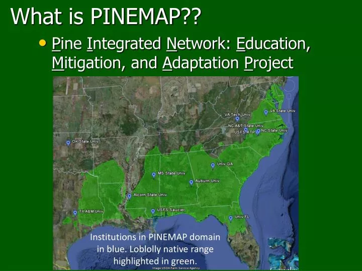
What is PINEMAP ??. P ine I ntegrated N etwork: E ducation, M itigation, and A daptation P roject. Institutions in PINEMAP domain in blue. Loblolly native range highlighted in green. Why Climate and Southern Forests?. Forest system is sensitive to climate:

E N D
What is PINEMAP?? • Pine Integrated Network: Education, Mitigation, and Adaptation Project Institutions in PINEMAP domain in blue. Loblolly native range highlighted in green.
Why Climate and Southern Forests? • Forest system is sensitive to climate: • Drought*, cold temps, damage from winter wx, flooding, extreme temp shifts, tropical storms Beetles Wildfires Image courtesy of: Dale Wade, Rx Fire Doctor, Bugwood.org Image courtesy of: Ronald F. Billings, Texas Forest Service, Bugwood.org
PINEMAP Audience: Planted Pine in the Southern US (thousands acres) (cooperatives) • Cooperatives: scientists and land managers • 10% of NIPF owners manage 70% of acres
Project Goals To create, synthesize, & disseminate knowledge that enables southern forest landowners: • to harness pine forest productivity to mitigate atmospheric CO2 • to more efficiently utilize fertilizer inputs (e.g. N) • to adapt forest mgmt approaches to increase resilience & reduce risk due to climate and other factors Also, climate literacy!
Disciplinary Aims Contribute to Broader Integrated Project Goals Mitigation Adaptation Education and Extension Aim 1 Monitoring Network Aim 2 Multi-scale Models Aim 3 Genetics Aim 4 Economics, policy, LCA Aim 5 Education Aim 6 Extension
Meet Aim 6: Extension land-grant end-users
PINEMAP DSS overview • Synthesizes PINEMAP research for forest landowners (industry, agency, Extension, etc.) • Providing management guidance for a changing climate and for year-to-year & interannual climate variability • Options for novice and advanced users • Also includes: • PINEMAP information • Tools (online models, related material, etc.) • Tips (how to use and interpret DSS information)
Heather Dinonhadinon@ncsu.edu919-513-0244pinemap.org Photographer: J Seiler jseiler@vt.edu
Questions/Comments Questions or comments about PINEMAP? Questions or comments in general about the SALCC, what we’re doing, where we’re going, etc.?
Next Web Forum • No SALCC Third Thursday Web Forum in December • Look for the Forum to start back up in January! • Landscape Conservation Cooperatives and Climate Science Centers– An Evolving Relationship, Jerry McMahon (Director, SE CSC) and RuaMoredcai(Science Coordinator, SALCC) • January 17, 2013 10:00 am EST
Contacts Ken McDermond –ken_mcdermond@fws.gov Rua Mordecai –rua@southatlanticlcc.org Janet Cakir –janet_cakir@nps.gov Amy Keister –amy_keister@fws.gov Laurie Rounds –laurie.rounds@noaa.gov Ginger Deason –ginger@southatlanticlcc.org Hilary Cole – hlcole@ncsu.edu