Download
1 / 27
290 likes | 383 Views
UTILIZING INPUT FROM EMERGENCY MANAGERS, THE MEDIA, THE PUBLIC AND LOCAL NWS METEOROLOGISTS TO BETTER COMMUNICATE SURGE AND OTHER STORM HAZARDS. Betty Hearn Morrow SocResearch Miami for Eastern Research Group and NCAR Jeffrey K. Lazo National Center for Atmospheric Research

E N D
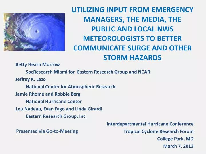
UTILIZING INPUT FROM EMERGENCY MANAGERS, THE MEDIA, THE PUBLIC AND LOCAL NWS METEOROLOGISTS TO BETTER COMMUNICATE SURGE AND OTHER STORM HAZARDS Betty Hearn Morrow SocResearch Miami for Eastern Research Group and NCAR Jeffrey K. Lazo National Center for Atmospheric Research Jamie Rhome and Robbie Berg National Hurricane Center Lou Nadeau, Evan Fago and Linda Girardi Eastern Research Group, Inc. Interdepartmental Hurricane Conference Tropical Cyclone Research Forum College Park, MD March 7, 2013 Presented via Go-to-Meeting
Background Research supported by: • HFIP Socio-Economic Working Group • NOAA Coastal Services Center Conducted through: • National Center for Atmospheric Research • Eastern Research Group, Inc. • SocResearch Miami Leadership: Jesse Feyen, National Ocean Service Jennifer Sprague, National Weather Service Richard Knabb, National Hurricane Center
OBJECTIVES • To determine the concerns and needs of key stakeholders regarding storm surge and storm surge forecast communication • To evaluate several prototype surge inundation graphics • To begin to explore ways to improve storm track forecast communication • To evaluate a prototype graphic for communicating potential damaging winds • To evaluate a prototype graphic for communicating combined wind and track forecasts • To evaluate a prototype graphic for communicating the arrival of tropical storm force winds
TASKS • Develop, test, and refine storm surge and wind prototype graphics • One-on-one webinars, interviews with key stakeholders • Discussions with groups of EMs and NWS personnel • Exhibit at 2012 AMS Weatherfest • Booth and survey at 2012 National Hurricane Conference • Develop survey questions for key stakeholders • OMB approval • Pre-test • Conduct 6 surveys (including add-ons to other surveys)
SURVEYS • Coastal EMs TC Online Survey (NCAR) • NC to TX • N = 53, 45% response rate • Coastal EMs ET TC Online Survey (NCAR) • Atlantic, Gulf, Pacific, Alaska, Hawaii • 90% vulnerable to tropical cyclones • N = 102, 52% response rate • Coastal Broadcast Mets ET TC Online Survey (NCAR) • 4 major local TV stations (ABC, CBS, Fox, NBC) in each market • Atlantic, Gulf, Pacific, Alaska, Hawaii • 82% vulnerable to TC, 90% vulnerable to ET • N = 51, 42% response rate
SURVEYS (continued) • Coastal Public ET TC Telephone Survey (NCAR) • Atlantic, Gulf, Pacific, Alaska, Hawaii • N = 900, 59% completion rate (of 1525 screened) • 38% ET, 30% TC, both 32% • Coastal Public ET TC Online Survey (ERG) • Atlantic, Gulf, Pacific, Alaska, Hawaii • N = 459, 51,000 emails, 84% cooperation rate • NWS WCM ET TC Survey (ERG) • Eastern, Southern, Western, Pacific, Alaska • N = 54, 77% response rate
CONCERNS • Public • Concerned about severe coastal storms • Most concern about wind and tornadoes • Often not aware of surge and flooding potential • EMs • Very concerned about storm surge • Most believe the public does not understands its surge risk • Media • Very concerned about wind and storm surge • Believe only about 1/3 of public understands its risk
POSITIVE SUPPORT FOR STORM SURGE WARNING • 76% EMs TC survey • 87% EMs ET-TC survey • 95% Broadcast mets • 72% Public telephone survey • 94% Public online survey • 77% NWS WCMs Most support the label “Storm Surge Warning”
REASONS FOR STORM SURGE WARNING • Serious lack of public understanding of surge • Too much focus on categories • Would increase public attention to surge • Would result in greater emphasis in EM decisions • Would lead to better communication of surge threat in weathercasts COUNTER ARGUMENTS: • Public familiar with current coastal flood warnings • Already too many warnings • Concern about NWS’s ability to provide reliable, timely information at necessary spatial and temporal scale
PREFERRED DESCRIPTIONS FOR EXPRESSING DEPTH OF WATER • 83% EMs – height of water above land • 82% Broadcast media – height of water above land • 66% Public Tel. Survey – feet above ground level • 87% Public On-Line Survey – above ground level • 86% WCMs – above ground level • Other suggestions: • Ocean water above land • Depth of water on land
ASSESSMENT OF PROTOTYPES • 1 Storm Surge Warning Area Map • 3 Storm Surge Inundation Maps • 2 Potential for Damaging Winds Maps • 3 Current Forecast Track Cone and alternatives • 1 Arrival of Storm Force Winds Map
STORM SURGE WARNING AREA • Criteria: • Ease of understanding • 92% by EMs • 96% by Media • 63% by WCMs • Effectiveness • 96% Public
STORM SURGE INUNDATION MAP
STORM SURGE INUNDATION MAP • Criteria: • Ease of understanding • 86% by EMs • 96% by Media • 77% by Public • 90% by WCMs • Usefulness • 84% by EMs • 94% by Media • 98% by Public • 83% by WCMs The majority of respondents in all surveys preferred this map May affect evacuation decisions at both extremes Problems with using “low” to describe storm surge hazard
TRACK FORECAST CONES • Criteria: • Ease of understanding • 64% by EMs • 50% by WCMs • 83% by Media • Usefulness • 84% by EMs • 50% by WCMs • 83% by Media Comments about too much information, too much jargon, confusing
TRACK FORECAST CONES • Criteria: • Ease of understanding • 65% of EMs • 72% of Media • 50% of WCMs • Usefulness • 66% of EMs • 69% of Media • 40% of WCMs Research problem: non-equivalency to current cone and other characteristics that make comparison difficult
TRACK FORECAST CONES • Evaluated on: • Ease of understanding • 70% of EMs • 76% of Media • 93% of Public • 56% of WCMs • Usefulness • 72% of EMs • 74% of Media • 87% of Public • 46% of WCMs
POTENTIAL FOR DAMAGING WINDS • Criteria: • Ease of understanding • 91% of EMs • 83% of media • 99% of public • 74% of WCMs • Usefulness • 94% of EMs • 88% of media • 99% of public • 70% of WCMs Some concern that probabilities may be too low (10%-20%)
POTENTIAL FOR DAMAGING WINDS PLUS CONE • Criteria: • Ease of understanding • 75% of EMs • 62% of Media • 95% of Public • 57% of WCMs • Usefulness • 75% of EMs • 64% of Media • 55% of WCMs
POTENTIAL FOR DAMAGING WINDS PLUS CONE – LAND ONLY • Criteria: • Ease of understanding • 75% of EMs • 64% of Media • 55% of WCMs • 89% of Public • Usefulness • 75% of EMs • 62% of Media • 90% of Public • 50% of WCMs Of the two maps, most preferred the one that showing the winds over both land and water
ARRIVAL OF TROPICAL STORM FORCE WINDS • Criteria: • Ease of understanding • 83% of EMs • 95% of Media • 83% of Public • 74% of WCMs • Usefulness • 81% of EMs • 95% of Media • 81% of Public • 70% of WCMs Most public respondents were able to interpret correctly
ADDITIONAL FINDINGS • Maps should be: • High resolution • Interactive • Allow zooming to view neighborhood • Mouse-overs with explanations • Usable on smart phones, etc.
ADDITIONAL FINDINGS (continued) • NWS websites need to be more user friendly • WFO websites are under-utilized by public • Too many NWS products and too much text • Timing of storm surge information is too late for EMs • Timing of forecast products too close to media broadcast times
SUMMARY • Strong support for Storm Surge Warning from all stakeholder groups • Positive assessment of Storm Surge Warning Area Map • Positive assessment of Storm Surge Inundation Map using multiple colors to show depth • Strong support for Potential for Damaging Winds Map • Strong support for Combined Winds and Cone (particularly from the public) • Mixed review of Forecast Track Cone (current and alternatives) • Strong support for Arrival of Tropical Storm Force Winds Map (especially from the media)
AREAS FOR FUTURE WORK • Track forecast communication (cone?) • Format and content of text products such as public advisory and Hurricane Local Statement • Coordination and streamlining of TC and ET forecast products • More user friendly web sites • Interactive communication products
Four reports are available open access on UCAR OpenSky website: http://opensky.library.ucar.edu Please send comments or questions to: betty@bmorrow.com lazo@ucar.edu Linda.Girardi@erg.com