Download
1 / 41
410 likes | 600 Views
AIRNow and AIRNow-Tech. Dianne S. Miller and Alan C. Chan Sonoma Technology, Inc. Petaluma, California Presented to the National Tribal Forum Spokane, Washington June 15, 2011. 910216-4140. Outline. Overview of AIRNow AIRNow-Tech About Features

E N D
AIRNow and AIRNow-Tech Dianne S. Miller and Alan C. Chan Sonoma Technology, Inc. Petaluma, California Presented to the National Tribal Forum Spokane, Washington June 15, 2011 910216-4140
Outline Overview of AIRNow AIRNow-Tech About Features Case study analysis: Use of AIRNow-Tech during 2008 California wildfires Related topics Air Quality Index (AQI) Getting data into AIRNow AIRNow mapping AIRNow-Tech Demonstration
Overview of AIRNow AIRNow provides a common framework for acquiring and distributing air quality information that • Fosters community effort among tribal, federal, state, and local air quality agencies (130+) • Collects, quality assures, and transfers real-time and forecasted air quality information to the public • Communicates air quality via the AQI • Issues weather/air quality news stories • Enables partnerships with national media • Provides air quality education and outreach 3
Program Coordination: 44 tribes, 130+ agencies, and 1,500+ stakeholders Monitoring: 2,000+ sites, 400 forecasts Assistance: 130+ agencies, 30+ media users, 20+ data users Education: Stakeholders Media outreach: print, TV, web outlets, social media Systems Centralization: one-stop data source for real-time/forecast data Quality control : automated and manual quality checks AQI conversion: consistency across the nation Mapping: quick and automated mapping methods Distribution: data for public, media, researchers, systems Overview of AIRNow 4
Overview of AIRNow – AIRNow vs. AQS * Data available on AIRNow-Tech back to February 2009
Overview of AIRNow – A Brief History 1997: Beginning (northeast U.S.) 1999–2002: Expanding coverage Early 2000s: First tribal partner 2003–2009: New services AIRNow-Tech (technical web site) AIRNow Gateway (distribution service) Coordination with media More pollutants 2009+: AIRNow-International New software system Coordination with other countries
Participation: 2010 Shanghai 11
Overview of AIRNow – Purpose 78 21 5 54 33 99 238 32 61 • Data Decision • Inform the public, media, and decision makers • Educate and support the voluntary AIRNow community of agencies • Provide data to other systems 13 13
Overview of AIRNow – Community • 130+ tribes and agencies • 1,500+ stakeholders and users • 2,000+ monitoring sites • 400 forecast cities 14
Overview of AIRNow – Data Flow 130+ Air Agencies 15
Example Monitoring Data Flow Data dissemination to public10:25-11:00 LST AIRNowGateway data files Automatic QA/QC10:01-10:25 LST Delivery to AIRNow10:01-10:30 LST Data collection 09:00-10:00 LST AIRNow database Data file AIRNow web services Example: Cherokee Nation delivers data 5-9 minutes past every hour
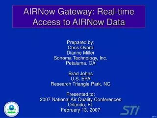
About AIRNow-Tech AIRNowTech.org • Decision Support System – management and analysis tool for the AIRNow Program • GIS functions – HYSPLIT trajectory tool, satellite, and smoke products • Data queries, personalized tools, preferences, and services • Ability to view meteorological and air quality data • Password-protected user accounts Hazard Mapping System smoke plumes with forward HYSPLIT trajectories
AIRNow-Tech Features (1 of 2) Home – Relevant news, events, and snapshot of agency status Agencies – Status of monitor data delivery by agency and parameter Sites – Monitor information, configuration, and status by site Navigator (GIS) – Monitor maps, current and historical air quality and meteorological data display, HYSPLIT trajectories, numerous supporting GIS layers (including tribal boundaries) Data – Hourly, daily, and historical monitoring data queries Forecasts – Forecast submittal, analysis tools, and configuration Polling – Summaries on data delivery times and completeness Notifier – AIRNow program email listserv EnviroFlash – Air quality forecast distribution system Resources – General information for AIRNow Program and the Data Management Center (DMC) My Account – Account management, customizable preferences, and tools
AIRNow-Tech Features (2 of 2) Query and export spreadsheets Real-time and past hourly air quality data (PM2.5, PM10, O3, and other pollutants) Data summaries (e.g., days with AQI over 100) Create time-series plots of current and past hourly or daily air quality data Access real-time and past meteorological observations Create and save GIS maps of Current or past observed AQ and meteorological conditions HYSPLIT backward and forward trajectories at different heights Hazard Mapping System smoke and fire locations and other layers AIRNow-Tech tools for current or past event analysis
Case Study Analysis with AIRNow-Tech AIRNow-Tech was a key tool during the summer wildfires of 2008 in California Data flowed into AIRNow from mobile monitors that were deployed near fire locations Emergency response personnel used AIRNow-Tech to track air quality Data queries Navigator GIS HYSPLIT Satellite-detected fire locations
AIRNow-Tech Navigator (1 of 3) = Mobile Monitors July 9, 2008, at 11 a.m. PST Hourly PM2.5 concentrations in µg/m³
AIRNow-Tech Navigator (2 of 3) Sacramento = Satellite-detected fires 24-hour backward trajectory at 300 m Backward trajectory showing where Sacramento’s air came from during the last 24 hours.
AIRNow-Tech Navigator (3 of 3) 24-hour forward trajectory at 300 m July 10, 2008, at 11 a.m. PST Hourly PM2.5 concentrations in µg/m³ Sacramento Forward trajectory showing where the smoke from the wildfires was going during the next 24 hours.
What is the Air Quality Index? (1 of 3) Air Quality Index (AQI) Provides indicator of the quality of the air and its health effects Color is key for communication Ranges from 0 to 500 101 corresponds to the level that violates the federal health standard (except for PM2.5)
What is the Air Quality Index? (2 of 3) NAAQS* *National Ambient Air Quality Standard
Pollutant Reporting – Air Quality Index Uniform for all pollutants Raw data 8-hr ozone concentration estimate of 87 ppb 1-hr ozone concentration of 102 ppb Standardization 129 AQI 24-hr PM2.5 concentration of 52 µg/m3 Health effects (general) Members of sensitive groups may experience health effects. The general public is not likely to be affected. PM2.5 Ozone Health effects (by pollutant) Active children and adults, and people with respiratory disease, such as asthma, should limit prolonged outdoor exertion. People with heart or lung disease, older adults, and children should reduce prolonged activity or exertion.
Getting Data into AIRNow Three ways to submit data to AIRNow OBS file (phasing out) XML file via Data Exchange Node AQCSV file Details on each file format are available on the AIRNow-Tech Resources page Many data logger manufacturers have modules available to automatically create one or more of these formats
OBS Format Legacy format for data ingest into AIRNow Why are we phasing it out? Difficult to program No native support for Mobile monitors Three-dimensional data Limited list of accepted parameters No sub-hourly data Applied only to North America Difficult to use in mobile applications
AQCSV Format (1 of 2) Supports AQS standards (parameter codes, POC) Any AQS parameters Speciated/lab data Mobile monitors data (changing location) Allows for Ingest of AQS data into AIRNow Backfill of AQS certified data into AIRNow when available Bulk data updates Support of international data exchange Easy encoding and parsing of data (Excel)
AQCSV Format (2 of 2) ISO Standards Country codes (840 = USA) Date and time AQS-Based Parameter codes Units codes Support for AQS qualifier codes Location information Latitude and longitude Elevation and GIS datum Method codes Measurement performance characteristics (value and uncertainty)
AIRNow Maps Map types include Forecast or observed AQI Pollutant-specific or overall AQI Local, regional, or national scale Current hour, current animation, or daily peak Map are archived on AIRNow.gov Maps are created automatically whenever new data are received Forecasts Observations
AIRNow.gov – Current Air Quality Maps AQI Animation Current Ozone Current PM2.5 Current AQI maps Archive maps Forecast maps
AIRNow.gov – Archived Maps Search archives by Map type Region Month/year
Making AIRNow Maps: Masking AQI is first interpolated based on observations at stations. But how do we deal with monitor-sparse regions?
AIRNow Maps: Masking A mask is created to block out areas without sufficient monitoring. Blue shading indicates masked areas
AIRNow Maps: Masking The resulting map shows interpolated AQI which is accurate near station observations but is not displayed in regions far from monitors.
AIRNow-Tech Demonstration Site and monitor management Performing data queries Navigator GIS Customizable preferences and tools in My Account
Request an Account www.airnowtech.org
AIRNow Scoping Study forTribal/Underserved Communities • Purpose: to better serve members of tribes and communities that are involved in air quality management • Focuses on the data collection, information management, and decision support needs of air quality managers at tribal and community air agencies • Provides information for future efforts to improve AIRNow system in ways that benefit tribes and communities • Timeline: March-October 2011
Contacts Alan Chan707-665-9900 chan.alan@epa.gov Dianne Miller 707-665-9900dianne@sonomatech.com