Download
1 / 29
290 likes | 409 Views
F-1545. Request Summary. Petitioner: R.S. Parker Homes, LLC Site: 29.47 acres located on the east side of Lasater Road, north of Peace Haven Road Request: Special use rezoning from RS40 to RS15-S. F-1545. Waterford Village (2000) 30.5 acres; 80 lots; 2.63 du/acre.

E N D
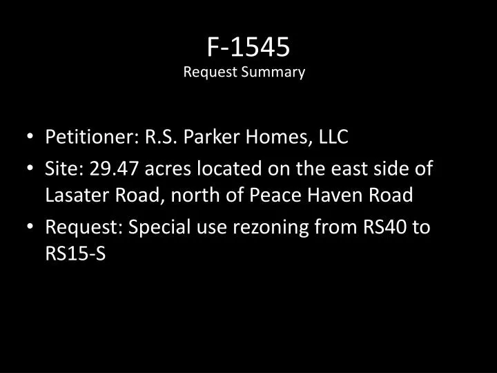
F-1545 Request Summary • Petitioner: R.S. Parker Homes, LLC • Site: 29.47 acres located on the east side of Lasater Road, north of Peace Haven Road • Request: Special use rezoning from RS40 to RS15-S
Waterford Village (2000) 30.5 acres; 80 lots; 2.63 du/acre Proposed density is 1.8 dwelling units per acre. (53 homes on 29.47 acres = 1.8 units per acre) Waterford (1986) 125 acres; 178 lots 1.4 du/acre Clemmons Community Compass recommends cluster single family residential at minimum densities of two (2) homes per acre.
Looking northwest from Lasater Road into Union Hill Baptist Church parking lot
Looking northwest from Tralee Road, site is in the background
Initial site plan, 80 lots within Planned Residential Development (PRD), 15% open space. 2.71 homes per acre. ;;;;;;;;;;;;;
Plan reviewed at public hearing by Planning Board: 53 lots under a conventional subdivision. 1.8 homes/acre. ;;;;;;;;;;;;;;;;;;;;;;;;;;;;;;;;;;;;;;;;;;;;;;;;;;;;;;;;;;;;;;;;
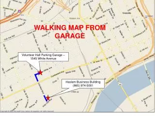
F-1545 Street Connectivity • Waterford was developed with several stub streets to connect with future residential growth. • Extension of existing street stubs is an ordinance requirement unless: -Existing pavement width is less than 18’ -Connection would exceed carrying capacity of the street -Physical barrier i.e. stream or topography
Traffic Counts, 2011 Traffic capacity at LOS/D: Lasater Rd: 13,800 Peacehaven Rd: 13,800 Traffic generation for proposed development: 507 trips/day ; If developed under RS 40 density: 307 trips/day
F-1545 Stormwater • County does not have its own stormwater standards or program—in absence of that, State requires developments in County unincorporated area to comply with stormwater standards administered by the State • State stormwater requirements address water quality, not water quantity; involve detaining and treating first 1” of stormwater (10 year storm) ; release is over a 2-5 day period. Water volume greater than 10 year storm bypasses pond and released to stream • Developer’s engineer showed preliminary plans for 2 possible stormwater ponds---one at eastern edge and one at southern edge • Developer will not be submitting to State DENR for review until after rezoning is decided • Planning staff sent site plan to State stormwater review staff for a preliminary look, but does not have enough info for them to do a full review
F-1545 Watershed • Site is in Yadkin River WS IV Watershed--state requires lot size, density, or impervious surface restrictions • Revised site plan reduces number of homes from 80 to 53, below the watershed density limits of 2 units/40,000 s.f
F-1545 Stream Erosion • Stream runs through site from north to southeast • City-County Sedimentation/Erosion Control staff walked the stream from Waterford through the site to Waterford Village • Observed stream erosion and sedimentation that had occurred related to Waterford Village stormwater release • Waterford Village was approved prior to State stormwater quality management requirement
F-1545 Analysis • Density per acre is 1.8 units/acre, lower than what is allowed in RS 20 (up to 64 lots or 2.17 units/acre), and lower than Clemmons’ plan • Sewer will not be available for permitting until later in 2015 when Harper Road pump station is completed • Generally consistent with the surrounding single family residential development pattern • Consistent with Legacy’s recommendations for the Suburban Neighborhoods GMA • Includes sidewalks along one side
F-1545 June 12 City-County Planning Board Public Hearing • Significant opposition appeared, spoke and wrote in—primarily from Waterford • Concerns expressed included traffic impact on Peacehaven; impact on streets in Waterford swimming pool area; lack of sidewalks in Waterford; stormwater impacts; size and dangers of possible stormwater detention pond and dam upstream of some Waterford homes; sedimentation/erosion on existing stream; loss of trees and buffer that the property provides to Waterford
F-1545 June 12 City-County Planning Board Public Hearing • Planning Board discussed extensively • Motion to deny---failed • Motion to approve with recommendation that condition be added that development meet Clemmons’ stormwater standards for both quality and quantity---passed
F-1545 Update since July 31 Briefing • Site plan sent by planning staff to Winston-Salem office of DENR for any preliminary comments • DENR staff said based on preliminary look at incomplete info, the eastern pond structure might be considered high hazard—would require more documentation from engineer to determine if it is, or if it is exempt. • If high hazard, any downstream properties in flood risk zone for a dam breach could purchase flood insurance, but would not be required to purchase.
F-1545 Update since July 31 Briefing • Clemmons’ stormwater quantity standards available on their website • Request made to Clemmons Manager to have staff available to explain their standards • New revised site plan proposal sent out by petitioners to neighbors last night---reduces lots from last proposal of 53 to 52, replaces earlier 2 ponds with 5 smaller facilities; stated that it is designed to be consistent with Clemmons’ standards; adds buffer along Waterford boundary
Revised Site Plan 8/6/14 * Has not been reviewed by staff 52 lots, 29.47A = 1.76 units/acre
Plan reviewed at public hearing by Planning Board: 53 lots under a conventional subdivision. 1.8 homes/acre. ;;;;;;;;;;;;;;;;;;;;;;;;;;;;;;;;;;;;;;;;;;;;;;;;;;;;;;;;;;;;;;;;
F-1545 Benefits of Street Connectivity • Enhances public safety and service delivery • More evenly disperses traffic rather than concentrating it • Increases mobility for pedestrians and bicyclists
UDO-249 Request Summary • Petitioner: Planning and Development Services staff • Request: Amend Chapter B of the UDO to allow certain permitted uses to have appropriate signage in residential zoning districts.
UDO-249 Background • Current County sign ordinance allows signage for some uses in residential zoning (i.e. Golf Course, Riding Stable, Church, etc) • Staff recently discovered that some uses that are allowed in residential zoning are not included in the list of uses allowed to have signage • Staff believes this to be an oversight
UDO-249 Analysis • UDO-249 allows the following uses to have freestanding and wall signage in residential zoning districts: • Recreation Facility, Public • School, Public or Private (definition of both in UDO) • Police or Fire Station • Library, Public • Does not alter the size or height limits currently in place • County-only amendment
UDO-249 July 10 City-County Planning Board Public Hearing • No opposition • Planning Board recommended approval