Download
1 / 129
1.29k likes | 1.44k Views
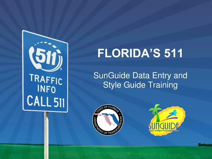
FLORIDA’S 511 SunGuide Data Entry and Style Guide Training. AGENDA. Introduction and Purpose of the Training Flow of EM location data from TMC to 511 Data Entry Style Guide: The Need for consistency How to Officially Add and Modify configuration System Maintenance Activities

E N D
AGENDA • Introduction and Purpose of the Training • Flow of EM location data from TMC to 511 • Data Entry Style Guide: The Need for consistency • How to Officially Add and Modify configuration • System Maintenance Activities • Operational Coordination Issues • Contact Information for Questions
Purpose of this Training • Every change made in SunGuide has the potential to affect 511 users, especially My Florida 511 Personalized Services users
Purpose of this Training • Review FDOT’s Data Entry Style Guide for SunGuide and FL-ATIS
Flow of EM Location Data from TMC to 511 Configuration Data within FL-ATIS Manually-entered Config Data / Voice Recordings EM Location Prompts, TvT Link Prompts, EM Extracts, Call Transfers Config Data – Sent when C2C Publisher Restarts EM Locations, TSS and TvT Links, DMS, CCTV District X Status/Command Data– Sent Periodically/Asynchronously EM Events, TSS and TvT Status DMS Messages, Floodgate Messages NOTE: Differences in these two configurations may lead to errors in IVR IVR Database IDS Database All website status and configuration data comes from IDS Database Additional IVR configuration data comes from IVR Database All IVR status and someIVR configuration data comes from IDS Database FL-ATIS Website FL-ATIS IVR
Sources of FL-ATIS Data Errors • Administration inconsistencies among Districts • Naming Roadways • Cross Streets and Mile Markers • Travel Time reporting • Missing or different densities of EM Locations • DMS and CCTV location names • Reporting inconsistencies among Districts • Incidents and congestion on roadways • Cross-district congestion reporting • Inconsistency when duplicating other districts’ EM Locations
Sources of FL-ATIS Data Errors • C2C refresh for configuration data • Ramps • Latitude, Longitude and Midpoints • CCTV camera locations • DMS locations • TSS and TvT links • EM Locations
Data Entry Style Guide • Need for consistency • Twelve different systems entering data, but public interacts with ONE 511 (One FDOT) • Web data is dynamic…it changes when SunGuide data is changed or C2C Publisher is restarted • I-95, I95 and I 95 are different roads to FL-ATIS • How it looks to end user • My Florida 511 • 511 Traffic Map page • Consequence of • Repeated EM locations • Gaps and missing locations
Negative Consequences of Adding & Inconsistency of EM Locations • When a new EM location is added to SunGuide, there are consequences for FL-ATIS and 511 • Impacts the Web site • Changes My Florida 511 roadways and locations • Confuses users about where a crash or incident is located • Creates inconsistencies that reflect poorly on FDOT • Impacts the IVR (phone) system • FL-ATIS team must record .wav files for all new locations in English and Spanish • FL-ATIS team must program and test new grammars — words 511 recognizes — in English and Spanish
Crucial Priorities in Data Consistency • Roadway Description • Roadway Description is commonly referred to as “Covered Roadways” • Affects how Highways appear in the filter drop-down menus on the Web site
Roadway Description (Style Guide Page 3) • Interstate Highways: • I-XX (where XX is the number of the highway, whether it is 1, 2 or 3 digits in length) • U.S. Roads: • US-XX (where XX is the number of the highway, whether it is 1, 2 or 3 digits in length) • State Roads: • SR-XX (where XX is the number of the highway, whether it is 1, 2 or 3 digits in length) • County Roads: • CR-XX (where XX is the number of the highway, whether it is 1, 2 or 3 digits in length) • The Turnpike: • Florida’s Turnpike
Roadway Description (Style Guide Page 3) • The roadway designator is in all capital letters • There is a hyphen (-) between the letters and the roadway number • There are no spaces between the letters and the hyphen or the hyphen and the numbers • There are no periods after the letters in the highway designation • The direction of travel should not be included when not a part of the roadway name
Roadway Description (Style Guide Page 3) • Named Roadways: • Capitalize the first letter of each word in the roadway name and designation, except where noted below • For example: Davie Boulevard (not DAVIE BOULEVARD) • There should not be abbreviations in roadway names (unless otherwise noted) • Roadway designations also should be spelled out fully: Avenue, Boulevard, Causeway, Expressway, Road, Street
Roadway Description (Style Guide Page 3) • For highway names that are abbreviations or acronyms, the name should be in all caps • For example: PGA or LPGA Boulevard (NOT Pga or Lpga) • When a direction is part of a roadway name, spell out the direction • For example:North Jones Road, Southwest Davis Boulevard
Roadway Description (Style Guide Page 3) • A District wants to add this roadway to SunGuidefor coverage on 511. How should the roadwaydescription be correctly entered into SunGuide? • SR 434 • Alafaya Trl • SR-434 • N. Alafaya Trail • Alafaya Trail North
Roadway Description (Style Guide Page 3) • A District wants to add this roadway to SunGuidefor coverage on 511. How should the roadwaydescription be correctly entered into SunGuide? • SR 434 • Alafaya Trl • SR-434 • N. Alafaya Trail • Alafaya Trail North
Roadway Description (Style Guide Page 3) SR-434 SR-434
Crucial Priorities in Data Consistency • Cities and Metro Areas • It is required that each EM Location have an associated City or Metro Area where applicable, except in rural parts of the state • For example, I-10 between Tallahassee and Jacksonville • This is important for the phone (IVR) system because it allows users to: • Search for incidents by city at the main menu • Narrow down a highway search by city • If an event is at a location without a city or metro area, selecting a city will not report that event
Crucial Priorities in Data Consistency Cities and Metro Areas Multiple cities can be entered into SunGuide for an location that is in or near multiple major cities. Multiple cities must be separated by a comma. For example: Hollywood, Pembroke Pines Leave the City and Metro Area fields blank on EM Locations with no city Anything other than a city name (for example: N/A, None) will cause errors in the IVR Exceptions to this rule should be discussed with Central Office
Cities and Metro Areas(Style Guide Page 10) • Names should be entered with an initial cap only • For example: Orlando (NOT ORLANDO or orlando) • Only use the word “City” when it is a part of the official name • For example: Dade City • City names should be spelled out completely, even though certain parts of the name may ordinarily be abbreviated • For example: Fort Myers, Saint Cloud, Port Saint Lucie
Cities and Metro Areas(Style Guide Page 10) • Which of the following is an incorrect City or Metro Area entry in SunGuide? • Cooper City • Saint Augustine • South Daytona • City of Miami • Avon Park
Cities and Metro Areas(Style Guide Page 10) • Which of the following is an incorrect City or Metro Area entry in SunGuide? • Cooper City • Saint Augustine • South Daytona • City of Miami • Avon Park
Cities and Metro Areas(Style Guide Page 10) Orlando Altamonte Springs
Crucial Priorities in Data Consistency • EM Reference Point Long Name • Included in • the Description column of an incident on the Web site • My Florida 511 Segment Start and End Points • SunGuide Response Plan Generator (RPG) to fill in the “Cross Street” variable on Dynamic Message Signs (DMSs)
Crucial Priorities in Data Consistency • EM Reference Point Long Name • Needs to • make clear to the user where an event is taking place • be configured to accommodate DMS message limitations • be consistent with MUTCD requirements, which do not allow hyphens in roadway names
EM Reference Point Long Name(Style Guide Page 13) • Include ONLY the most commonly-used name for the roadway • For example: Floridas Tpke, I 595, US 441/ OBT SB, Sawgrass Expy • Do not include: • The word “Exit” • The exit number • The name of the Covered Roadway (Roadway Description) • The city or county name • Capitalize the first letter of each word Note: Excluding dashes and using abbreviations are due to DMS limitations
EM Reference Point Long Name(Style Guide Page 13) • When a directional location is part of a roadway name, the direction can be abbreviated, but should include a space between multiple letters (S E, S W, N E, N W) • For example: N Jones Rd, S W Davis Blvd, E Branch Hwy • Use ordinal extensions for numbered streets • For example: 1st Ave (NOT 1 Ave), 22nd St (NOT 22 St), 85th Blvd (NOT 85 Blvd) • Special cases and exceptions should be discussed with Central Office
EM Reference Point Long Name(Style Guide Page 13) • Abbreviate when local residents commonly refer to the roadway by its abbreviated name (space between letters) • For example: J T B or O B T • All abbreviated cross street names should be in all caps (space between letters) • For example: P G A or L P G A Boulevard (NOT Pga or Lpga) • Abbreviations should follow the U.S. Postal Service Guidelines: Hwy, Blvd, Rd, Trl, Expy, Pkwy, Cswy, Ave, Tpke, St
EM Reference Point Long Name(Style Guide Page 13) • MM XX • XX is the number of the mile marker • no space between the two Ms • a space between MM and the number • For example: MM 5, MM 37, MM 210 • For other locations or points of interest • unique and provide enough information • abbreviations may be used • For example: Fuller Warren Brg, St Johns River Brg
EM Reference Point Long Name(Style Guide Page 13) • How should this cross street on the Palmetto Expressway be correctly entered into SunGuide? • US-27/ Okeechobee Road • US 27/ Okeechobee Rd • Exit 17 Okeechobee Rd • US 17/ SR 25 • US 27/ NW South River Dr
EM Reference Point Long Name(Style Guide Page 13) • How should this cross street on the Palmetto Expressway be correctly entered into SunGuide? • US-27/ Okeechobee Road • US 27/ Okeechobee Rd • Exit 17 Okeechobee Rd • US 17/ SR 25 • US 27/ NW South River Dr
EM Reference Point Long Name(Style Guide Page 13) US 27/ Okeechobee Rd US 27/ Okeechobee Rd
Break Time Please be back here in 20 minutes.The workshop will resume promptly.
Other Priorities in Data Consistency • TvT Link Description • TvT Link Description is used on the Web site to designate unique Travel Time Links. It appears in the Estimated Travel Times pop-up and the Estimated Travel Times tab
TvT Link Description(Style Guide Page 21) • Each name must be unique • Consistency will help make the Web site list of Estimated Travel Times easier to read • Use abbreviated roadway designations without periods (Ave, St, Blvd, etc.) • Avoid other abbreviations unless necessary to make the Description unique or clear to the user
TvT Link Description(Style Guide Page 21) • TVT Links should include the following information in this order: • Covered Roadway • Direction of travel (abbreviated: NB, SB, EB, WB) • from • Starting Point (Mile Marker XX, Exit XX or Cross Street) • to • Ending Point (Mile Marker XX, Exit XX or Cross Street)
TvT Link Description(Style Guide Page 21) • For example: I-75 NB from Broward/ Miami-Dade County Line to I-595SR-826 SB from NW 67th Ave to I-75I-95 SB from I-10 to J Turner Butler BlvdI-275 SB from Exit 45: I-4 to Exit 39: SR-60/ West Tampa Airport
TvT Link Description(Style Guide Page 21) • County lines must refer to the two counties • For example:I-95 NB from Broward/ Palm Beach County line to Mile Marker XX • When a Cross Street is a numbered street, always use ordinal extensions. • For example: 1st Avenue (NOT 1 Avenue) 22nd Street (NOT 22 Street) 3rd Avenue (NOT 3 Avenue) 85th Boulevard (NOT 85 Boulevard)
TvT Link Description(Style Guide Page 21) • SR-826 in District Six travels in two different directions because of curves or other factors. In this case, include the direction of travel that local drivers will be most likely to recognize. Another option would be to include both directions of travel. • For example: SR-826 WB/SB from NW 37th Ave to I-75
TvT Link Description(Style Guide Page 21) • Additional Note on TvT Links and FL-ATIS. There are other aspects of TvT Links that are published to FL-ATIS beyond the naming that affect FL-ATIS functionality: • TvT links that overlap can create confusion and frustration among 511 users • Overlapping TvT links should to be kept to a minimum, except where this might create gaps in reporting • Make TvT links that make sense to end users and are most useful when setting up My Florida 511 routes • End points at exits, but not necessarily every exit • Make lengths appropriate to local commuter and traveler patterns • Use common sense
TvT Link Description(Style Guide Page 21) • What is missing from this TvT Link Description? • Covered Roadway • from • Starting Point (Mile Marker XX, Exit XX or Cross Street) • To • Ending Point (Mile Marker XX, Exit XX or Cross Street)
TvT Link Description(Style Guide Page 21) • What is missing from this TvT Link Description? • Covered Roadway • Direction of travel(abbreviated: NB, SB, EB, WB) • from • Starting Point (Mile Marker XX, Exit XX or Cross Street) • To • Ending Point (Mile Marker XX, Exit XX or Cross Street)
Other Priorities in Data Consistency • EM Location Long Name • Defines what shows on the Web site in the Location column under the Incidents tab • Populates the Location field in an “event pop-up” on the Map page • Can be exits, cross streets, mile markers, rest areas, toll plazas and other points of interest • Wherever possible, the EM Location Long Name should follow roadway signage with regard to the names of roadways included • Should not include the Exit number, since this is added by FL-ATIS from another SunGuide field