Download
1 / 52
520 likes | 671 Views
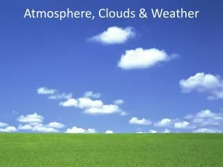
Air Pressure, Clouds and Weather. Laura Schofield, Ipswich Public Schools Tina Ciarametaro , Ipswich Public Schools University of MA, Amherst STEMS Jan. 26, 2013. Today’s Driving Questions:. 1) What are basis characteristics of the atmosphere?

E N D
Air Pressure, Clouds and Weather Laura Schofield, Ipswich Public Schools Tina Ciarametaro, Ipswich Public Schools University of MA, Amherst STEMS Jan. 26, 2013
Today’s Driving Questions: 1) What are basis characteristics of the atmosphere? 2) What is the horizontal and vertical movement of air in a “High” and “Low?” 3) How do clouds form and what can they tell us? 4) How are temperature, pressure and clouds related? 5) Applying concepts to real-time data
Today’s Schedule Highs and Lows (PowerPoint & Application) Short Break 2) Clouds (PowerPoint & Application) Short Break 3) WeatherCycler (Application) Short Break 4) Real Time Data (Application and Resources
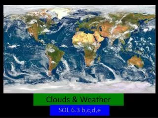
Earth’s Atmosphere • Ocean of air **3-dimensional • We live on the bottom of this “ocean” • Air moves horizontally and vertically
Air Mass Body of air that covers thousands of kilometers2 Horizontally homogenous in temperature and humidity Characteristics determined by type of surface over which the air mass resides or travels
Air Mass Tropical: “warm” Polar: “cold” and Continental: “dry” Maritime: “humid” Continentaltropical (cT) Maritimetropical (mT) Maritimepolar (mP) Continentalpolar (cP) Arctic (A)
Weather vs. Climate State of atmosphere at a specific time and place, variables include: • Temperature • Humidity • Cloudiness • Precipitation • Wind (speed & direction) • Weather, of a given location, averaged over a period of time • Includes extremes in weather behavior observed during the same time period • How the weather behaves over relatively long periods of time “Weather tells you what to wear on any given day; climate tells you what wardrobe to have.”
H = “highs” or high pressure system L= “lows” or low pressure system
Highs vs. Lows High or “H,” symbol on a weather map, the center of a high pressure system - where air pressure is relatively high compared to the *air pressure in surrounding area Low or “L” signifies the center of low pressure system - where *air pressure is relatively low compared to surrounding air *air pressure is calibrated to sea level measurements
Air Pressure Weight of a column of air above a per unit area
Highs are associated with fair weather Lows are associated with stormy weather
Horizontal Movement at surface in Highs (anticyclone) • Air near the center of Highs flows outward toward lower pressure. • Earth’s rotation makes this air spiral outward • In the northern hemisphere and as seen from above this air moves outward and clockwise
Vertical Movement in a High • Air sinks from above with Highs and replaces outward spiraling air • Sinking air in Highs warms due to compression • Clouds, if present, vaporize and skies tend to clear
Horizontal movement of air at surface in Lows (cyclone) • Air flows toward the center of a low • Earth’s rotation makes this air spiral inward • In the northern hemisphere and as seen from above this air moves inward and counter clockwise
Vertical Movement in a Low • Air spiraling into low produces an upward motion • Rising air expands and cools • Clouds form and precipitation can develop
Activity: Highs and Lows Modeling vertical and horizontal air movements using your hands.
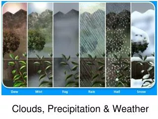
Clouds are Evidence of motion & conditions of the air in which they exist Cloud Appreciation Society
Clouds are: • Is a visible suspension of minute water droplets and/or ice crystals in the atmosphere above Earth’s surface • Fog is a cloud in contact with Earth’s surface • Clouds form as a result of condensation or deposition of water vapor in ascending air
Global Water Cycle The end circulation of a fixed amount of water among Earth’s ocean, atmosphere and terrestrial reservoirs.
Movement of between Earth’s surface and the atmosphere • Evaporation – Process of liquid water molecules absorbing heat energy and changing to water vapor • Condensation – Process of water vapor releasing heat energy to the atmosphere and changing to liquid water • Transpiration – Process by which water is taken up by roots of plants and released as water vapor through tiny leaf pores • Sublimation – Process of ice absorbing heat energy and changing directly to water vapor • Deposition - Process of water vapor releasing heat energy to atmosphere and changing directly to ice • Precipitation – when water, in liquid or solid form falls from clouds
Water Vapor in the atmosphere • All air contains water vapor, although the amount can vary greatly • Amount of water vapor air can hold has a limit which is dictated by air temperature • Warmer air can “hold” more water vapor than cold air Saturation – air can’t “hold” any more water vapor Unsaturated air can become saturated by a) More water vapor evaporating or b) Cooling the air temperature****
Most clouds are made by the cooling of air, as air moves upward • Boundary between two air masses of different densities Also called an air front • Fronts are mapped where the boundary touches Earth’s surface
Fronts Stationary front
Fronts Warm front
Fronts Cold front
Most clouds are made when air cools as it moves upward • Air Front • Moving up the slopes of a mountain or hill • Air near ground heats up causing less dense air to rise • Where surface winds converge (L) or Low
Strong vertical motions, updrafts Long, flat clouds indicate more horizontal air motion Clouds Sky watcher Chart Shapes, numbers, sizes and motion of clouds gives us clues to what the invisible air is doing.
Activity: Clouds, Air Pressure and TemperatureHow to make a cloud appear and disappear?
Current Weather Studies 1A General info about isobars: An isobar is a line passing through locations having the same air pressure By U.S. conventions, isobars are drawn at 4-mb intervals (e.g., 996 mb, 1000 mb, 1004 mb) In Europe the convention is to use 5-mb intervals
CWS 1A - Drawing Isobars • Draw an isobar so that air pressure readings greater than the isobar’s value are always on one side of the isobar and lower values are on the other side • Assume a uniform pressure change between neighboring stations. E.g. a 1012-mb isobar would be drawn between 1010 and 1013 about 2/3s the way to 1010. • Adjacent isobars tend to have similar shapes. Isobars will generally align with the curves of its neighboring isobars because the horizontal changes in air pressure from place to place are usually gradual • Draw isobar until it reaches boundary of map or “closes” to form a loop • Isobars never stop or end within a data field, they never fork, or cross one another • Isobars CANNOT be skipped if their values fall within the range of air pressures reported on the map
CWS 1B – Air Pressure & Wind Direction • Wind direction is identified by the direction from which it is coming… ”I want to know where my air is coming from…down from the arctic or from the south.” • Air moves from higher pressure area to lower pressure area
Real Time Data Resources • AMS DatastremeAtmosphere • Unanalyzed (“Pressures”) with the analyzed (“Isobars & Pressures”) surface pressure maps • Weather maps and maps showing water vapor • Blue Hill Observatoryin Milton, MA • National Weather Service www.weather.gov Supplies and other resources • Thermometers, American Meteorological Society • The WeatherCycler, The Weather School • Textbook, Weather Studies by Joseph M. Moran
It starts with the Teachers • Improve teachers’ competenceand confidence • Provide materials that are standards-based and scientifically accurate • Transformed by teachers into discipline- and age-appropriate lessons • Offer FREE graduate credits (SUNY Brockport) • Create a structure for peer-training • Training impacts felt in schools and communities • Create pathway for continued communication between trained teachers, scientists, and mentors