Download
1 / 22
220 likes | 295 Views
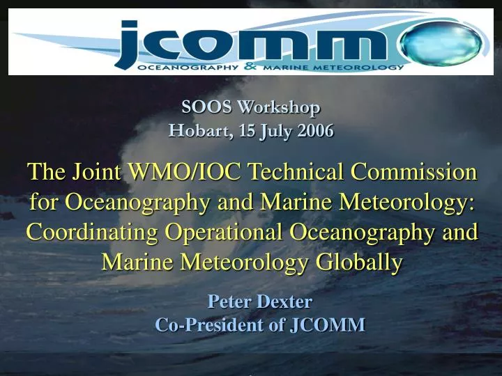
SOOS Workshop Hobart, 15 July 2006. The Joint WMO/IOC Technical Commission for Oceanography and Marine Meteorology: Coordinating Operational Oceanography and Marine Meteorology Globally. Peter Dexter Co-President of JCOMM. JCOMM Concept and Objectives.

E N D
SOOS WorkshopHobart, 15 July 2006 The Joint WMO/IOC Technical Commission for Oceanography and Marine Meteorology: Coordinating Operational Oceanography and Marine Meteorology Globally Peter Dexter Co-President of JCOMM
JCOMM Concept and Objectives NWP, maritime services, climate studies, ocean modeling and forecasting, ocean research, all require integrated metocean data and information streams • To address these requirements and realize potential benefits, JCOMM jointly sponsored by WMO and IOC • Combines and benefits from the strengths and expertise of the met. and ocean communities, avoids duplication of effort • User oriented, functions at global, regional and national levels • Integrated marine observing, data management and services system; extensive outreach programme • An implementation mechanism for global GOOS and marine component of WMO GOS
Status, National Input and Support • JCOMM is a coordination mechanism only, working at the intergovernmental level • Established formally in 1999 through the merger of several existing, long-standing bodies of WMO and IOC • Implementation of JCOMM programmes by national agencies and institutions • National representation in the work of JCOMM • Single national focal point and coordinator for JCOMM • High level, to coordinate met and ocean communities and ensure priority and budget for JCOMM activities • National members of the Commission • Technical experts to support JCOMM work nationally • Both met and ocean experts • National representation on expert teams and panels • Technical experts in specific fields covered by JCOMM
Ship observations ASAP Sea level Drifting buoy Argo Moorings Integrated Ocean Observing System
Observing networks statusagainst agreed GCOS goals for global coverage 56% February 2006 Total in situ networks 57% 99% 40% 82% 79% 43% 72% 21% 48%
Multi-year Phased Implementation Plan (representative milestones) 2001 2002 2000 2003 2004 2005 2006 2007 2008 2009 2010 Real-time Stations Initial GCOS Subset 170 155 140 125 Tide Gauges 113 101 89 89 91 51 56 1250 1250 1250 1250 1250 1250 779 787 807 671 Number of buoys 975 Surface Drifting Buoys 119 97 104 115 Number of moorings 84 87 Tropical Moored Buoys 77 77 79 79 79 High resolution and frequently repeated lines occupied 51 51 51 45 34 28 Ships of Opportunity 27 26 26 24 23 3000 3000 3000 3000 3000 Number of floats 544 20 31 2300 Argo Floats 1572 923 Number of observatories, flux, and ocean transport stations 89 49 42 78 41 60 37 15 35 Reference Stations 29 54 Ice buoys, drifting and Moored stations 85 31 78 64 29 29 30 30 Arctic System 54 37 34 31 Repeat Sections Committed, One inventory per 10 years 31 31 29 1 Ocean Carbon Network 0 0 27 27 24 24 830 830 730 340 Days at sea (NOAA contribution) Dedicated Ship Time 640 531 370 370 497 497 497 9 Product evaluation and feedback loops implemented (NOAA contribution) 9 9 9 3 8 2 System Evaluation 7 0 1 1 Initial Ocean Observing System Milestones including international contributions 100 88 77 System % Complete 45 40 34 30 66 Total System 55 53 48 2001 2002 2000 2003 2004 2005 2006 2007 2008 2009 2010
Ocean Observing System Coordination • JCOMM directly coordinates major components of the in situ ocean observing system • Ocean data buoys through DBCP and Action Groups, including IPAB, GDP, TIP and OceanSITES • Ship-based observations through SOT: VOS (including VOSClim), SOOP/XBT, ASAP • Sea level observations through GLOSS • Current experimental systems and pilot projects will eventually need to be incorporated under an intergovernmental umbrella • Argo, gliders, tsunameters, etc • Coordination with the satellite operators on data requirements • Coordination with regional elements and programmes • E-SURFMAR, E-ASAP, Ferrybox, GMES • Future coordination with GOOS Regional Alliances • Long-term maintenance of the complete system a key issue • Basic infrastructure required for operational ocean products and services • Key role of JCOMMOPS
System-wide monitoring and performance reporting • Standardized base maps across all networks • Show what is required for global coverage against what is presently in place • Illustrate gaps in coverage so the gaps can be filled efficiently • Show contributions by countries • Provide a single access point through JCOMMOPS
JCOMM Evaluation Metrics Observing System Status: 2005, Q2. Sea Surface Temperature Goal: 100% Global Coverage Drifting Buoys Moored Buoys Ships Total
Systems Approach to Standard Mapping and Reporting 2003 2005 JCOMM Reporting
Data stored here, there, and everywhere Data Management
JCOMM/IODE Joint Secretariat CBS JCOMM IODE ET Data Migration DMPA XML TT WIS OIT ETMC GEBCDEP GOSUD GTSPP ETDMP GE/TADE DM Integration
DM Activities • Marine climatology, climate change monitoring, climate indices • Closer integration with IODE and implementation of pilot projects • E2EDM prototype • Metadata • Data assembly, QC/QA • Participation in broader WMO/IOC DM work • WMO Information Systems development • IOC DM strategy
Maritime Safety Pollution Response Oceanographic Sea Ice information Waves and Surges Services
Services Activities • Expert Team on Maritime Safety Services • Review and tuning of the marine broadcast system for MSS • Establishment of a web site for global real-time MSS • Expert Team on Sea Ice • Management of the Global Digital Sea Ice Data Bank • Sea ice data exchange, formats and nomenclature, products and services • Support for IPY • Expert Team on Waves and Surges • Guide to Storm Surge Forecasting • Wave model verification • Expert Team on Marine Accident Emergency Support • MPERSS operational • Future Ocean Products and Services • OceanOPS 04 and GODAE Symposium • TT/OPD to address JCOMM recommendations on ocean products and services development
JCOMM Priorities 06-09 • Operational ocean products and services • Recommendations from JCOMM 2 • TT/OPD with GODAE • DPM and marine multi-hazard warning services • Full implementation of operational ocean observing system • Long-term maintenance of pilots • Key ocean satellite missions • Follow-up to IPY • Support for coastal GOOS implementation • DM pilot projects and integration with IODE and WIS • Focused CB to support implementation • Regional development projects • Hands on workshops, applications • Involvement of smaller maritime countries • Engagement with the private sector
Operational Ocean Products and Services • Operational ocean products and services • TT/OPD with GODAE to address the JCOMM 2 recommendations and transition research to an operational environment • Many NMS already involved, usually in collaboration with national ocean agencies • Operational data assimilation to generate analysis and forecast products of value to a wide user community
JCOMM, the Southern Ocean and the IPY • Existing JCOMM involvement in S. Ocean • Primarily operational, physical ocean and marine meteorology • DBCP: S. Ocean barometer drifter network; IPAB; JCOMMOPS support • SOT: SOOP, VOS, WRAP • Maritime safety services; sea ice services • The IPY and its legacy • Potential support for observation campaigns – communications, logistics, JCOMMOPS • Willing to work with IPY projects to develop plans for long-term maintenance of obs. system components of proven value to operational oceanography and climate monitoring/prediction • Eventual intergovernmental umbrella for operational ocean observing system and services for S. Ocean • Stress implementation by national agencies; JCOMM provides coordination, standardization, facilitation, reporting, advocacy
JCOMM and SOOS • Areas of potential support and cooperation between JCOMM and a future SOOS include: • Communications for data collection and location – Argos, Iridium, etc • Logistics for platform and instrument deployment and maintenance • Data exchange, especially real time (protocols, codes, formats, etc) – some capabilities already exist for non-physical data, and can be readily expanded • Data management, through JCOMM/IODE – again, there is some existing capability for non-physical data, which can be built on • JCOMMOPS for system and data flow monitoring, metadata, technical support • Possible intergovernmental level support