Download
1 / 12
120 likes | 252 Views
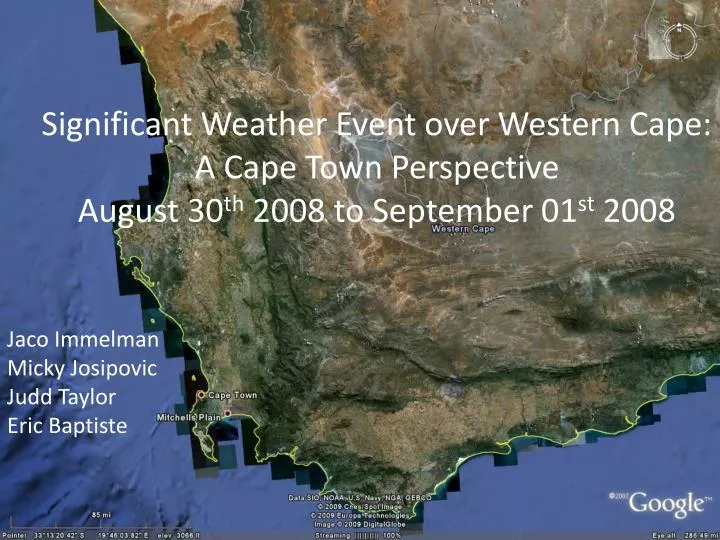
Significant Weather Event over Western Cape: A Cape Town Perspective August 30 th 2008 to September 01 st 2008. Jaco Immelman Micky Josipovic Judd Taylor Eric Baptiste. Overview.

E N D
Significant Weather Event over Western Cape:A Cape Town PerspectiveAugust 30th 2008 to September 01st 2008 JacoImmelman MickyJosipovic Judd Taylor Eric Baptiste
Overview The Western Cape endured strong wind, rain and snow on the mountains, while the wind fanned veld fires in the eastern Free State, KwaZulu-Natal and Gauteng. http://www.news24.com/News24/South_Africa/News/0,,2-7-1442_2385998,00.html
http://2.bp.blogspot.com/ http://www.capetowndailyphoto.com/ Flooding in Kalk Bay http://2.bp.blogspot.com/_
Preconditions – 30/08/2008: 0600Z SEVERI 11 micron 2008/08/30 0600Z DBCRAS 2008/08/30 0600Z Model Output
Storm Conditions 30/08/2008: 1800Z SEVERI Data 1800Z August 30th 2008 Measured rainfall at FACT
Storm Conditions DBCRAS model output Time Series DBCRAS model output of total precipitation 2008-08-30 1800Z DBCRAS model output of surface wind 2008-08-30 1800Z
Storm Aftermath http://www/skyscrappercity.com
Storm Aftermath NN Normalized Difference Snow Index September 1st 2008 1205 UTC
Storm Aftermath http://www/skyscrappercity.com http://www/skyscrappercity.com
Summary DBCRASmodel was very good in predicting the synoptic features, especially the location and amount of precipitation of this event. MODIS Direct Broadcast data is very instrumental in the monitoring and aftermath of this event. MODISNDSIwas able to easily identify snow on the Langeberg Mountain range outside of Cape Town.