Download
1 / 34
350 likes | 605 Views
Northern Alabama Piedmont. Cheaha State Park. Location. Top of Alabama – Cheaha Mountain. Highest Point in Alabama Elevation: 2,413 ft. Bunker Tower on top of the Mountain. There is a USGS Marker in front which notates Highest point. Animals to watch out for…. Geology. Geology.

E N D
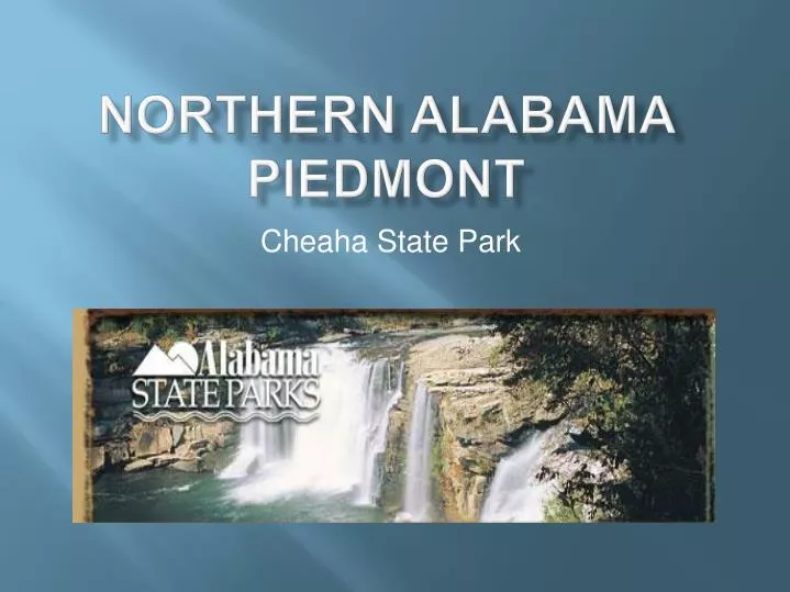
Northern Alabama Piedmont Cheaha State Park
Top of Alabama – Cheaha Mountain Highest Point in Alabama Elevation: 2,413 ft Bunker Tower on top of the Mountain. There is a USGS Marker in front which notates Highest point.
Geology Location Map of The Piedmont Upland. The broken back line separates the northern from the southern piedmont upland districts. The boundary between the Piedmont and the Valley and Ridge in Chilton and Shelby counties on the map does not match the geologic boundary between sedimentary and metamorphic rocks. The blue line shows the line of the topographic profile (Figure PD1).
How it all Happened • Stage 1: Compressional Deformation in foreland • Stage 2: Low angle thrust sheets • Stage 3: Redeformation of stage 2 nappe pile by large scale upright folds • Stage 4: Renewed low angle thrusting within Piedmont rocks • Stage 5: Large scale cross folding at high angle to previous thrust phases
Folding and Faulting in the Northern Piedmont • Harpersville Generation Folds • Pell City Fault • Sleeping Giants-Choccolocco Mountain- Indian Mountain Thrust Complex • Talladega Cartersville Fault • Columbiana-Jemison Generation Folds • Hollins Line Fault • Millerville-Childersburg Generation Folds • Goodwater-Enitachopco and Eden Faults
Harpersville Generation Folds • Folds that occur in the Pell City thrust sheet • Bound by the Pell City Fault and the Talladega-Cartersville Fault • Large-scale, upright, tight isoclinal folds • Outlined by Ordovician shales and carbonates • Thought to be any age post-middle Ordovician
Pell City Fault • Rocks of Pell City thrust sheet have undergone minimal horizontal slip. This means that structures predating the fault are found on both sides • Footwall is generally a narrow, highly imbricate thrust faulted zone between Pell City and the Eden Faults (referred to as the Coosa deformed belt) • Imbricate thrusts in Coosa deformed belt cut Upper Mississippian rocks are in turn cut by Pell City Fault
Sleeping Giants- Choccolocco Mountain- Indian Mountain Thrust Complex • Thrust slices along the southeastern margin of Pell City thrust sheet • Contain Lower Cambrian rocks • Variously interpretted as klippen above Talladega-Cartersville Fault Choccolocco Mountain Bains Gap Waterfall
Talladega-Cartersville Fault • Forms boundary between foreland fold and thrust belt and the Talladega slate belt • Has large displacement and one of most significant thrust faults in southern Appalachians • Dischordant to stratigraphy in upper and lower plates, and to individual thrust plates and structures below it
Columbiana-Jemison Generation Folds • Large scale folds in Chilton, Shelby, and Talladega counties • Orientation is variable because previously deformed and non-parallel surfaces are involved and there is later refolding • Doubly plunge to NE and SW • There are three major structures: the Columbian synform, the Jemison synform, and the Kelley mountain antiform
Hollins Line Fault • Forms boundary between Talladega slate belt and rocks of overlying Ashland Supergroup in Coosa and Chilton Counties • It is the roof thrust of a major thrust duplex system that involves large-scale imbrication of the upper part of the Talladega slate belt • Structure was tilted southeast by subsequent deformational events leading to the oblique view of the duplex and the braided pattern of footwall horses
Millerville-Chidersburg Generation Folds • Major subregional recess that results from and antiform-synform pair • Holds the Hillins Line Fault and rock units and structures within both the hanging wall and footwall, including the Talladega-Cartersville Fault, the Pell City Fault, and the faults at the base of the Sleeping Giant- Choccolocco Mountain- Indian Mountain thrust complex • Forms a broad synform in the Talladega slate belt
Goodwater-Enitachopco And Eden Faults • Cuts through Millerville-Childersburg Folds and earlier structures like Hollins Line Fault • Youngest major structures present • Steep reverse faults • Greater regional dip than the major thrusts that occur between them.
Results of Folding and Faulting The intensity of metamorphism increases southeast from the Talladega belt to the Southern Piedmont. P/T determinations on some rocks indicate temperatures as high as 1,400OF and depth of burial during metamorphism of 15 miles. The main metamorphic event took place about 360-380 Ma (millions of years before present), which means that as much as 15 miles of material has been eroded since that time to expose these rocks on the surface. The rocks in each belt are folded and suffered several episodes of folding. Small and early folds tend to be isoclinal, while the later and larger folds are more open. Early isoclinal fold, Dadeville Complex, Tallapoosa County Later syncline in quartzite, Pine Mountain Group, Lee County
Geologic Belts Geologic belts in the Piedmont (from Guthrie and others 1994: Alabama Geological Survey): 1. Solid red line: belt-bounding faults 2. Broken red line: faults within a belt 3. Thin red line: belt contact of unknown type 4. Green line: coastal plain boundary. The Piedmont consists six northeasterly-southwesterly trending belts of metamorphic rocks. With the exception of the boundary between the Opelika and Dadeville belts, each belt is bordered by a fault. Most faults are interpreted as thrust faults, though movement along the Towaliga, Brevard, Bartlett's Ferry and Goat Rock faults appears tohave been long and complex. The thrust faults moved blocks of rocks northwestward.
Geology The Northern Piedmont consists of the Talladega and Ashland-Wedowee belts. The Talladega belt contains slate, phyllite, marble, quartzite and greenstone. The Ashland-Wedowee belt contains phyllite, schist, gneiss and amphibolite. The Inner and Southern Piedmont contain the remaining 4 belts (Dadeville, Opelika, Pine Mountain, Uchee). These belts contain amphibolite, schist and gneiss. The Pine Mountain belt also contains quartzite and marble, as well as the oldest radiometrically-dated rock in Alabama. It is a gneiss that crops out in Chewacla State Park near Auburn and dates at 1,050 million years.
Talladega Belt • Kahatchee Mountain Group • Sylacauga Marble Group • Talladega Group • Hillabee Greenstone Sylacauga Marble
Kahatchee Mountain Group • Outcrop width varies from 6-30 km • Dischordant with lower units • Dominantly pelitic slate and phyllite and metasandstone (also includes a minor carbonate unit known as the Sawyer Limestone) • Lots of debate on the stratigraphic equivalence of other rocks in places like Georgia
Sylacauga Marble Group • Variable series of dolomite and calcite marbles • Locally cherty and interlayered with phyllites • Upper contact appears to be slightly dischordant • 1700 m thick
Talladega Group • Defined as the phyllites and metasandstones exposed along Talladega Creek in Clay and Talladega Counties • Lay Dam Formation: sequence of slates and metasandstones, large percentage is also unsorted and unbeddeddiamictite, 4.5 km thick • Butting Ram Quartzite: thickbedded, course grained arkosicmetasandstone intercalated with slates and layers of diamictite, variable thickness (max 850 m) • Jemison Chert: massive, thickbedded, fine-grained greyish-white metachert, contains marine invertebrate fossils
Hillabee Greenstone • More than 80% of exposed area is composed of mafic rocks that can be subdivided into Greenstones and mafic phyllites (greenschists) • Greenstones generally massive, fine-grained, pale green to light olive-brown and weather to dark red or brownish yellow color • Mafic phyllites are well foliated slaty rocks and commonly display laminar layering. Consist of albite, actinolite, epidote, zoisite, clinozoisite, and chlorite, although dynamothermal metamorphism has made primary mineral phases rare
Ashland-Wedowee Belt • Higgins Ferry Group: Gneiss, schist • Poe Bridge Mountain Group: Schist, gneiss • Hatchet Creek Group: Gneiss, schist, quartzite • Mad Indian Group: Gneiss, schist • Wedowee Group: Phyllite, gneiss, schist, quartzite (no slide later) • Emuckfaw Group: Schist, quartzite
Higgins Ferry Group • Interbedded clastic and pelitic units with occasional amphibolite, all of which are metamorphically retrograded and differentially folded • Accessory minerals include kyanite, sillimanite, rutile, and magnetite • Especially well exposed in western Coosa and eastern Chilton counties
Poe Bridge Mountain Formation • Almost identiacal in composition to the Higgins Ferry group, but classified differently because the two areas are disconnected by major transverse faults and individual units can’t be traced from one area to another • Width ranges from 1-13 km • Unit weathers easily because of high feldspar content
Hatchet Creek Group • Two distinct units: Hanover Schist and Pinchoulee Gneiss • Hanover Schist: consists of staurolite-albite-biotite-sericite quartz muscovite schist and staurolite biotite feldspathic gneiss • Pinchoulee Gneiss: consists of feldspathic and migmatitic biotite gneiss • Rocks of Hatchet Creek group are in the upper amphibolite facies of regional metamorphism • Pegmatites are common
Mad Indian Group • Composed of interbedded and infolded schist, gneiss, and amphibolite with scattered granitic intrusions • Interpretted as complexly folded series of metasedimentary rocks that have undergone extensive recrystallization • Metamorphic grade is in the sillimanite or kyanitesubfacies of the almandine-amphibolite facies (but lower metamorphic facies are scattered throughout outcrop area and are typically associated related to late structural features)
Emuckfaw Formation • Interlayered sequence of schist and gneiss • Schist is generally medium grained and composed of muscovite, feldspar, and quartz. Mineral composition is suggestive of a subgraywacke • Contains a fair amount of garnets, from 1mm-1 cm depending on area of formation • Commonly exhibits tight crenulation folds • Weathers to a white, sandy, muscovite rich soil