Download
1 / 18
180 likes | 318 Views
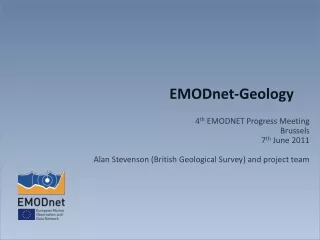
From Emodnet Chemical Pilot to Emodnet Chemistry 2 Matteo Vinci, Istituto Nazionale di Oceanografia e di Geofisica Sperimentale – OGS – NODC group, Dipartimento OCE. NORTH SEA. BLACK SEA. MEDITERRANEAN SEA. The Pilot Project: where. Regional Leaders: North Sea – NERI Black Sea– MHI

E N D
From Emodnet Chemical Pilot to Emodnet Chemistry 2 Matteo Vinci, Istituto Nazionale di Oceanografia e di Geofisica Sperimentale – OGS – NODC group, Dipartimento OCE
NORTH SEA BLACK SEA MEDITERRANEAN SEA The Pilot Project:where Regional Leaders: North Sea – NERI Black Sea– MHI Med Sea – HCMR
The Pilot Project:what -Choice based on MSFD requirements; -Selected from 8 groups of compounds; -3 matrices: water, biota, sediment; -17 selected parameters for product generation.
The Pilot Project:How Based on SDN infrastructure: • An efficient distributed Marine Data Management Infrastructure for large and diverse sets of data deriving from in situ and remote observation of the seas and oceans. Principle of “ADOPTED AND ADAPTED” SDN Standards for metadata ,data and products : • CDI for metadata (xml ISO 19115), • Standard Vocabs (P021,P011,P061...) for common terms. • ODV format for background data exchange , Infrastructure: • CDI mechanism to access data with data policy management, • SDN Security Services for users registrations, • SDN Products viewing services for discovery, visualization and downloading of products.
The Pilot Project:How ADOPTED Softwares: • MIKADO → metadata mapping and xml generator • NEMO → data formatting tool • DIVA software → to produce gridded data products and error maps as NetCDF files, • ODV software → for “time series” products generation and QC check
The Pilot Project:How ADAPTED • Extension of SDN Common Vocabularies: • P021 for CDI generation • P061 for units • P011 for ODV generation • Chemical CDI directory – continuously updated • Ocean Browser Products Viewing Service • ODV/DIVA softwares upgrade to produce maps, plots and related metadata DivadoXML • Sextant Products Discovery Service – under finalization
The Pilot Project • Partners: 25 partners; • Contract had a duration of 3 years from June 2009 to June 2012; Work Packages: • WP1 - Project Coordination • WP2 – Data collection and metadata compilation • WP3 – QC/QA and data products • WP4 – Technical development and operation • WP5 – Analysis and Evaluation
The Pilot Project NORTH SEA BLACK SEA MEDITERRANEAN SEA WP2 Data collection and metadata compilation : All partners collected and updated : • Data → ODV file → managed by Reg. Leaders at level of the 3 Regional data pools → (de-centralized) • Metadata → CDI entries → Maris (centralized) All partners gave access to: • metadata (unrestricted) • and data according to the data policy as agreed with the data ORIGINATOR
The Pilot Project:challenge to face along the path from DATA to PRODUCTS Data complexity: • from 8 groups of compounds; • 3 matrices (sediment, water column and biota); • 17 selected parameters for products generation; Heterogeneity: • Of the sampling/data distribution (coastal points time series Vs homogenous sampling at basins level); • Of measurement methods (instrument, method, target species, target basis, grain sizes).
The Pilot Project WP3 QC/QA and data products: From available data main substets highlighted: Homogeneous ditribution In time and space (basins) Not homogeneous ditribution In time and space (basins) Expert workshop, summary of decisions for Products generation: -Standard Diva Interpolated maps produced for parameters with homogeneous and suitable data coverage, measured on basin scale; -“Time series plots”. Showing station maps linked to plots of measured time series. This for not homogeneous data as: • coastal points repeated in time, • datasets with fragmented coverage.
The Pilot Project: WP4 Services: • Portal + wiki; • Common Vocabs; • CDI interface + Matrix Variables VS Regions; • Ocean Browser ; • Product Catalogue: Camioon → Sextant; • Tools: Diva, ODV, Nemo, Mikado...
The Pilot Project WP5 Analysis and Evaluation:
Open issues from the Pilot • QC for exotic parameters (eg:contaminants...) nospikes to detect but events, at the moment not enough data to calculate regional ranges, help from Marine Conventions; • Finalization of Sextant and tuning with DivadoXML to load Maps metadata /Time series plots metadata loading; • Improvements of web interfaces searchcriteria as highlighted by SDN2 userpanel and Chemistry Lot users (paramenters and geographic search); • Handling of Chemical Parameters metadata and Common Vocabs (P01 vocab use case); • Set up a group of experts for the data-products periodic validationfor each regions.
The New Phase The portal should cover all European waters Note: This map is derived from the EU Tender document but lacks the Norwegian sea
The New Phase • The parameters: The table: • The right hand column of the table above indicates the minimum number of chemical species to be assembled; • All available measurements of chemicals in the groups on the left hand column of the table should be assembled; • For pesticides, biocides, antifoulants, pharmaceuticals, heavy metals and hydrocarbons the focus should be on those elements addressed at priority substances in the relevant EU legislation and proposed legislation. * * Parameters for the new call
The New Phase • Enlarged partnership: 32 partners + 14 sub-contractors = total of 46 participants (about twice!); • New parameters; • The portal should cover all European waters; • New products: new tools to be developed for coastal visualization + proposal for assessment !!! • Specific focus on Coastal Data.
The New Phase, evaluation from EU: Strengths of the proposal: - Large partnership with a small steering committee; - Great effort to raw data access; - Identified high number of datasets; - Portal is based on the previous one, quickly operation system; Weaknesses of the proposal: -sevaral comments on how to deal with the userfriendliness of the portal and linked services; -need a verification of DG-ENV and... about compliance with INSPIRE, OGC, WMS, WFS...