Download
1 / 13
130 likes | 132 Views
This project aims to update existing Burn Probability (BP) and Fire Intensity Level (FIL) grids by incorporating crop fuel loading estimates. By creating fuel models for different crop types, we can estimate BP and FIL values in areas misclassified by LANDFIRE. The resulting grids will provide more accurate data for DOI lands.

E N D
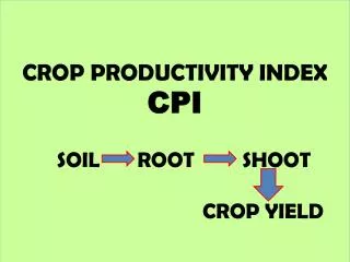
Supplementing Existing BP & FIL Data with Crop BP &FIL • Background • Current BP & FIL grids not showing BP & FIL values in areas designated NB3 by LANDFIRE • National Agricultural Statistics Service (NASS) produces cropland data layer (CDL) for all CONUS http://nassgeodata.gmu.edu/CropScape • Michigan Tech Research institute developed fuel loading by crop type as an input to their studies on wildfire emissions http://wfeis.mtri.org
Supplementing Existing BP & FIL Data with Crop BP &FIL • Background • We can use these crop fuel loading estimates to estimate a fuel model for each crop type based on fine fuel loading estimate • The resulting fuel model can then be used to estimate BP and FIL • Final result is updated BP/FIL grids that incorporate agricultural lands that have been incorrectly classified NB3 by LANDFIRE
Supplementing Existing BP & FIL Data with Crop BP &FIL for DOI Lands • Methods: Create Fuel Model Map of NB3 Areas • Extract areas classified as NB3 in LANDFIRE FBFM40 fuel model layer
Supplementing Existing BP & FIL Data with Crop BP &FIL for DOI Lands • Methods: Create Fuel Model Map of NB3 Areas • Determine Crop type in areas designated NB3
Supplementing Existing BP & FIL Data with Crop BP &FIL for DOI Lands • Methods: Create Fuel Model Map of NB3 Areas • Assign Fuel Model to Crop Type based on fine fuel loading figures described in CDL research (representative fuel models based on Scott & Burgan FBFM 40 fine fuel loading)
Supplementing Existing BP & FIL Data with Crop BP &FIL for DOI Lands • Methods: Create Fuel Model Map of NB3 Areas • Fuel Models applied to NB3 Areas based on fine fuel loading and substituted in for NB3 pixels
Supplementing Existing BP & FIL Data with Crop BP &FIL for DOI Lands • Methods: Remove NB3 Areas From Burn Probability (BP) and Fire Intensity Level (FIL) Grids
Supplementing Existing BP & FIL Data with Crop BP &FIL for DOI Lands • Methods: Extrapolate Burn Probability and Fire Intensity values based on smallest geographically significant area • Agriculture occurs in areas where the fuel model classification is not geographically similar in non-agricultural areas • Example: GR7 Fuel model assigned to Wheat Crop Type which has wide distribution across the US.
Supplementing Existing BP & FIL Data with Crop BP &FIL for DOI Lands Example: GR7 Fuel model assigned to Wheat Crop Type which has wide geographic distribution across the US.
Supplementing Existing BP & FIL Data with Crop BP &FIL for DOI Lands Example: GR7 Fuel model distribution in LANDFIRE FBFM40 layer. The distribution is limited to NE MT, ND, SD, NE, MN
Supplementing Existing BP & FIL Data with Crop BP &FIL for DOI Lands • Methods: Extrapolate Burn Probability and Fire Intensity values based on smallest geographically significant area • In GR2 & GR3 fuel model datasets the geographic distribution of the fuel model pixels was wide enough to use matching or geographically similar Fire Planning Units (FPU) as a geographic unit to summarize mean BP & FIL values • In GR4, GR5, GR7 fuel model datasets the geographic distribution of the fuel model pixels was not wide enough to use FPU as a summary unit, so the mean national BP&FIL values for each fuel model was used.
Supplementing Existing BP & FIL Data with Crop BP &FIL for DOI Lands • Methods: Assign representative BP & FIL values to cropland designated NB3 based on existing FBFM BP &FIL values
Supplementing Existing BP & FIL Data with Crop BP &FIL for DOI Lands • Methods: Add BP& FIL created for Agricultural areas to existing BP & FIL grids to create final product