Download
1 / 10
100 likes | 106 Views
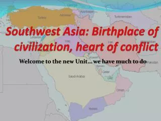
7 th Grade Unit 2: Impact of Location and the Environmental Issues in Southwest Asia. Georgia Department of Education THIS WORK IS LICENSED UNDER A CREATIVE COMMONS ATTRIBUTION - NONCOMMERCIAL - SHAREALIKE 4.0 INTERNATIONAL LICENSE.

E N D
7th Grade Unit 2: Impact of Location and the Environmental Issues in Southwest Asia Georgia Department of Education THIS WORK IS LICENSED UNDER A CREATIVE COMMONS ATTRIBUTION - NONCOMMERCIAL - SHAREALIKE 4.0 INTERNATIONAL LICENSE
https://en.wikipedia.org/wiki/Continental_climate#/media/File:World_Koppen_Map.jpghttps://en.wikipedia.org/wiki/Continental_climate#/media/File:World_Koppen_Map.jpg
Oil pipelines in southwest Asia http://geography.name/southwest-asia-human-environment-interaction/
https://www.npr.org/templates/story/story.php?storyId=122294630https://www.npr.org/templates/story/story.php?storyId=122294630
https://www.npr.org/templates/story/story.php?storyId=122294630https://www.npr.org/templates/story/story.php?storyId=122294630
Video: WRI | WHAT'S THE BIG IDEA? Mapping Water Risk with Aqueduct https://youtu.be/I80-UpaCsT8
water risk maps identify areas that are most susceptible to experiencing water scarcity. Overall water risk identifies areas with higher exposure to water-related risksMap: present conditions http://www.wri.org/resources/data-sets/aqueduct-global-maps-21-data
WATER STRESS PROJECTIONS MAP The Aqueduct Water Stress Projections Data include indicators of change in water supply, water demand, water stress, and seasonal variability, projected for the coming decades under scenarios of climate and economic growth. http://www.wri.org/resources/data-sets/aqueduct-water-stress-projections-data
River Scene on the Banks of the TigrisAbdul Qadir al-Rassam1920 From the collection of Mathaf: Arab Museum of Modern Art • Title: River Scene on the Banks of the Tigris • Year: 1920 • painter: Abdul Qadir al-Rassam • Alternate Title:مشهد على ضفاف دجلة • Type: paintings • Medium: oil on canvas https://www.google.com/culturalinstitute/beta/asset/river-scene-on-the-banks-of-the-tigris/UgEFYXJtWD2KWw
Political cartoon Artist rendering of the water crisis in the Middle East. https://wateringthedragon.wordpress.com/