Download
1 / 27
270 likes | 276 Views
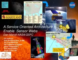
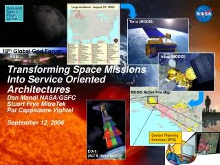
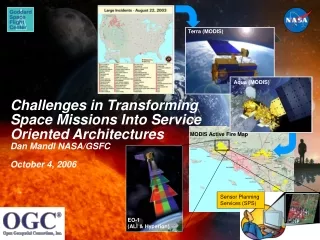
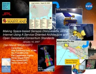
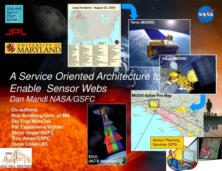
Terra (MODIS). Aqua (MODIS). A Service Oriented Architecture to Enable Sensor Webs Dan Mandl NASA/GSFC. MODIS Active Fire Map. Co-authors: Rob Sohlberg/Univ. of Md. Stu Frye/MitreTek Pat Cappelaere/Vightel Steve Ungar/GSFC Troy Ames/GSFC Steve Chien/JPL. Sensor Planning Services (SPS).

E N D
Terra (MODIS) Aqua (MODIS) A Service Oriented Architecture to Enable Sensor WebsDan Mandl NASA/GSFC MODIS Active Fire Map Co-authors: Rob Sohlberg/Univ. of Md. Stu Frye/MitreTek Pat Cappelaere/Vightel Steve Ungar/GSFC Troy Ames/GSFC Steve Chien/JPL Sensor Planning Services (SPS) EO-1 (ALI & Hyperion)
Introduction Lower cost of new Earth science products by: Sharing open source science algorithms Creating standard interfaces for tasking sensors via a service oriented architecture Making sensor capabilities, data sources and algorithms discoverable on the Internet Allowing users to create new algorithms out of existing algorithm components Enable rapid and cost-effective reconfiguration of new sensor webs via this architecture
Our First Sensor Web Experiment with EO-1 National Priority Wildfires Fire location confirmed and selected for imaging 3 Science Goal Monitor 1 Identify NIFC-tracked Wildfire Incidents 3 SGM adds target to EO-1 ground & on-orbit planning & scheduling systems and tasks EO-1 1 Roberts Fire 2 Correlate latest fire location information with MODIS imagery 4 5 EROS Data Center L1 Data Roberts Fire UMD Natural HazardsInvestigation Team 6 Active Fires Detection Map Aqua or Terra MODIS data Roberts Fire USFS Burned Area Emergency Response (BAER) team
End product of Event Driven Service Chain Burned Area Reflectance Classification (BARC) map - used by Forestry Service to efficiently rehabilitate burned areas
Often times the Features Were Correlated or Superimposed on Maps Burned areas – red Unburned areas – green Burn perimeter –blue MODIS Rapid Response Active Fire Detections Map EO-1 Advanced Land Imager Burn Scar Image
Piru/Simi/Verdale MODIS Old/Padua ALI MODIS ALI MASTER Landsat 5 Cedar/Paradise SPOT AirDAS Also Needed to Implement Horizontal Sensor Data Fusion Across Multiple Sensors such as for This Set of Images of Southern California Wildfires • Assets used: • EO-1 • SPOT • Aqua & Terra (MODIS) • Terra (ASTER) • Landsat 5 • MASTER • Aircraft (ER-2) based MODIS & ASTER • AirDas • Airborne Infrared Disaster Assessment System
EO-1 EO-1 Aqua and Terra TIROS EO-1 Volcano Sensor Web Experiment Targets loaded to EO-1 tasking website and ultimately uplinked to EO-1 on-board planning & scheduling system (CASPER) On-board thermal detection algorithms Univ of Hawaii Volcano Alert Webpage • Re-image in < 8 hours • Create browse images on-board • D/L to Hawaii Volcano Observatory ASPEN monitors volcanic “hot spots” from MODIS, AVHRR imagery & Insitu sensors In Situ Networked Sensors Kilauea, Hawaii HVO
How We Would Like to Do It The previous slides depicted a sensor webs that operated in slow motion and were manpower intensive to coordinate images and assemble finished science products The following slides are how we would like to do this same or similar processes Discovery of data availability and algorithm availability Automatic tasking of sensors Easy specification of algorithm service chain Automatic execution of service chain Automatic delivery of finished science product to desktop First experiments being conducted under auspices of Opengeospatial Consortium (OGC) Webservices Phase 4 (OWS-4) testbed
User Shielded From Details By Services Sensor Planning Service (SPS) details or capability and availability of sensor (whether in-situ or on-orbit) and provides automatic means for user to task sensor Sensor Observation Service (SOS) provides observation data to user Web Processing Service (WPS) classified desired features Web Coverage Service (WCS) places features on map provided by Web Map Service (WMS) Language such as SensorML used to self-describe sensor capabilities and availability, thus enabling discovery of services Other services as depicted on next slide fill in the architecture to allow the general array of services to work together
EO-1 Sensor Web Enablement (SWE) Experiment with OGC Standards Web Map Service (WMS) Observation Features L1G Subset GEOTIFF WGS84 JPEG Science Product Wizard Catalog Registry Catalog Service for Web (CSW) 1 “Discover” Geospatial Model & Geospatial Decision Support System “Register” Earth Sciences Gateway / IONIC (ebRIM) 2 “Task” “Register” Sequencer SensorML Business Processing Execution Language (BPEL) “Register” 4 “Order” SensorML XML SCRIPT Service Chain Service Chain Sensor ML Capabilities Documents 1 2 3 4 5 Google Maps ESRI ArcIMS Community Mapbuilder(OGC) SAS SAS Sensor Alert Service(SAS) EO-1 Satellite EO-1 Satellite Instrument Markup Language (IML) In-situ sensor data node UAV sensor data node Web Coverage Service (WCS) Sensor Planning Service(SPS) Web Coordinate Transformation Service (WCTS) Web Processing Service (WPS) SOS SOS Satellite sensor data node L1G WFS WFS Web Feature Service(WFS) Map 3 “Got Data” L1G Sensor Observation Service(SOS) SPS SPS Renderer L1G Subset GEOTIFF UTM EO-1 Data Node DEMIS EO1.GEOBLIKI from WFS to SAS ebRIM – Enterprise Business Registry Information Model 6 “Subscribe” 5 “View”
Example of How SPS Service Works: Discovering and Tasking EO-1 Sensors (OGC OWS-4 Demo) Area of Interest EO-1 Tasking Menu Selection
Target EO-1 User Scenario for OWS-4 • Department of Homeland Security (DHS) analyst requests satellite imagery in disaster area to validate potential site. Catalog returns EO-1 as possible source via Catalog Services for the Web (CSW). • Access to high resolution EO-1 data is granted based on user/role permission • No data is available, so satellite tasking is required and achieved (at no cost to DHS via SPS service). • Analyst is notified via instant message that Hyperion/ALI data products are available. High resolution imagery is retrieved via SOS, WCS and WFS services.
The Architecture Behind the SPS for EO-1 processed science data JPL USGS GSFC targets targets, engineering requests Science Processing targets WWW SOA Users weekly goals raw science data targets White Sands contacts SPS ASPEN station in-views overflights daily goals Note that engineer and mission planner removed goals FDSS ASIST telemetry tracking data Onboard EO-1 science data Science Processing EO-1 goals commands CASPER SCL activities
Architecture That Drives SPS Includes Onboard Intelligent Software Band Extraction Raw Instrument Data ObservationPlanner Image ObservationGoals Overflight Times CASPER Planner – response in 10s of minutes Onboard Science High level S/C State Information Plans of Activities(high level) L2 – Model-based Mode Identification & Reconfiguration SCL – response in seconds with rules, scripts AutonomousSciencecraft Commands (low level) S/C State Conventional Systems EO 1 Conventional Flight Softwarereflexive response Control Signals (very low level) Sensor Telemetry Spacecraft Hardware
Other Targeted Activities Add NASA/Ames Unmanned Aerial System (UAS) to sensor web with services (see next two slides) Add a standardized set of sub-services to enable the SPS to be reconfigured in a plug and play manner Use Instrument Markup Language (IML) to control various sensors Create a variety of WPS as standard services from the already available onboard classifiers used on EO-1 such as thermal, clouds, floods, ice, etc. Demonstrate ease of tasking and coordination of multiple assets via SPS’s
Vince Ambrosia, PI 12-Channel Wildfire Scanner Specifications Channel 1: 0.42 - 0.45 um Channel 2: 0.45 - 0.52 um Channel 3: 0.52 - 0.60 um Channel 4: 0.60 - 0.62 um Channel 5: 0.63 - 0.69 um Channel 6: 0.69 - 0.75 um Channel 7: 0.76 - 0.90 um Channel 8: 0.91 - 1.05 um Channel 9: 1.55 - 1.75 um Channel 10: 2.08 - 2.35 um Channel 11: 3.60 - 3.79 um (VIIRS M12) Channel 12: 10.26 -11.26 um (VIIRS M15) FOV: 42.5 or 85.9 degrees (selectable) IFOV: 1.25 mrad or 2.5 mrad (selectable) Spatial Res.: 3 – 50 meters (altitude dependant) General Atomics Altair UAS Also compatible with the GA Mariner, Predator-B & Cessna Caravan C208. • Targeting input from NIFC, MODIS Rapid Response, and GOES. • Onboard, real-time geolocation and product generation for both imagery and fire detects. • Browse and fire detects available via Google Earth interface within ca. 4 minutes. • Cal/Val coordination with MODIS Land Team and CEOS-LPV. • Activities in plan with AIST PIs for SensorWeb implementation in concert with MODIS and EO-1.
At the request of California Gov. Schwarzenegger, the FAA issued an emergency COA to fly the Altair UAS with the NASA WRAP payload into civilian airspace to support the Esperanza Fire incident command. #2 Climb to altitude using Edwards AFB restricted airspace. #1 Take off from GA / El Mirage. #3 Esperanza Fire 96 images collected (including conincident with MODIS). Altair UAS Flight Line 10/28 pm & 10/29/06 am.
Conclusion Integrating sensors with open source, interoperable reusable science services facilitates the vision of Global Earth Observing System of Systems Creating these open services, lowers the cost of performing science analysis and creating new methods With the OGC or similar standards, any set of sensors can become a virtual sensor web Data volume is greatly reduced since only virtual products stored and desired products produced on-demand
Glossary BPEL – Business Processing Execution Language DSS -- Decision Support System ebRIM -- Enterprise Business Registry Information Model SOS – Sensor Observation Service CSW – Catalog Services For the Web SPS – Sensor Planning Service GMSEC – Goddard Mission Services Evolution Center WCS – Web Coverage Service IML – Instrument Markup Language WCTS – Web Coordinate Transformation Service SAS – Sensor Alert Service (Pub/Sub) WFS – Web Feature Service WMS – Web Map Service WPS – Web Processing Service
Underlying “Plug and Play” Message Bus Architecture-- Goddard Mission Services Evolution Center (GMSEC) GMSEC architecture provides a scalable and extensible ground and flight system approach • Standardized messages formats • Plug-and-play components • Publish/Subscribe protocol • Platform transparency • ST5 first mission to be totally GMSEC compliant More info at: http://gmsec.gsfc.nasa.gov
Example of Rapid Mission Configuration Using GMSEC Interoperable Catalog Components GMSEC approach gives users choices for the components in their system. The ST-5 mission rapidly selected key components from the GMSEC catalog.
Core Flight Executive (cFE), an Extension for GMSEC for Flight SW cFE provides a framework that simplifies the development and integration of applications • Layered Architecture – software of a layer can be changed without affecting the software of other layers • Components communicate over a standard message-oriented software bus, therefore, eliminating the need to know the details of the lower layers of inter-networking. • Software components can be developed and reused from mission to mission. • Developed by Flight SW Branch at GSFC • To be used on LRO • More info at: http://gmsec.gsfc.nasa.gov
Advantages of SOA for Space Sensors • Networked standardized interface connections, loosely coupled • Components connected at run-time • Enables discovery of services • Hides details of how service performed (encapsulated implementation) • Fault tolerant • Since connection occurs at run-time, if service not available, a component can find or “discover” an alternative service and if unavailable, can connect to another instance of the service if available • Troubleshooting is easier because information is provided at component and services level • Highly reusable • Standardized, networked “plug and play” interfaces • Scalable • Interactions between services and clients independent of location and numbers • Sustaining engineering for constellation simplified • Can initiate new instance of service or alternative service and then disconnect old services Taken from: Hartman, Hoebel; “Lightweight Service Architectures for Space Missions”, SMC-IT 2006, Pasadena, Ca
Key Capabilities Implemented to Enable EO-1 Sensor Webs & Support “Backend” of SPS