Download
1 / 13
131 likes | 275 Views
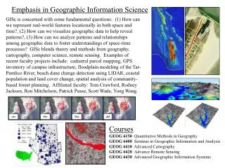
Geographic Information Science. Introduction. GIS answers the question: Where GIS helps to design and manage our resources and help improve our world. Our world faces challenges: natural disasters, poverty, environmental degradation and etc. Continue Introduction: Basic GIS Knowledge.

E N D
Introduction • GIS answers the question: Where • GIS helps to design and manage our resources and help improve our world. • Our world faces challenges: natural disasters, poverty, environmental degradation and etc.
Continue Introduction: Basic GIS Knowledge • GIS can be defined as a system for entering, storing, manipulating, analyzing and displaying geographic or spatial data. • These data are represented by points, lines, and polygons along with their associated attributes. • Geographic data can be represented as 2 formats: 1) raster data that are stored in a grid or pixel format that is referenced to coordinate system (latitude, longitude) 2) vector or polygon data which uses a series of points (x, y) coordinates to define the boundary of the object of interest.
Continue Basis GIS Knowledge • Map projection and coordinate system: registering spatial data to the ground requires transforming data, recorded in digitizer inches, to some ground-based coordinate system. • A map projection is an orderly, mathematical system of parallels and meridians that allows us to flatten the earth only at the cost of one or more spatial attributes. • Common coordinate system: UTM (Universal Transverse Mercator), state plane coordinates, latitude-longitude. • Question: Why is this important?
History of GIS • During 1950s, the quantitative geography was reinforced. • The introduction of statistical methods and computers, giving rise to analytical spatial analysis.
The image of map produced by SYMAP • In 1960s, a computer mapping program (SYMAP) was released.
Pen Plotter in 1960s Pen Plotter nowadays • Pen Plotter outputs actually resembling traditional maps, thereby initiating the era of computer –assisted cartography.
Continue GIS History • During 1970s, digital cartographic files of boundaries and entities included topological information that enables them to be “intelligent” and subject to query. • 1980s, the vast majority of GIS incorporate some generic RDBMS engine. • The software handles the geographic attribute data and allow access to analytical and computer mapping functions operating on digital cartographic files and the geographic database.
Today’s GIS • Over 260 vendors offering services covering, digitizing, data conversion, consulting and specializing in a particular application domain, such as Trimble, IBM, HP, Microsoft, ESRI, NAVTEQ and etc. • How GIS helps to us to face the challenges, such as, natural disasters, poverty, environmental degradation?
Examples of GIS Uses: • Idaho Falls Campus map: http://vmx115.mapserve.net/website/kgohMap/viewer.htm • Before making this map, what are the errors that we need to take in considerations? • http://www.xfrogdownloads.com/greenwebNew/products/products.htm • What can these 3D visualization tools contribute to GIS world?
Continue with examples: • Cheetah Conservation Botswana a GSM collar from African Wildlife Tracking to track the cheetah (Nala)’s movement, a relatively recent development in satellite collars which works via the cellular network. The collar was programmed to send her location once every 12 hours. • With this tracking device and Google map, they were able to learn so much about Nala and her cubs with this new technology that wouldn't have been possible otherwise. • http://www.cheetahbotswana.com/tracking.php
GreenBelt Movement • The greenbelt movement was founded 1977 by professor Wangari Maathai who is the first environmentalist to receive the Nobel Peace prize. • GBM began as a grassroots tree planting program to address the challenges of deforestation, soil erosion, and lack of water in order to support agriculture, ranching, commercial plantations and development. • Through the use of GIS technology, GBM can monitor and manage the rehabilitation process andn demonstrate that with commitment and hard work, these ecosystems can be restored. • http://greenbeltmovement.org/
Other examples: • http://maps.yahoo.com/broadband#env=a • http://maps.google.com/ • Google earth • http://www.maps.live.com/ • http://giscenter-ims.isu.edu/Sisp/maps/viewer.htm