Download
1 / 30
310 likes | 453 Views
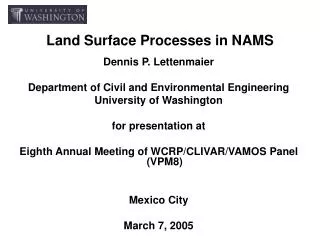
Hydrometeorological modeling in NAMS. Dennis P. Lettenmaier Department of Civil and Environmental Engineering University of Washington for presentation at Eighth Annual Meeting of WCRP/CLIVAR/VAMOS Panel (VPM8) Mexico City March 8, 2005.

E N D
Hydrometeorological modeling in NAMS Dennis P. Lettenmaier Department of Civil and Environmental Engineering University of Washington for presentation at Eighth Annual Meeting of WCRP/CLIVAR/VAMOS Panel (VPM8) Mexico City March 8, 2005
NAME HYDROMETEOROLOGICAL WORKING GROUP DRAFT RESEARCH STRATEGY • Foster coordination of hydrologically-relevant NAME research within NAME and with appropriate operational and research communities • Engage stakeholders, creators and users of operational hydrological forecasts • Define a suite of key hydrological forecast parameters and make measured improvements in their skill across a range of societally-relevant space and time scales. (These parameters may include, spatially-distributed and probabilistic forecasts of precipitation, evaporative demand for agriculture, actual evaporation from forests and rangelands, soil moisture and streamflow among others.) • Foster transfer of hydrologically-relevant research for improvement of operational hydrological forecasts from the NAME region. • Support efforts to share research findings and prediction systems between U.S. and Mexican collaborators
NWHG key science questions • Identify the dominant runoff generation mechanisms and streamflow regimes in the NAM region and how different regions respond to: • particular event characteristics • evolution of the monsoon season • modes of monsoon climate variability • anthropogenic control of the river networks via reservoirs and diversions • modification of the stream network and landscape due to extreme events, (e.g. flash floods, land-falling tropical storms, etc.) • Determine if basin scale water budgets from the NAM region can be closed with any confidence and, if so, over what spatial and temporal scales. Define the roles of vegetation, soils and shallow aquifers in modulating basin- and regional-scale hydrologic budgets. • Assess the sensitivity of hydrological predictions to uncertainty in precipitation estimates and specification of land surface conditions from event through seasonal time scales. • Quantify the impacts of enhanced observations obtained during the 2004 NAME EOP on short and long term Quantitative Precipitation Forecasts S/I hydrological predictions. • Prioritize additional in-situ and remotely sensed observations that are critical to improving hydrological forecasts from flash flood to S/I time-scales.
Hydrological modeling goals • Evaluate the utility of current hydrologic modeling architectures for hydrological prediction in both gauged and ungauged river systems • Demonstrate the utility of spatially-distributed precipitation estimates and forecasts generated from NAME climate process teams • Demonstrate an improved capacity to advance hydrological prediction capability throughout the NAME region
Programmatic linkages • IAHS Prediction in Ungauged Basins (PUBS): PUBS is a decade-long program aimed at improving the capacity to make hydrologic predictions in ungauged river basins • Hydrological Ensemble Prediction Experiment (HEPEX): The aim of HEPEX is to demonstrate how to produce reliable hydrological ensemble forecasts that can be used in operational water management decision making. Its stated goal is to quantify forecast uncertainty at each step of the forecast process in a way that can be communicated to end users
Macroscale modeling • LDAS retrospective (real time NAME 2004 field campaign (being updated with NERN data); extension of Maurer et al (2002) retrospective N-LDAS data over Tier 2 1925 – present • Basin scale hydrologic modeling (Gochis)
Development of a Long-Term Land Surface Data Set for Mexico Surface forcing data: Daily precipitation, maximum and minimum temperatures ERIC2 (1940-1998)a product from Mexican Institute of Technology of Water (IMTA) of the SEMARNAP, over 5,000 stations Data322 (mainly for data pre-1940, and for Northwestern mexico)produced by SMN (Servicio MeterorolÓgico Nacional, 2000), around 70 stations extending back to 1920s. SMN daily historical precipitation data (1995 – near realtime) provided courtesy of Miguel Cortez Vázquez of SMN, around 1,000 stations.
Guage Station Distribution (ERIC2) • There is a hole in Northwestern Mexico since 1990, which can be filled somewhat by SMN near-real time data 1995-2002.
SMN ERIC2 Data322 Guage Station Distribution 1995- 1900-1940
Gridded Precipitation and Temperature Dataset (1925-2003) Long-term mean precipitation spatial pattern This spatial plot shows reasonable pattern with lower precipitation in desert region and higher magnitude in coastal and south Mexico. Long-term mean daily temperature This plot shows lower temperature over mountainous area (~10C), and higher value over the coastal line especially in South Mexico.
Comparisons with SMN climatologic Tmean over some state’s capitals (http://smn.cna.gob.mx/productos/normales/medias.html) : SMN (1961-1990) Gridded(1925-2003) Lat Lon Tmean Lat Lon Tmean 24.8 -107.15 24.5 24.8125 -107.1875 25.33 24.4 -106.7 24.9 24.4375 -106.6875 23.00 19.2 -103.8 26.1 19.1875 -103.8125 26.995 18.8 -103.67 26.2 18.8125 -103.6875 27.51 17.9 -101.78 27.0 17.9375 -101.8125 28.36 17.38 -101.07 26.7 17.4375 -101.0625 27.30 16.37 -98.05 27.4 16.3025 -98.0625 28.14 15.5 -93.07 27.4 15.4375 -93.0625 28.50 22.83 -99.23 25.0 22.8125 -99.1875 25.68
Comparison of simulated and observed streamflow 1 2 5 6 6 7 9 8 4 12 10 11 13 14 15 3 The streamflow dataset is the Mexico acronym BANDAS (CNA and IMTA).
Realtime LDAS (over NAME Tier 1 & 2) Target Realtime report by next day 9:00AM Currently Real-time VIC runs Met. data EDAS realtime analysis Ongoing Initializing & comparing Precipitation SMN Mexico realtime guage station data USA Met. data LDAS realtime (lag 1 and ½ days)
Realtime LDAS Website (http://www.hydro.washington.edu/~chunmei/realtime/)
Macroscale modeling status • Long-term LDAS forcing and derived (VIC) land surface fluxes and states completed for 1950-2002 (to be extended to 1925-2004) for NAME Tier 2 • Summer 2004 (May-September) LDAS forcings and fluxes being updated to include NERN data
Predictability issues in the context of regional hydrologic forecasting
Western U.S. experimental hydrologic forecast system • ~100 forecast points • 6-month forecasts (12 month for CPC) issued monthly using VIC model for ESP, stratified ESP, NSIPP, NCEP/GMS • Planned implementation of weekly updates winter 2005 • Planned implementation of multi-model hydrologic ensemble
Relative important of initial condition and climate forecast error in streamflow forecasts Columbia R. Basin fcst more impt ICs more impt Rio Grande R. Basin RMSE (perfect IC, uncertain fcst) RMSE (perfect fcst, uncertain IC) RE =
Sonora Basins Features (INEGI, 1993) River Basin Surface (Km2) Surface Watera (%) Water Useb (%) Annual Precipitation (mm) Sonora 34,654 31.8 13:85.5:1.3:0.2 100-500 Yaqui-Matape 83,578 80.0 3.5:95:0.5:1 200-1000 Mayo 26,500 87.8 2.5:96.5:0.5:0.5 300-1100 Sonoita 18,346 9.2 29:69:1:1 0-300 Concepcion 40,770 26.2 4:93.5:1.5:1 0-400 a The proportion of Surface Water is with respect to Groundwater b Proportions of water uses (Urban:Agriculture:Cattle:Industrial)
Comments on land surface hydrologic prediction issues in the NAM region • Sources of predictability (IC vs climate forecast) • Role of space-time variability of precipitation, and its interaction with basin scale • Hydrologic processes, and their representation (e.g. infiltration excess overland flow, groundwater/baseflow)