Download
1 / 28
280 likes | 410 Views
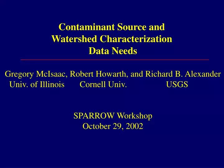
Contaminant Source and Watershed Characterization Data Needs Gregory McIsaac, Robert Howarth, and Richard B. Alexander Univ. of Illinois Cornell Univ. USGS SPARROW Workshop October 29, 2002. Contaminant source and watershed data

E N D
Contaminant Source and Watershed Characterization Data Needs Gregory McIsaac, Robert Howarth, and Richard B. Alexander Univ. of Illinois Cornell Univ. USGS SPARROW Workshop October 29, 2002
Contaminant source and watershed data needed for effective water quality modeling Contaminant Sources Point source discharges Non-point sources Atmospheric deposition Erosion, fertilizers and pesticides Livestock wastes Biological N fixation Watershed Characteristics Land cover and management practices Topography Soils Precipitation Hydrology: surface and sub-surface discharges Hydraulics: flow paths and residence times
Integrating Databases Various efforts underway USGS: SARROW model USDA-NRCS EPIC modeling with NRI and Census of Ag Data USDA-ARS: SWAT model CENR effort for the Mississippi River Basin (Goolsby et al) USDA-ARS: Miss. R. Basin N budgeting by Burkart and James.
NRI Data Modeled with EPIC: Change in average Labile P in Runoff 1992-97 due to Changes in Crop Mix, manure not considered(by Atwood, Kellogg, Lemunyon, Potter and Pitts USDA-NRCS and TX Ag Exp. Station)
N inputs – N outputs by Basin for 1992 (Burkart and James, 1999)
1980-96 Average Annual Total N inputs: Fertilizer, Fixation, Manure, Atmospheric, Deposition, Cropland Soil Mineralization (Goolsby and Battaglin, 2000)
Proposed National Nutrient Accounting System Interagency effort to compile nutrient input and output estimates on a consistent national basis for: model evaluation and comparison targeting monitoring and research guide conservation efforts
Contaminant source and watershed data needed for effective water quality modeling Contaminant Sources Point source discharges Non-point sources Atmospheric deposition Erosion, fertilizers and pesticides Livestock wastes Biological N fixation Watershed Characteristics Land cover and management practices Topography Soils Precipitation Hydrology: surface and sub-surface discharges Hydraulics: flow paths and residence times
Point Source Discharges EPA National Pollutant Discharge Elimination System (NPDES) Designed for avoiding problems caused by point discharges, not designed for monitoring of actual loads discharged
Non-Point Sources: Atmospheric Deposition Wet depositionDry Deposition National Atmospheric Clean Air Status and Deposition Program Trends Network (NADP) (CASTNET) Current Monitoring Locations CASTNET
Non-point sources: Fertilizers Sales and Survey data
Non-point sources: Fertilizer Sales data by state Assoc. of Am. Plant Food Control Officials (AAPFCO) County level sales for some states County level estimates of sales developed by USGS Estimated N fertilizer use per county for the 1991 crop year (Battaglin and Goolsby, 1994)
Non-point sources: Fertilizer Survey data USDA-ERS annual surveys for major crops in states where production is concentrated Surveys are costly and sampling is often sufficient for state level aggregation only Until recently, information on recommended levels of fertilizer application or timing of application were not collected.
Non-point sources: Pesticides USDA annual surveys by crop and state National Center for Food and Agriculture Policy compilations of national and state data Census of Agriculture expenditures on agri-chemicals USGS county level estimates
Non-point sources: Livestock Wastes Annual state and county livestock inventory and production estimates statistics from USDA-NASS More extensive data collection from the Census of Agriculture every 5 years. Waste volume and nutrient content are estimated from generalized relationships for species and age classes. Recent experiments indicate that waste characteristics can vary considerably with diet. Impacts on water quality will depend on animal and manure handling practices and proximity to water bodies.
Land cover National Land Cover Data (NLCD) From Schwarz, USGS, 2001
Land cover Satellite Imagery: there are some errors in classification difficulties distinguishing annually planted crops from hay and pasture USDA-National Resource Inventory Survey of a sampling of fields every 5 years to estimate soil erosion USDA Census of Agriculture Anonymous surveys, precise location cannot be reconstructed
Topography USGS DEMs at 30 m resolution available for most of USA 10 m resolution in progress in some locations. May still be too coarse for flat regions in portions of Illinois, Ohio & Michigan where tile drainage is common. Soils Soil Survey STATSGO ~1 km resolution Finer resolution data are available, but not yet in digital form for most locations
Hydrology: discharge Daily and 15 minute discharge from USGS gauges High quality data. Mostly large basins where there are multiple influences. Few stations in coastal areas.
Hydrology: flow paths and residence times EPA and USGS National Hydrography Dataset (NHD)
Hydrology: flow paths and residence times EPA and USGS National Hydrography Data (NHD) 1:100,000 scale, designed to accommodate higher resolution Existing flow network data needs corrections Inconsistent coverage of wetlands, lakes and reservoirs Need to have correct and consistent coverage of stream density, flow, time of travel and integrate information on National Inventory of Dams (NID) from US ACE. Does not address tile drainage, which can significantly influence nitrate transport to streams.
US ACE National Inventory of Dams (NID) >70,000 Reservoirs, Lakes, Ponds
Effect of Tile drainage on River N Flux in Illinois Region Tile drainage Net N Input River N flux --------(kg N/ha-yr)------- East Central IL extensive 27 24 Southern IL minimal 23 9
Infrared aerial photograph east Central IL, prior to crop emergence and after significant precipitation Inferred location of tile drains From Zucker and Brown, 1998
Summary Much data is available but there is always room for improvement
Summary Much data is available but there is a continual need for improvement Highest priority needs in our opinions: Point source loads Refined NHD Atmospheric Deposition in Urban and Coastal Regions Finer resolution of fertilizer use in agricultural regions Tile drainage and finer resolution topography in flat areas CAFOs and animal waste handling practices Higher frequency, nationally consistent land cover that can distinguish between row crops and pasture Institutional cooperation for integrating, improving and interpreting data