Download
1 / 32
390 likes | 668 Views
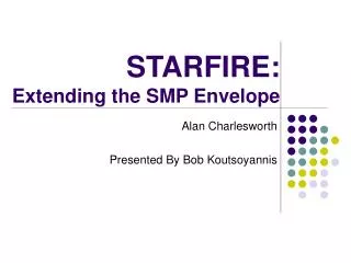
The StarFire Global Satellite Based Augmentation System. Ron Hatch NavCom Technology, Inc. Agenda. Introduction System Description User Benefits/ Performance StarFire Navigation RTK Extend System integrity Summary. Introduction. Who is NavCom Technology, Inc?.

E N D
The StarFire Global Satellite Based Augmentation System Ron Hatch NavCom Technology, Inc.
Agenda • Introduction • System Description • User Benefits/ Performance • StarFire Navigation • RTK Extend • System integrity • Summary
Who is NavCom Technology, Inc? • Located in Southern California • Major Business Areas • Proprietary Products for precise positioning & wireless communication • Product Services (Global Differential GNSS Corrections) • Contract Engineering • Acquired by Deere & Co. November 1999 • Technology steward • NavCom remains “pathfinder brand”
What is StarFire • Worldwide Satellite Based Augmentation System (SBAS) • Broadcasts satellite clock and orbit corrections • Utilizes six L-band satellites in geosynchronous orbits to provide duplicate global coverage 10 cm Positioning Anywhere, Anytime
StarFire System Ground Tracking - Global Network User – Receivers and System Space – Signal Distribution Control - Processing Center
StarFire System - Ground Ground Tracking - Global Network
Reference Station Network Over 50 Reference Stations Worldwide • The network tracks all GPS satellites continuously – GNSS upgrades in progress • Survey grade receivers • Processing centers receive measurements from each reference station once a second
StarFire System - Control Ground Tracking - Global Network Control - Processing Center
StarFire Processing Centers • Two Processing Centers • Torrance, California • Moline, Illinois • Both Processing Centers Compute a Correction Stream for Satellites • Orbit Corrections once a minute (∆xyz ECEF) • Clock Corrections once every two seconds
StarFire System - Space Ground Tracking - Global Network Space – Signal Distribution Control - Processing Center
StarFire Uplink and Space Segment • StarFire channels on global beams of 6 different L-band communication satellites • All users see StarFire signals from two sources • Americas –Laurentides, Canada • Americas – Santa Paula, CA • Europe – Burum, Netherlands • Europe – Southbury, CT • Asia – Perth, Australia • Asia - Auckland, New Zealand Redundant Uplink Sites and Satellites
StarFire System - User Ground Tracking - Global Network User – Receivers and System Space – Signal Distribution Control - Processing Center
StarFire System Performance Reliability achieved by ensuring no single point of failure and thorough monitoring • Redundancy throughout entire system • From reference sites to broadcast signals • Extensive real-time monitoring • internal checks • real-time positioning results • 99.999% availability • Under 6 minutes of outage annually
StarFire Integrated Receivers StarFire SF-3000 Multi-frequency GNSS receiver MEMs inertial attitude determination StarFire SF-3050 Series Military, Offshore, Machine Control markets Full GNSS capability CORS and Heading Functionality StarFire SF-2040 Survey markets Worldwide decimeter accuracy in real-time
Applications • Machine Guidance • Agriculture • Construction • Intermodal (port operations) • Offshore Survey • Aerial Survey • Autonomous Vehicles • Land Survey
System Performance and User Benefits Real-time global accuracy • Less than 10 cm. one-sigma per horizontal axis (20 cm. vertical) • No local base station • Transparent communication link • Global availability
StarFire and Unaided Horizontal Accuracy 24 hour data sample
RTK Extend • RTK Extend bridges the gaps in RTK coverage • RTK and StarFire operations all in ONE receiver • Patented innovation exclusive to NavCom StarFire corrections StarFire corrections Continuous cm-level positioning for up to 15 mins . RTK corrections No blockage. No problems. Blockage! Problems!!!
Additional Benefits from StarFire Augmentation • Integrity monitoring • Broadcast correction stream contains validity flags for each satellite which are tightly monitored and controlled by the processing center software • Most common satellite vehicle error, clock runoff, detected early – PRN 02 example from 2006
PRN 30 - 02 June 2006 (Indian Ocean) StarFire Provided corrections for 36 Seconds and then disabled the satellite GPS System Invalid clock for 12 Minutes before setting the satellite unhealthy
PRN30 Effect on StarFire Positioning NCT-2100D Receiver Johannesburg, S.Africa No Effect on StarFire Positioning from PRN30 Clock Issue
StarFire Key Features and Discriminators • Only global SBAS owned and operated by a manufacturer of high precision GNSS receivers • Unique fusion of RTK with global SBAS RTK-extend • Reliable, global decimeter accuracy in one receiver • Built-in StarFire capability • Independence from local base
Thank You! Please visit www.navcomtech.com