Download
1 / 9
100 likes | 127 Views
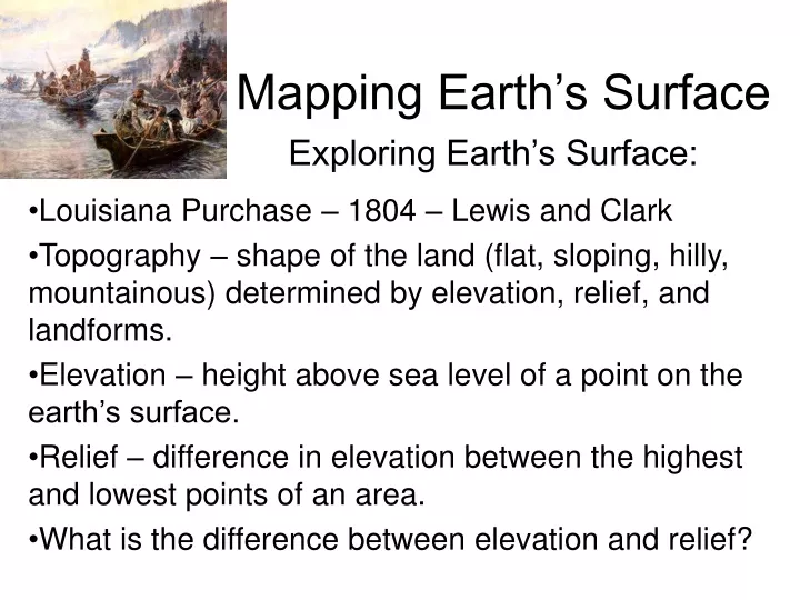
Mapping Earth’s Surface. Louisiana Purchase – 1804 – Lewis and Clark Topography – shape of the land (flat, sloping, hilly, mountainous) determined by elevation, relief, and landforms. Elevation – height above sea level of a point on the earth’s surface.

E N D
Mapping Earth’s Surface • Louisiana Purchase – 1804 – Lewis and Clark • Topography – shape of the land (flat, sloping, hilly, mountainous) determined by elevation, relief, and landforms. • Elevation – height above sea level of a point on the earth’s surface. • Relief – difference in elevation between the highest and lowest points of an area. • What is the difference between elevation and relief? Exploring Earth’s Surface:
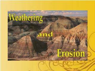
Mapping Earth’s Surface • Landforms – a feature of topography formed by the processes that shape the earth’s surface. (all landforms have elevation and relief) • Landform region – large area of land where the topography is similar. • There are three main types of landforms: plains, mountains, and plateaus Exploring Earth’s Surface:
Mapping Earth’s Surface • Plains – a landform made up of flat or gently rolling land with low relief. • Ex. #1 Coastal – low elevation and relief • Ex. #2 Interior – low relief but elevation varies • Ex. #3 Great Plains – Texas to Canada Exploring Earth’s Surface:
Mapping Earth’s Surface • Mountains – landform with high elevation and high relief; normally part of a mountain range (shape, structure, age) • Mountain Ranges are normally part of a mountain system, which are part of a mountain belt. Exploring Earth’s Surface:
Mapping Earth’s Surface • Plateaus – a landform that has high elevation and a level surface. • Rarely perfectly smooth on top. • What types of landforms have low relief? Exploring Earth’s Surface:
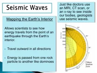
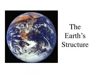
Mapping Earth’s Surface • Earth’s four spheres: lithosphere, hydrosphere, atmosphere, biosphere • Lithosphere – Earth’s solid, rocky outer layer (Continents; islands) and extends under the ocean floor • Atmosphere – mixture of gases that surround the planet (most – nitrogen & oxygen) • Hydrosphere – Earths oceans, lakes, rivers, and ice (includes salt and fresh water) (2/3 earth- oceans) • Biosphere – All living things on earth; goes into other spheres. Exploring Earth’s Surface:
Mapping Earth’s Surface Section Review: • What three factors determine the topography of a region? • What are the most common types of landforms? • Which is larger, a mountain belt or a mountain system? • In which of Earth’s spheres would you find a cloud? A Mountain? A lake? A Tree? • How are mountains and plateaus similar? Different? Exploring Earth’s Surface:
Mapping Earth’s Surface • What three factors determine the topography of a region? Elevation, Relief, and Landforms • What are the most common types of landforms? • Plains, Mountains, and Plateaus • Which is larger, a mountain belt or a mountain system? • Mountain Ranges and Systems form a Mountain Belt • 4. In which of Earth’s spheres would you find a cloud? Atmosphere A Mountain? Lithosphere A lake? Hydrosphere A Tree? Biosphere • 5. How are mountains and plateaus similar? Both have high elevations Different? Relief is different Exploring Earth’s Surface: