Download
1 / 34
340 likes | 348 Views
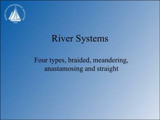
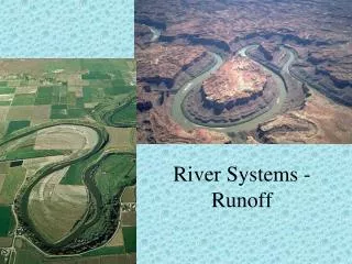
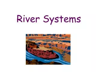
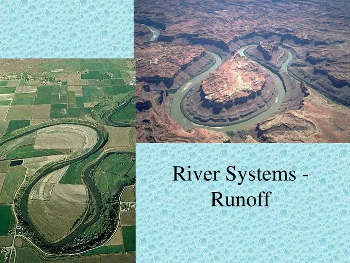
River Systems - Runoff. Hydrologic Cycle. Precipitation – 4.2 trillion gallons per day 66% is lost as evapotranspiration 31% is runoff 3% infiltrates into the subsurface. Running Water. Integral part of sculpting the Earth’s surface MOST IMPORTANT AGENT OF EROSION

E N D
Hydrologic Cycle • Precipitation – 4.2 trillion gallons per day • 66% is lost as evapotranspiration • 31% is runoff • 3% infiltrates into the subsurface
Running Water • Integral part of sculpting the Earth’s surface • MOST IMPORTANT AGENT OF EROSION • Indirectly results in the formation of sedimentary rocks
Stream Formation • Sheetflow or Sheetwash – overland flow of water • Repeated precipitation events cause a preferential channel to form – downcutting • Tributaries form & the main channel continues to grow up slope – headward erosion
Stream Terminology • Stream System – main stream plus tributaries • Drainage Basin – area drained by main stream and tributaries • Drainage Divide – area of higher elevation that divides drainage basins • Function of size/scale For Example: Kickapoo Creek Sangamon River Illinois River Mississippi River
Stream Subsystems • Collecting System • Tributaries is head water region • Funnel water and sediment to main channel • Primarily erosion and transport • Transporting System • Main tributary • Main process is the movement of the sediment and water • Erosion, transport, and deposition all occur • Dispersing System • Distributaries at mouth region • Primarily deposition of the sediment • Coarse sediment along the confluence • Fine particles carried further in to body of water
Permanent Stream Water flows year-round in the stream Bed of the stream is below the groundwater table Water is from both surface runoff and groundwater discharge Ephemeral Stream Water flows only after precipitation events or spring thaws (seasonal) Bed of stream is above the groundwater table Water is only from surface runoff Permanent vs. Ephemeral Streams
Radial Pattern • Streams radiate outward from central zone • Generally surround a topographic high point, such as a conical mountain, a dome, or a volcano • Dendritic Pattern • Resembles branches of a tree • Random Orientation of streams • Represents a uniform resistance of bedrock to erosion • Underlain by sedimentary rocks or uniform igneous or metamorphic rocks • Rectangular Pattern • Streams develop along fractures or joints in the underlying bedrock • Sets of fractures/joints tend to form at right angles • Trellis Pattern • Represents area of alternating weak & resistant rocks • Tributaries develop in the weak rock • Main stream cuts across resistant rock • Common in folded mountain belts (Appalachians for example) Drainage Patterns • Function of the underlying geology, the topography of the area, & the history of the stream
Streamflow Dynamics • Examine the physical and hydraulic properties of the stream • Discharge • Velocity • Gradient • Channel Properties • Wetted Perimeter • Shape • Size • Roughness • Sediment Load
Discharge (Q) • Volume of water passing a given point over a specified length of time (length3/time), generally given in ft3/s or m3/s • Calculated by: • Where A is the cross-sectional area (length2) & v is the velocity of the water (length/time)
Velocity • The speed of the water at a given point along a stream • Directly related to a stream’s ability to erode and transport material • High velocity water can carry heavier sediment • Is a function of • Gradient • Channel Properties • Wetted Perimeter • Shape • Size • Roughness
Stream Gradient • Slope of steepness of the stream channel • Vertical drop (relief) of a stream over a fixed distance • Controls the potential energy of the water • Steeper the gradient – the higher the velocity, the lower the gradient – the lower the velocity • Meanders decrease the gradient by increasing the horizontal distance of the stream
Wetted Perimeter • The area in which water touches the channel walls • Channel shape and size controls the wetted perimeter • Most efficient streams have small wetted perimeters • Roughness of the channel controls the frictional resistance to water movement • A smooth channel decreases frictional force • A rough channel increases frictional force
Stream Morphology • Streams increase in length by headward erosion – erosion occurring at the beginning of the stream • Streams become wider through lateral erosion – mass wasting of the stream banks • Streams become deeper through downward erosion of the channel by abrasion of the sand and gravel
Stream Piracy • Continual headward erosion of one stream causes the intersection of two streams, thus diverting the headwater from one stream to another.
Erosion • Removal and transport of rock, sediment, soil • Running water is the major cause of erosion • Source of Materials in a stream • Mass Wasting • Lateral erosion of banks • Downward erosion of stream channel • Headward erosion • Sheetflow • Chemical Weathering
Stream Dynamics – Sediment Load Bed Load Suspended Load Dissolved Load
Sediment Load – Bed Load • Particles to large to be lifted into suspension • Sediment moves along stream bed • Particles move by sliding, rolling, or saltating (short leaps) • Accounts for 10 to 25% of sediment load • Agent of downward erosion
Sediment Load – Suspended Load • Light sediment lifted above stream bed by current • Mostly silts and clays • Accounts for most of stream load ( 60%)
Sediment Load – Dissolved Load • Chemical ions produced from chemical weathering of minerals • Ca2+, Cl-, Mg2+, SO42-, Na+, K+, HCO3-, etc. • Acquired from groundwater, sheetflow, or dissolving rock along a stream’s course. Generally 10%, but can be up to 50% of sediment load.
Effects of Transport on Particles • Rounding • caused by abrasion • Increases with distance particle is transported • Sorting • Varies with the competence of the stream • As competence decreases large particles are deposited
Capacity The amount (weight) of sediment a stream can carry It is a function of discharge (velocity) Velocity (proportional to) Capacity 3 to 4 Example, if velocity doubles (2) – capacity increases between 8 (23) to 16 (24) times Competence The maximum particle size a stream can transport Function of velocity and fluid density Velocity (proportional to) Competence2 Example, if velocity doubles (2) – competence increases 4 (22) times As stream density increases with more suspended and dissolved sediment, competence increases Controls of Sediment Load
Velocity’s role in Erosion • Threshold Velocity – minimum velocity required to move grains of a certain size
QUIZ What effect does urbanization have on streams? • Increase in discharge • Increases flooding intensity and frequency • Increases erosive ability of the stream • All of the Above • None of the Above
Urbanization Effects • Decrease infiltration – Increases runoff • Produces Higher Peak Discharge • Produces shorter lag time • Produces more floods • Higher discharge = increased ability to erode
Deposition of Material • Occurs when streams lose velocity (competence decreases) • Velocity decreases due to • Lower gradients • Flow into still or slow moving waters (reservoirs, lakes, etc.) • Changes in channel shape (widening or narrowing)
Stream Equilibrium • Stream want to be at a low energy state • When the gradient is high (high energy) erosion will occur • When the gradient is low (low energy) deposition will occur • Graded Stream – stream gradient is in balance (equilibrium) with the volume of water available, thus neither erosion nor deposition occur along the stream profile
Longitudinal Profile • Cross-sectional image showing the variation in a stream’s elevation along its length
Base Level • The downward limit of stream erosion; lowest elevation to which a stream can erode its channel • Ultimate Base Level – sea level • Local Base Level – lakes, resistant layers of rock, reservoirs, etc.
Effects of Changes in Base Level • Changes in base level change the energy of the system, which changes the velocity of the water. • What would happen if base level was increased, say with a dam?
Because of the reservoir – velocity of the water decreases. Thus competence and capacity decrease and sediment load is deposited in the reservoir. Water leaving the reservoir is “starved” for sediment – erosion occurs below the dam.